
Route: Thixendale
Area: North Yorkshire
Date of walk: 17th May 2026
Walkers: Andrew and Gilly
Distance: 4.3 miles
Ascent: 500 feet
Weather: Mixed sun and cloudy
Thixendale is a secluded village set in the high wolds in an area of international archaeological importance. Ancient Neolithic, Bronze and Iron age burial sites have been found here, and the natural chalk grasslands around the village are a rare and important habitat. It’s also a wonderful base for walkers – the Yorkshire Wolds Way, the Chalkland Way and the Centenary Way all pass through Thixendale
We were here to collect a sculpture of a barn owl from Wold Wire Sculptures. Our recent visit to Stillingfleet Lodge Gardens, which is home to several similar sculptures, had inspired us to acquire one for our own garden. After collecting our owl we parked at nearby St Mary’s Church. The church, as well as a vicarage, school and schoolmaster’s house were added in the 1870’s by the then landowner Sir Tatton Sykes
Following a route which we’ve walked on several occasions, we headed west out of the village, turning off the road after a short distance to climb up a chalk track to Cow Wold. We were now on the Yorkshire Wolds Way, retreading a section of this long distance walk which runs from Hessle to Filey. It was a case of up hill and down dale as we descended from the wold and then ascended Vessey Hill, but it was all easy going thanks to the gently rolling nature of the chalk landscape in these parts
Beyond Vessey Hill we turned east to follow a path above Wharram Percy Farm. At this point the walk could be extended (by about three miles) to include a visit to the nearby site of the medieval village of Wharram Percy. We headed south instead on the final leg of the walk, which took us back towards Thixendale along the Chalkland Way, a 40 mile long distance walk around the Yorkshire Wolds. We were lucky that sun and cloud had combined on this walk to show the Yorkshire Wolds landscape at its best
For other walks here, visit my Find Walks page and enter the name in the ‘Search site’ box
Click on the icon below for the route map (subscribers to OS Maps can view detailed maps of the route, visualise it in aerial 3D, and download the GPX file. Non-subscribers will see a base map)

Scroll down – or click on any photo to enlarge it and you can then view as a slideshow

The start of today's walk as we leave Thixendale village and turn right here at a public footpath sign

Looking back to Thixendale as we climb up a chalk track

Thixen Dale on our left

...and now Water Dale as we continue up Cow Wold

We continue to climb up Cow Wold, following a section of the Yorkshire Wolds Way...


Chalk farmland at the top of Cow Wold...


Start of the descent into Vessey Pasture Dale, to be followed by a re-ascent

Hawthorn blossom, which enhanced the scenery throughout the walk

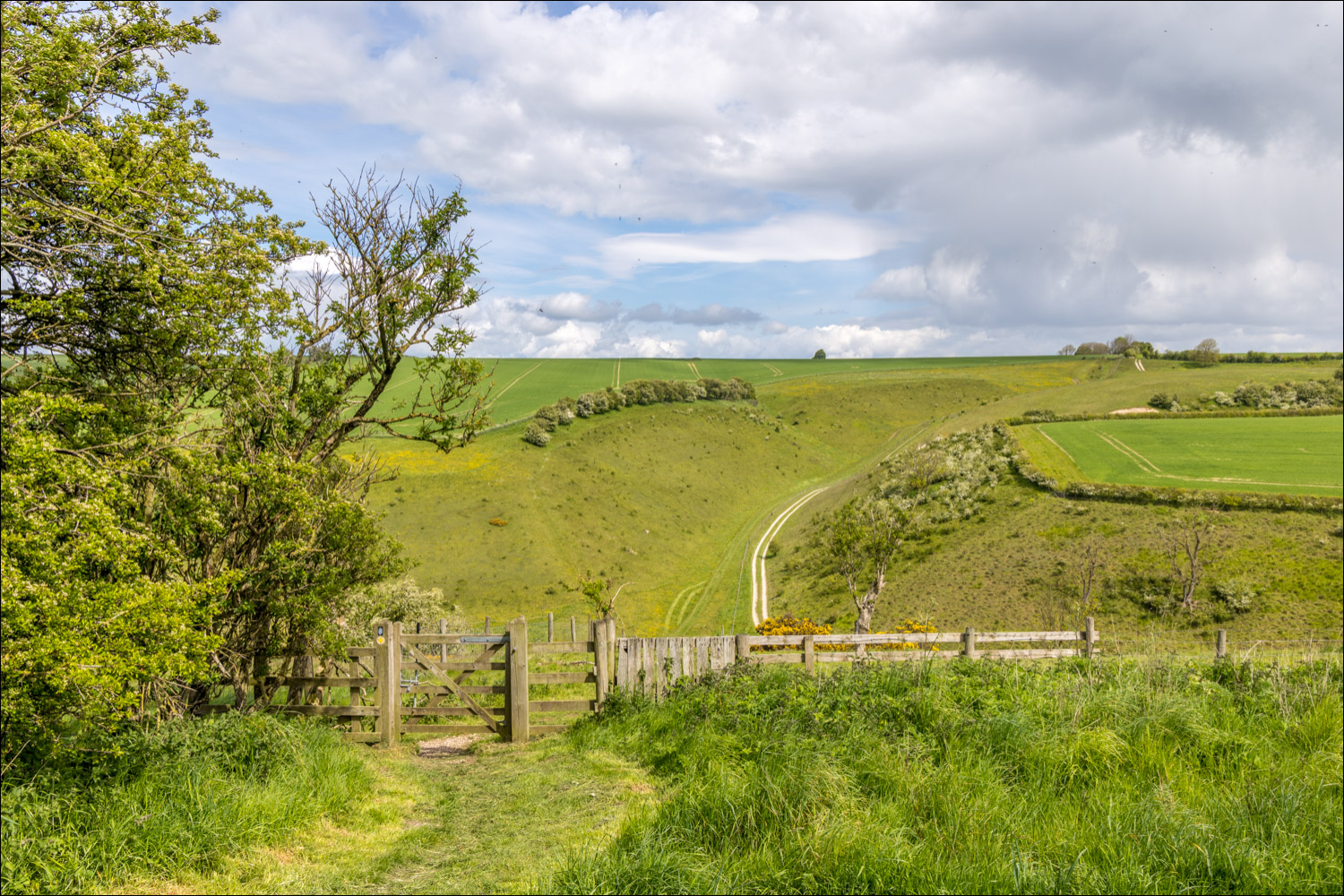
We pass through the gate and will follow a path beside the chalk path beyond

Looking across to North Plantation, the thin strip of trees mid picture. We'll follow a path beside the plantation, with Back Dale below

We descend into Vessey Pasture Dale

On reaching the valley floor we climb up again, following a path beside the chalk track

Back Dale on our right as we walk across the valley floor

We follow the Chalkland Way uphill...


Looking back

Wildflowers lining the path on this section of the walk...


Another view back along our path

On reaching the top of the wold we turn right and follow a path beside North Plantation

Rolling farmland on our left

We turn right as we approach Deep Dale

A change of direction as we head south towards Thixendale...


Hawthorn blossom and cow parsley lining the path towards Court Dale

We pass through the gate and turn left to walk above Court Dale, with Honey Dale right of picture...


View along Honey Dale

We follow a narrow path above Court Dale

As we descend, Thixendale comes into view on our right. We follow a vague grassy path towards the village, ignoring the tracks in the picture

Last leg of the walk as we head along Water Dale, passing by the village cricket ground on the left

Looking back along Water Dale

We arrive back in Thixendale and pass by St Mary's Church to end a wonderful walk on the Wolds

Back home, the wire sculpture of a barn owl by artist Richard Gibson, the reason for our visit to Thixendale today - the walk was the icing on the cake
