
Route: Burton Constable Hall
Area: East Yorkshire
Date of walk: 14th May 2026
Walkers: Andrew and Gilly
Distance: 3.0 miles
Ascent: nil
Weather: Mixed sun, light showers and a brief hailstorm
Burton Constable Hall is an Elizabethan gem 10 miles east of Hull city centre, and set in over 300 acres of Grade II listed parkland landscaped by Capability Brown (check the website for opening times, prices and other information). There are plenty of walking opportunities in the grounds and they are perfect for anyone who doesn’t like to climb hills – the surrounding landscape is as flat as a pancake. We last visited the Hall in 2017 and were looking forward to our return
The house itself isn’t open until 11am and we’d arrived at 10am so decided to walk around the parkland first. A map of the grounds is handed out at the entrance so the route maps on this post aren’t really necessary, but I’ve included one fthe sake of completeness. We set off along the Woodland Walk following a long avenue of trees, at the end of which we turned right to head towards North Lake. A static caravan park on the far side of the lake detracts somewhat but it’s lovely section all the same, with views over the parkland on the right. We paused to admire the Capability Brown Bridge, designed in 1776 and a clever piece of engineering as the photos will show
Beyond North Lake we continued beside South Lake (enduring a passing hailstorm for a couple of minutes) before turning back towards Burton Constable Hall. Dramatic skies loomed over the Hall as we arrived at its west wing. We made our way to the entrance to the interior of the Hall and enjoyed a fascinating walk around 30 or so of the rooms. This wasn’t a guided tour, but there were several volunteers offering helpful information along the way
After leaving the Hall we made our way back to the start, passing through the Stable Block, built in 1770 to the designs of the architect Timothy Lightoler. Don’t make the mistake which I did, which is to overlook the Story of Constable Moby, to be found within the stables. I must return to rectify this omission, no hardship when there is so much to see here
For other walks here, visit my Find Walks page and enter the name in the ‘Search site’ box
Click on the icon below for the route map (subscribers to OS Maps can view detailed maps of the route, visualise it in aerial 3D, and download the GPX file. Non-subscribers will see a base map)

Scroll down – or click on any photo to enlarge it and you can then view as a slideshow

Map of the grounds, which is handed out at the entrance

We set off along the Woodland Walk, following a long avenue of trees...


Wildflowers line the way and there are views across to the surrounding parkland

Looking back to Burton Constable Hall as we walk across to North Lake

The landscape was once scrubland, with few trees to break the horizon. Capability Brown planted carefully planned clumps of trees such as this to improve the view

Start of the walk beside North Lake

North Lake


The Victorian Bathing Pool, restored in 2009

The ingenious Capability Brown Bridge, designed in 1776

North Lake, to the right of the bridge, is higher than South Lake on the other side. Capabilty Brown lived up to his name by building a dam between the two, disguising it below the bridge

South Lake from the bridge, covered by a blanket of water lilies

Now looking along North Lake, devoid of water lilies and highlighting that these are two separate bodies of water

We make our way back to Burton Constable Hall

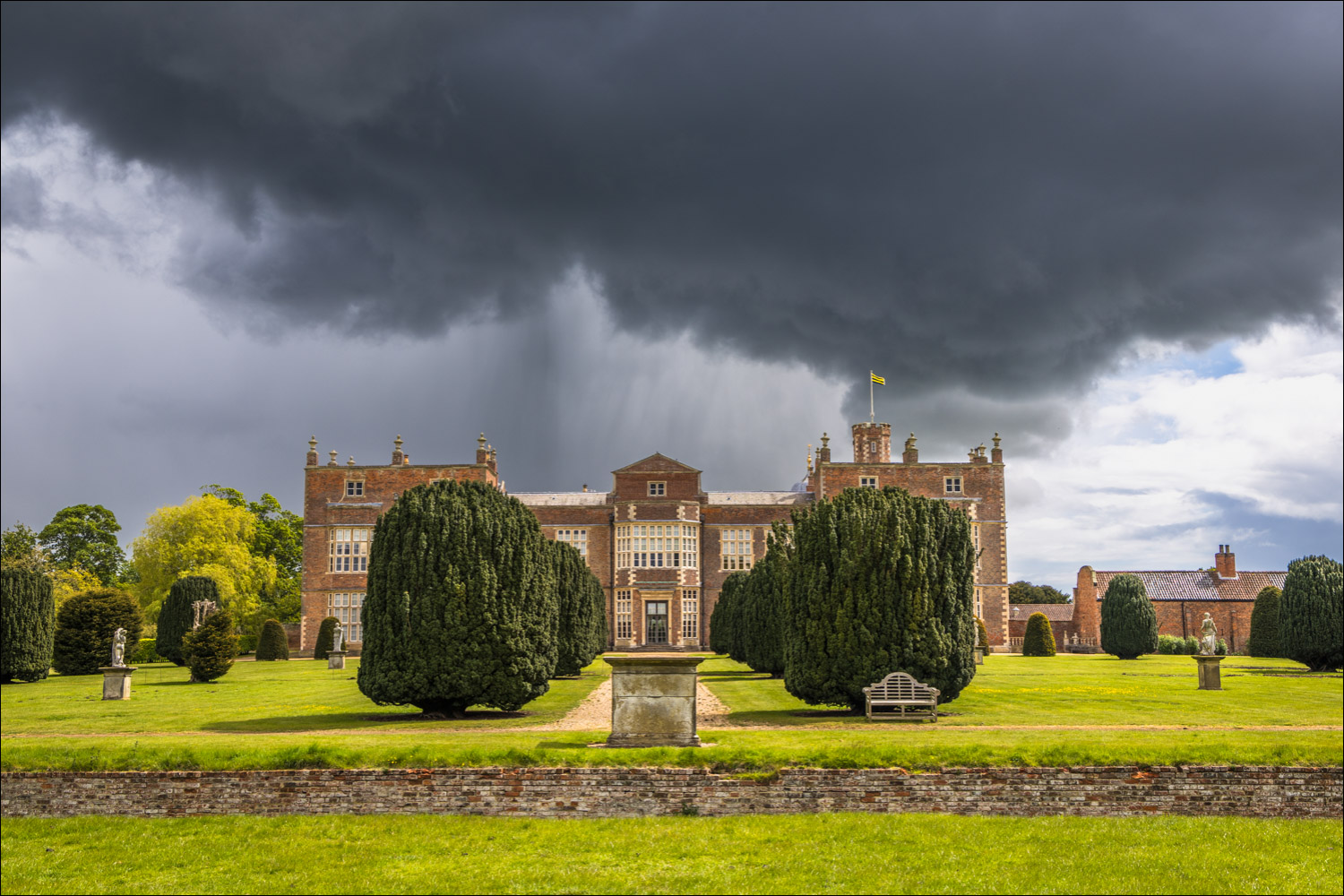
Rapidly changing skies as we approach the Hall - luckily the clouds were moving across from left to right and we avoided a soaking

Contrasting weather, with the west wing of Burton Constable Hall illuminated by the sun and the parkland beyond under foreboding skies

The ha-ha which runs around parts of the Hall. This feature was widely used by Capability Brown and is designed to keep livestock out of the formal gardens without obstructing the view

Seen from the Hall, the ha-ha is invisible and the garden and parkland appear as one

The Orangery, a 18th century hothouse formerly used for growing exotic fruits for the Constable family's dining table


Beside the Orangery is the oldest sweet chestnut tree in East Yorkshire with a girth of 24 feet and dating back to the late 16th or early 17th century

We make our way around the Hall to the main entrance


Views back to the parkland...


Approaching the west front, entrance to the interior of the Hall...


The Great Hall, once a focal point of Elizabethan life

The Staircase Hall

The Blue Drawing Room

The Chapel

The Dining Room

View through the windows...

...and the same view from outside

From the interior of the Hall, The Entrance Front, Burton Constable by George Barret the elder, early 18th century...

...and the Entrance Front today

A few concluding photos of Burton Constable Hall and its parkland as we make our way to the exit


The Stable Block at the end of a wonderful visit to Burton Constable Hall
