
Route: Wasdale
Area: Southern Lake District
Date of walk: 14th December 2018
Walkers: Andrew and Gilly
Distance: 4.7 miles
Ascent: 300 feet
Weather: Sunny, with a bitterly cold wind where exposed
Having been blown over by gale force winds on the fells yesterday, and with more of the same forecast for today, we decided on a low level walk and headed south to Wasdale. We parked in the free National Trust car park at Cinderdale Bridge, just beyond Nether Wasdale. We crossed the bridge over the River Irt, and then joined the track leading to Easthwaite, with the Wasdale Screes ahead of us. After passing through the farm we headed towards the foot of Wast Water, arriving at a junction where a public footpath to Lund Bridge is clearly marked on the OS maps. However, as on the previous occasion here, there was a sign on the gate ‘PRIVATE – no public right of way’. The gate was open and there were no livestock in the field so we decided to follow the path to the bridge. Last time I was here it was lambing season and I took a slightly longer alternative path
We followed the path around Low Wood and arrived at the foot of Wastwater. One of the best views in the country was revealed here in all its glory – the view along the lake to Wasdale Head and some of lakeland’s finest mountains. It was a magnificent sight. We followed the path around the foot of the lake, gawping at the panorama all the while. After passing by Wasdale Hall we arrived at the lakeshore road and with reluctance turned our backs on the view to start the return journey
We left the road after a short distance to join a path through Ashness How, a small area of uncultivated moorland, where the track is a muddy and deeply rutted quagmire. The views ahead of us were nothing in comparison to those behind us, and we kept looking back to admire them
Beyond Ashness How we turned off at Scale Bridge and followed a very pleasant path back to the start. It had been a superb walk, and we felt privileged to have seen the classic view of Wasdale Head in such good conditions
For other walks here, visit my Find Walks page and enter the name in the ‘Search site’ box
Click on the icon below for the route map (subscribers to OS Maps can view detailed maps of the route, visualise it in aerial 3D, and download the GPX file. Non-subscribers will see a base map)

Scroll down – or click on any photo to enlarge it and you can then view as a slideshow

The start of today's walk as we cross the River Irt via Cinderdale Bridge

Beyond the bridge, an immediate left turn to follow the delightful track to Easthwaite

The steep face of Whin Rigg in the background...


Further along the track

A hint of things to come - Yewbarrow, Great Gable and Lingmell at the head of an unseen Wast Water

Approaching Easthwaite

The Wasdale Fells again

We walk through the farmyard at Easthwaite

Heading towards Low Wood

Having crossed the field mentioned in the introduction we cross Lund Bridge over the River Irt

Beyond the bridge we follow a path through Low Wood, with the river on our right

Boathouse at the foot of Wast Water

Our path will take us past Wasdale Hall

A wonderful moment as the view to Wasdale Head is revealed from the lakeshore path

We pass by Wasdale Hall

Views along Wast Water from the path beside the lake...

This is the deepest lake in England, with a maximum depth of nearly 80 metres

It's good to be walking with our golden retriever Bonnie again - this is her first proper walk after a knee replacement operation

It doesn't get much better than this

We reach the valley road and start the return leg (it's possible to continue here and extend the walk, but we didn't have time today)


We follow the road away from Wast Water for a short distance

Having left the road, a view back to Wasdale Head from the path beside High Birkhow...

...and again, from the start of the small moorland area of Ashness How

Looking across to Buckbarrow

Contrasting flat scenery as we head west away from the fells

Ashness How

Looking back to Middle Fell

We walk towards Scale Bridge, with Buckbarrow to the right

Looking across to Scafell

Some retrospective views beyond Scale Bridge - Buckbarrow...

...Lingmell and Scafell...

...the Wastwater Screes - Whin Rigg and Illgill Head

We arrive back at Cinderdale Bridge

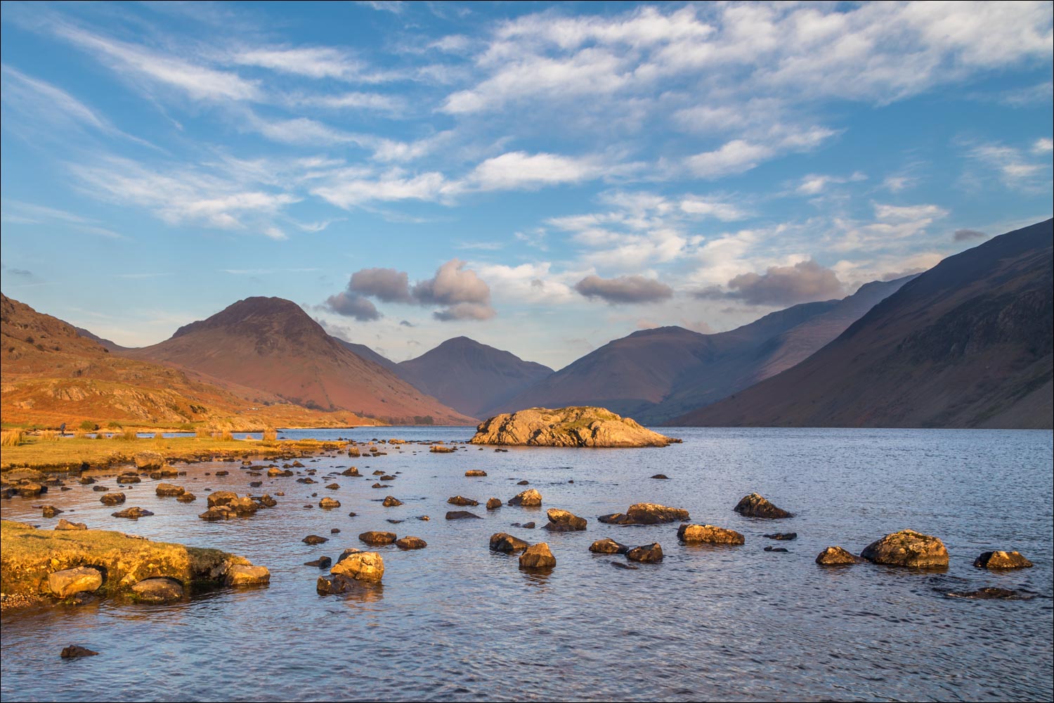
We drove back along the valley to catch the classic view to Wasdale Head in the late afternoon sunshine
