
Route: Nether Wasdale
Area: Southern Lake District
Date of walk: 24th April 2018
Walkers: Andrew
Distance: 4.8 miles
Ascent: 300 feet
Weather: A few bright patches at first, but gradually clouding over
Low cloud hanging over most of the Lakeland fells persuaded me to plan a low level walk today, and as it’s a while since I was last in Wasdale I decided to head south. I parked in a small car park at a triangle of roads just beyond Nether Wasdale, and after turning right out of the car park crossed the River Irt, and then joined the track leading to Easthwaite. After passing through the farm I headed towards the foot of Wastwater. There was some momentary confusion when I reached the path to Lund Bridge. This is clearly marked as a public footpath on the latest OS map, yet there was a sign on the gate ‘PRIVATE – no public right of way’. It wasn’t worth risking a trespass, and in any event is was lambing season so I thought it best to avoid disturbing the sheep, and instead made a short detour via the river which soon brought me to Lund Bridge
I followed the path around Low Wood, where a mass of bluebells were just starting to come into flower, and arrived at the foot of Wastwater. On a clear day the view from here is one of the finest mountain landscapes in the Lake District. Sadly it was not a clear day today, but the view was impressive all the same
I continued along the lakeshore path and just beyond Wasdale Hall I climbed up to the road, which I followed for a short distance before turning off at High Birkhow. The track beside the wood, and through the open countryside at Ashness How, has been reduced to a deeply rutted quagmire by heavy farm vehicles, though much of the thick mud could be avoided by weaving from side to side of the track. It was a relief to turn off at Scale Bridge and to follow the very pleasant path back to the start of a splendid short walk
For other walks here, visit my Find Walks page and enter the name in the ‘Search site’ box
Click on the icon below for the route map (subscribers to OS Maps can view detailed maps of the route, visualise it in aerial 3D, and download the GPX file. Non-subscribers will see a base map)

Scroll down – or click on any photo to enlarge it and you can then view as a slideshow

The start of today's walk as I cross the bridge over the River Irt and turn left immediately beyond it...

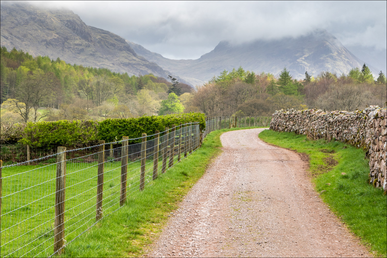
...to follow this delightful track leading to the foot of Wast Water - the dramatic crags of Whin Rigg are ahead

Lots of new born lambs around, all of them black

A couple of escapees

The Screes, which plunge into Wast Water from Whin Rigg and Illgill Head

Middle Fell

Approaching Easthwaite Farm

Looking towards The Screes

I believe these are Jacob Sheep

Buckbarrow

I walk through Easthwaite Farm

Yewbarrow near the head of Wast Water


Yewbarrow again

The Screes

The path beyond this gate leads directly to Lund Bridge and is shown on the OS map as a public right of way. I decided to respect the notice, but believe it to be a misrepresentation

I continued along the track, walking past Lund Bridge which is bottom right

When the scenery is like this, a short detour is no hardship

The foot of Wastwater - the path continues but I turn sharp left here to head towards Lund Bridge

Path beside the River Irt...


I cross Lund Bridge and then turn right into Low Wood

Emerging bluebells - I'm a little too early to see them at their best

Boathouse at the foot of Wast Water

I follow the path around the lakeshore

The Screes

The classic view to the head of the lake is mostly missing in low cloud

I follow the path past Wasdale Hall

A small unnamed island

The Screes again

Looking back along the shore to Low Wood

I reach the road here, and would normally have lingered to admire the view of Wasdale Head, but there was no point today

A short road section before I turn off at the bend ahead

Buckbarrow to the right

The best of the scenery is behind me now...

Looking back to Buckbarrow...

....and Middle Fell...

...Illgill Head

I carry straight on at this crossroads

Mill Place ahead

I pass through Mill Place

Cinderdale Bridge, and the car park is just around the corner
