
Route: Drewton
Area: East Yorkshire
Date of walk: 24th December 2018
Walkers: Andrew and Gilly
Distance: 4.0 miles
Ascent: 500 feet
Weather: Mostly sunny
This is a walk we’ve done many times and it never fails to please – it provides a perfect example of rolling East Yorkshire Wolds countryside
We parked on the roadside verge of the estate road leading to Drewton Manor. The landowners kindly permit this as long as care is taken to park considerately. We walked past the manor house and, just beyond it, we left the road and crossed Drewton Beck. There then follows a gradual climb up to the top of the wold. There were extensive, though rather hazy, views over miles of open countryside as we made our way above Austin’s Dale
Near the top of the wold there’s a short section beside the busy B1320. The road can be kept behind a hedge by following an informal path along the edge of a field – this obscures the view of the traffic, but not the sound. In any event the road section only lasts for a couple of minutes before the start of the return leg above the other side of Austin’s Dale
After enjoying some more big views we gradually descended back into Drewton Dale, eventually reaching the estate road and from here we retraced our steps back to the start. For anyone following this walk, a visit to the nearby Drewton’s Farm Shop is highly recommended
For other walks here, visit my Find Walks page and enter the name in the ‘Search site’ box
Click on the icon below for the route map (subscribers to OS Maps can view detailed maps of the route, visualise it in aerial 3D, and download the GPX file. Non-subscribers will see a base map)

Scroll down – or click on any photo to enlarge it and you can then view as a slideshow

The Humber Bridge at sunset earlier in the week

A couple of days later, the start of the walk as we follow the lane to Drewton Manor

Looking across Drewton Beck to Austin's Dale, where we'll be walking later

Drewton Manor on the left

Looking along Drewton Dale, but we turn left here and will return via the lane ahead

Drewton Wold beyond the beck

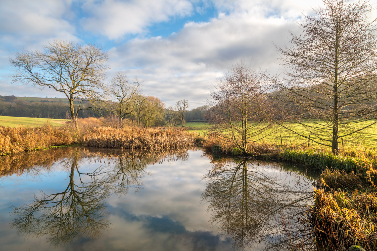
We cross the bridge over Drewton Beck, which has been widened at this point to form an attractive pond

Start of the climb up the wold

Looking across to Hunsley Dale

A hazy view across the flat countryside to the west

We follow a path above the woods

Looking back along the path...

...and again


We continue the easy climb up Drewton Dale

A view back towards Hunsley

The path skirts along the edge of the woods above Austin's Dale...


Looking through a long lens at a power station in the west, which I think is Drax

Having walked beside the B1230 for a short distance we reach the half way point of the walk near the top of the wold

Looking back towards the road

The power station again in the distance

Start of the descent down Drewton Wold

We follow the edge of the woods above the other side of Austin's Dale...


Diamond Cottage ahead

Our path had taken us above the woodland in the distance

Looking back along the path

Sheep near Diamond Cottage

Looking towards High Hunsley...


Beyond the cottage we join the lane and retrace our steps back to the start

Season's greetings!
Follow the link for more walks in East Yorkshire (117)
