
Route: Watches
Area: Northern Lake District
Date of walk: 13th December 2018
Walkers: Andrew, Gilly and David (part of the way)
Distance: 3.1 miles
Ascent: 1,300 feet
Weather: Cloudy, rather hazy, and gale force winds
The title for today’s walk was intended to be ‘Skiddaw’, but circumstances caused us to improvise a change of plan. Nephew David was staying with us and we’d plotted a linear walk which would enable him to tick off 5 Wainwrights – Ullock Pike, Long Side, Carl Side, Skiddaw and Skiddaw Little Man. We were aware that a bitterly cold wind was forecast, and according to the Mountain Weather Information Service the temperature would be -2c but would feel like -18c. Wearing plenty of layers, we set off from the small parking space just before Barkbeth
We made our way through the fields, aiming for the long ridge line known as The Edge, which leads up to the first fell Ullock Pike. The coldness of the wind wasn’t a problem, and we were well prepared for that. What set us back – literally – was its strength, which was gale force
We gained the ridge line and battled our way up to a height of about 1,500 feet, at which point Gilly was blown off balance by a sudden gust, and so was I. Progress had been tortuous all the way and after a brief discussion it was agreed that Gilly and I would retreat, while David would continue as far as Carl Side, enabling him to bag three of the Wainwrights on our proposed round. As far as I can recall, this is the first time I’ve ever had to abandon a walk
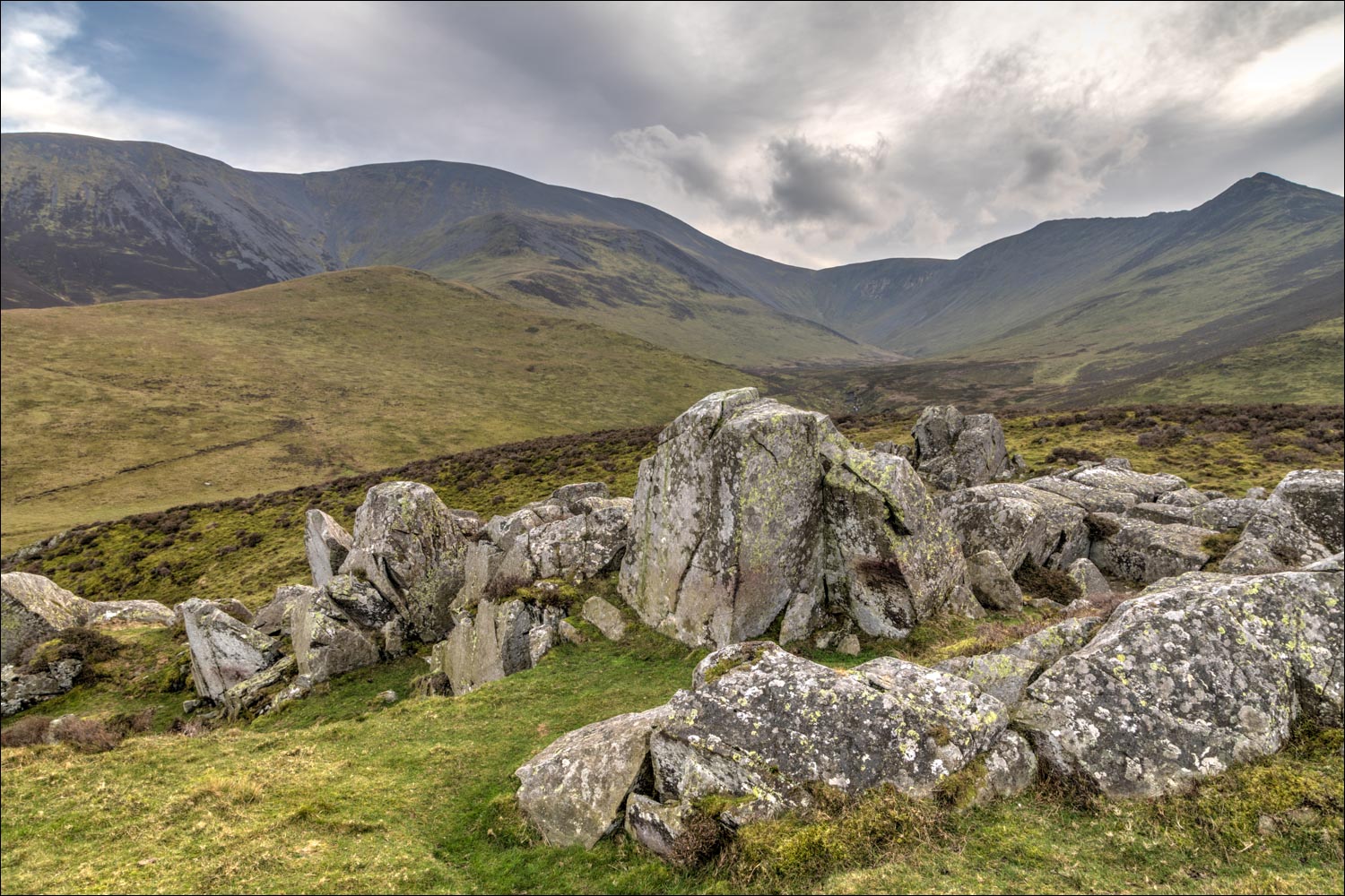
As Gilly and I returned down The Edge, we decided to visit Watches, which is an independent fell over 1,000 feet high, as classified by Bill Birkett in his Complete Lakeland Fells. At least we wouldn’t have wasted the morning. It was an easy climb up the grassy slopes and we were soon on top of this curious fell which is covered with large rocks and is quite unlike anything else in the surrounding area. The views were rather hazy and the wind was relentless, so we didn’t linger there and made our way down the north end of the fell to rejoin our earlier path. Although we didn’t achieve our objective, I’ve included the walk on these pages for anyone looking to tick off a Birkett, or seeking a short stroll in the Bassenthwaite area. The route can easily be adapted to omit our aborted climb up The Edge
If you’re only here for the photos you may wish to press the back button now, as they’re not very inspiring thanks to flat light and the rather bleak nature of the terrain
Click on the icon below for the route map (subscribers to OS Maps can view detailed maps of the route, visualise it in aerial 3D, and download the GPX file. Non-subscribers will see a base map)

Scroll down – or click on any photo to enlarge it and you can then view as a slideshow

The start of the walk from the small roadside parking space, looking towards Sale Fell beyond Bassenthwaite Lake

Looking back to Bassenthwaite village as we start the climb

We follow the grassy slopes. aiming for the ridge line

Ullock Pike, which was to be the first fell on our planned walk


Sale Fell and Bassenthwaite Lake again

Our planned route would have taken us up the fells on the right, and then around to Skiddaw on the left

Looking east towards the Uldale Fells

Southerndale Beck below as we follow a wide path around the foot of Watches

Skiddaw looms large on our left

The Edge ahead, leading up to Ullock Pike

We make it onto The Edge, where it's blowing a gale and progress is arduous

Looking back to Bassenthwaite - but at this point both Gilly and I are blown over and decide to abort the mission, David gamely soldiers on

We retrace our steps to Watches, which lies ahead, and is a simple walk

The curious rocks strewn about on Watches, in contrast to the grassy slopes elsewhere in the area

Looking towards the Uldale Fells....

....Skiddaw


Bassenthwaite Lake

Small cairn on the summit of Watches, which just manages to qualify as a Birkett at a height of 1,092 feet

Looking back up The Edge, from which we'd retreated earlier

We descend from Watches, with Binsey in the background


Park Wood

Looking down to the track we'd followed earlier


We follow the dry stone wall gently downhill

End of the walk as we reach the road below
