
Route: Rydal Water
Area: Central Lake District
Date of walk: 21st December 2017
Walkers: Andrew
Distance: 3.7 miles
Ascent: 300 feet
Weather: Low cloud and mist
Today’s walk was an unplanned one – I’d prepared for a fell walk but the fells were obscured by low lying clouds and there would have been no views at all, even from the nursery slopes, so it was time for a re-think
I decided instead to walk round Rydal Water which looked quite atmospheric as I drove by. I parked on the roadside at Rydal Mount and followed the footpath beside the A591. I’d normally have followed the higher level Coffin Road which avoids the road and has good views but there would have been no point in doing so today. It’s possible to leave the footpath in a couple of places and descend to the lakeshore
I soon reached White Moss Common, where several paths lead in different directions. I followed the path through the woods which emerges onto Loughrigg Terrace, one of the loveliest paths in lakeland. I followed the lower level path in order to enjoy such views as there were, and on reaching the head of the lake I crossed the footbridge over the River Rothay to complete the circuit of the lake
For other walks here, visit my Find Walks page and enter the name in the ‘Search site’ box
Click on the icon below for the route map (subscribers to OS Maps can view detailed maps of the route, visualise it in aerial 3D, and download the GPX file. Non-subscribers will see a base map)

Scroll down – or click on any photo to enlarge it and you can then view as a slideshow

A brief detour at the start of the walk to Rydal Mount to visit The Grot, a Grade II listed building built in 1668 to frame the view of the waterfall

Looking along the river at the end of an atmospheric and enjoyable walk

Looking along Rydal Water as I start the walk along its northern shore

The boathouse

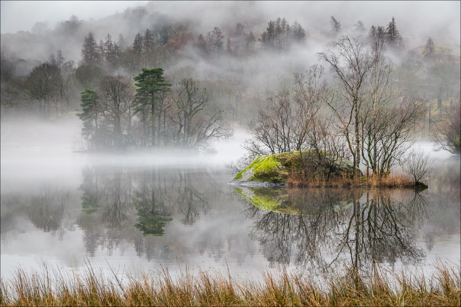
A small unnamed island near the head of the lake

Looking across Rydal Water

The path is beside the A591 for some of the way, but I can leave it here to walk along the shore

Little Isle

View along the shoreline

Little Isle again, behind a small unnamed island...


Heron Island...


Looking back along the lake

Another of the small islands on Rydal Water which enhance its appearance

White Moss Common, where I pass round the head of the lake

I cross the bridge over the River Rothay...


A short section through the woods

I emerge onto Loughrigg Terrace to start the return leg along the southern shore

I pass by a ruined barn

Loughrigg Terrace

Looking down to Rydal Water

A lone canoeist paddles by Heron Island

Further along Loughrigg Terrace

A heron waiting patiently

I arrive back at the head of the lake

The boathouse again

Looking back along Rydal Water

I cross the footbridge over the River Rothay
