
Route: Loweswater
Area: Western Lake District
Date of walk: 22nd December 2017
Walkers: Andrew
Distance: 4.5 miles
Ascent: 600 feet
Weather: Mist, then fog
I awoke to another misty morning and went for a short drive to check out the weather conditions. Parts of the district were shrouded in thick fog, yet others were relatively clear with some magical misty views. I dithered for a while – a high level fell walk could have produced a cloud inversion or it may have been a walk in thick clag. It was a lottery, and the choice was made more difficult by the rapidly moving mist. In the end I decided to revisit Loweswater for the umpteenth time, a place which I never tire of
I parked as usual in the small National Trust car park at Maggie’s Bridge and followed the track to Watergate Farm at the head of the lake. I then followed the path through Holme Wood, and on reaching the bothy I left the main path to join an alternative route along the lakeshore
At the foot of the lake I climbed uphill to Hudson Place and descended to the Loweswater road. I’d normally have followed the road and the shoreline path back to the start but today I decided instead to make a short diversion uphill to Askill and follow the old Mosser Road. The road isn’t fit for vehicles but at 600 feet above sea level provides good views over Loweswater. As I made my way along the road the ethereal mist was gradually overtaken by gloomy fog and I lost the good light which had accompanied me for most of the walk
The Mosser Road eventually emerges onto the Loweswater road and from here I walked past the head of the lake, turning right before Loweswater village hall to follow the lane back to Maggie’s Bridge. It had been another wonderful walk in this area, and I hardly saw another soul
For other walks here, visit my Find Walks page and enter the name in the ‘Search site’ box
Click on the icon below for the route map (subscribers to OS Maps can view detailed maps of the route, visualise it in aerial 3D, and download the GPX file. Non-subscribers will see a base map)

Scroll down – or click on any photo to enlarge it and you can then view as a slideshow

Before the start of the walk I drove over to Crummock Water, looking quite magical in the mist...

Woodhouse Islands....

...and again, this time in black and white and with a ghostly flock of gulls passing by

Newlands Valley

The start of the walk as I follow the track to Watergate Farm at the head of Loweswater...


Watergate Farm

Head of Loweswater

Looking across to Thrushbank on the right, a house which dates back to 1697


I walk along the edge of the lake to enter Holme Wood

Bench at the entrance to the wood

I branch right here to keep to the shore of the lake

Looking across to Thrushbank

The bothy, available to rent from the National Trust

The National Trust also owns and manages Holme Wood, a wonderful place...


I leave the wood to follow the path towards Hudson Place

A view back along the lakeshore

The foot of Loweswater

Looking back to Holme Wood

I continue to climb towards Hudson Place

Darling Fell on the far side of the lake

Looking back along the path...


Beyond Hudson Place I follow the track around the foot of Loweswater

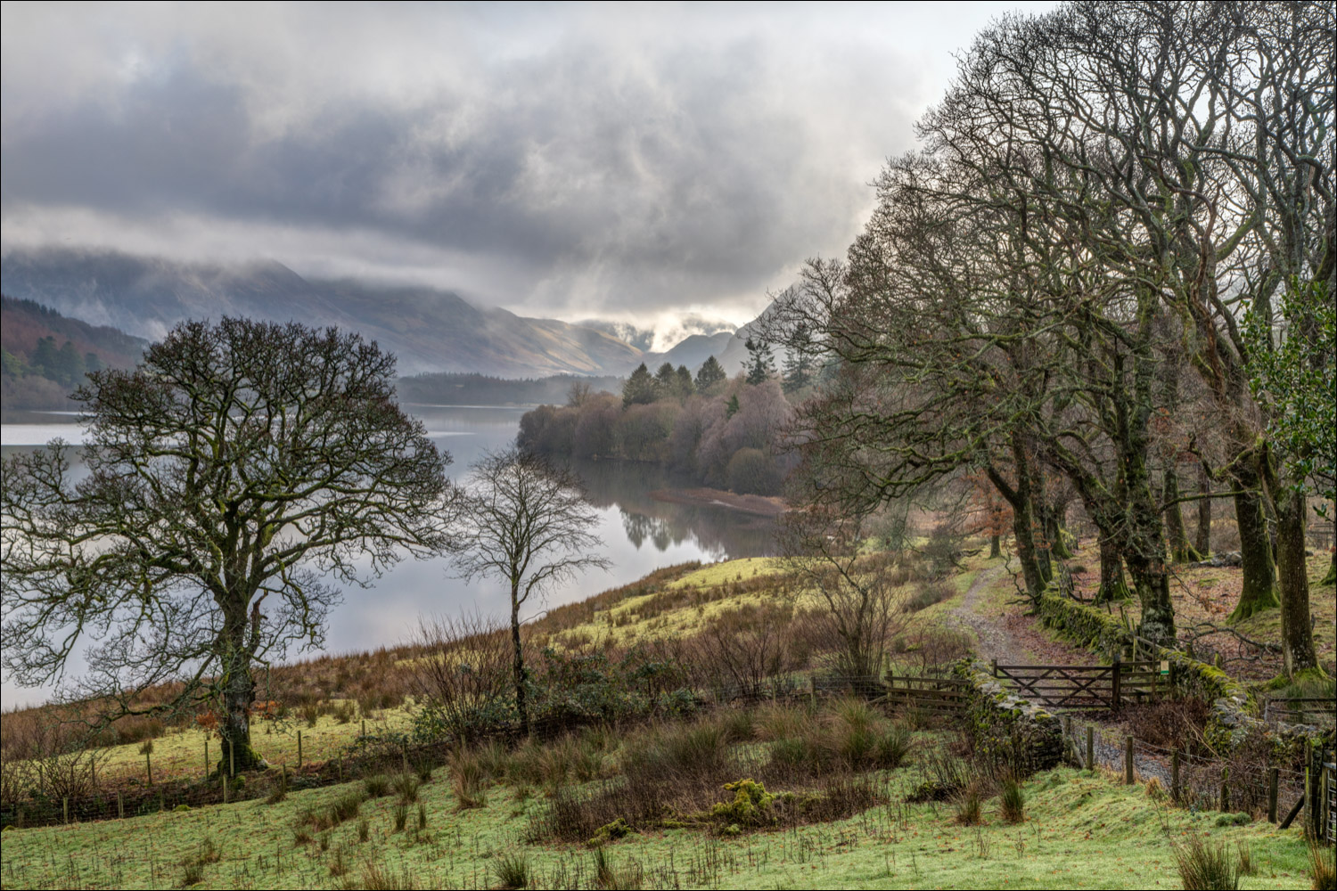
I leave the track to join this path. My route will take me up the slopes of Darling Fell and along the line of trees at the top of the picture


Holme Wood and Loweswater

After reaching the Loweswater road I leave it almost immediately to take the track up to Askill

The track becomes a grassy slope...


The old Mosser Road

Looking down over Loweswater in deteriorating light...


I rejoin the Loweswater road

Last view of Loweswater

The lane back to Maggie's Bridge and the end of a wonderful walk
