
Route: Circuit of Loweswater
Area: Western Lake District
Date of walk: 28th February 2024
Walkers: Andrew
Distance: 4.2 miles
Ascent: 300 feet
Weather: Cloudy with some light drizzle and weak sun
Loweswater is unique in the Lake District, as it is the only lake that drains towards the centre of Lakeland, into Crummock Water to which it was once joined
I parked in the small car park at Maggie’s Bridge where there is room for about 8 cars. If this is full there is alternative parking on the Loweswater road at the other end of the lake. An easy track leads across the foot of Loweswater and past Watergate Farm. Just beyond the farm I entered into Holme Wood, managed by the National Trust, and having many inviting paths and some superb mature trees – alder, oak, lime, chestnut, ash, sycamore and others. Sadly the larch trees in the wood have been affected by Phytophtora Ramorum, and all of them have recently been felled by the National Trust in order to reduce the chance of the disease spreading.
There’s a choice of paths running through the the wood – a wide track is the most direct route, but I preferred to follow an alternative path which follows the lakeshore and passes by Holme Wood Bothy. At the end of Holme Wood I emerged at the head of Loweswater and walked along the track past Hudson Place. After crossing a couple of fields I arrived at the Loweswater road. Points must be deducted from an otherwise perfect walk, as the return section follows the road for much of the way. However it’s a fairly quiet road and can be avoided for some of the way by taking a narrow footpath which runs close to the lakeshore and parallel with the road
The narrow path rejoins the road by an ancient pinfold which has an information board about its interesting origins. Beyond the pinfold I continued along the road before turning right to walk along the lane leading back to Maggie’s Bridge to complete the circuit of Loweswater
For other walks here, visit my Find Walks page and enter the name in the ‘Search site’ box
Click on the icon below for the route map (subscribers to OS Maps can view detailed maps of the route, visualise it in aerial 3D, and download the GPX file. Non-subscribers will see a base map)

Scroll down – or click on any photo to enlarge it and you can then view as a slideshow

A promising start to the walk as I leave the car park at Maggie's Bridge and follow the track to Watergate Farm

Watergate Farm below Holme Wood and Carling Knott

I follow the track past the foot of Loweswater

The path passes to the right of Watergate Farm

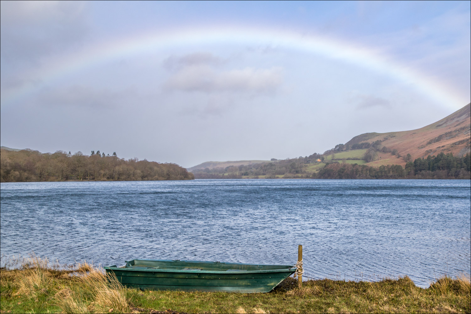
Rainbow over Loweswater...


Looking back along the lakeshore to Low Fell

I follow the easy track through Holme Wood

I pass by Holme Wood Bothy, available to rent from the National Trust

Instead of taking the main track through the wood, I follow this alternative path which keeps closer to the shore...


Askill Knott through a gap in the trees

Lichen covered tree in Holme Wood

I leave the wood via this gate

I follow the path to Hudson Place

Looking across to Darling Fell

A view back along Loweswater

I join the lane to Waterend

Rare breed sheep in the fields at the head of Loweswater...


Askill Knott and Darling Fell

I arrive at the Loweswater road - this is an alternative place to start the walk. The roadside section can't be avoided, but there is a path later on

Dark skies over Loweswater

After following a narrow path for a while I emerge back onto the Loweswater road at the pinfold

Beware the pinder

Looking across Loweswater to Holme Wood and Carling Knott

I pass by Thrushbank, one of several old farms around Loweswater dating back to the 17th and 18th centuries

I leave the Loweswater road to follow this lane down to the car park at Maggie's Bridge
