
Route: Wast Water
Area: Southern Lake District
Date of walk: 29th February 2024
Walkers: Andrew
Distance: 4.8 miles
Ascent: 300 feet
Weather: Overcast
Wast Water is the deepest lake in England and the view to its head is a classic. It may be thought that this would make Wast Water a good candidate for a circular walk around its shoreline. Although a circuit is possible I wouldn’t recommend it – about half of the route follows the road and the other half is along the Wasdale Screes, where the going is torturous. Wasdale is a place for fell walking but has limited opportunties for low level walks. There are however several wonderful circular walks starting from Nether Wasdale which enjoy the view to Wasdale Head. For variations of today’s walk follow the link at the end of these notes
I parked as usual in a small car park at Cinderdale Bridge, at a triangle of roads just beyond Nether Wasdale. After turning right out of the car park I crossed the River Irt, and then joined the track leading to Easthwaite. After passing around the farm via a waymarked path I headed towards the foot of Wastwater. The direct path to Lund Bridge has been designated ‘Private’ by the local farmer, even though it’s clearly marked as a public footpath on the latest OS map. It’s not an issue though, and a slightly more circuitous route leads to Lund Bridge via the banks of the River Irt
I followed the path around Low Wood, where masses of bluebells will appear later in spring, and arrived at the foot of Wastwater. On a clear day the view from here is one of the finest mountain landscapes in the Lake District. Sadly it was not a clear day today, but the view was impressive all the same
I continued along the lakeshore path and just beyond Wasdale Hall I climbed up to the road, which I followed for a short distance before turning off at High Birkhow. The track beside the wood, and through the open countryside at Ashness How, has been reduced to a deeply rutted quagmire by heavy farm vehicles, though much of the thick mud could be avoided by weaving from side to side of the track. It was a relief to turn off at Scale Bridge and to follow the very pleasant path back to the start of an enjoyable short walk, despite the rather uninspiring weather
For other walks here, visit my Find Walks page and enter the name in the ‘Search site’ box
Click on the icon below for the route map (subscribers to OS Maps can view detailed maps of the route, visualise it in aerial 3D, and download the GPX file. Non-subscribers will see a base map)

Scroll down – or click on any photo to enlarge it and you can then view as a slideshow

The start of the walk as I follow the track to Easthwaite Farm

The crags of Whin Rigg ahead

Easthwaite Farm

Wasdale Head beyond Ashness How

Looking across to Middle Fell

The path has now been diverted to the left around Easthwaite Farm

Beyond the farm I follow the track to the foot of Wast Water

Middle Fell and Yewbarrow

The Screes on the right, plunging into Wast Water

The direct path to Lund Bridge on the left, which is a public footpath, has now been marked 'private'. I follow the alternative route to the foot of the lake

A short diversion to the boathouse at the foot of Wast Water...


I retrace my steps and follow a path along the bank of the River Irt

I cross Lund Bridge and turn right

I follow a path through Low Wood, with the River Irt on my right

The boathouse again, seen from the other side of the river

The path joins the shore of Wast Water

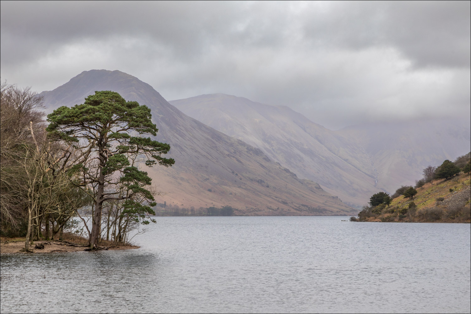
The wonderful view to Wasdale Head is sadly not shown in good light today


That view again....

...and on a previous occasion in better light

I pass by Wasdale Hall


The Wast Water Screes

I arrive at the road to Wasdale Head, the far point of the walk, and follow the road in the other direction...

The road section is very short and ends around the corner

Looking across to Buckbarrow

I cross the ladder stile and traverse some bleak and very juicy terrain

Buckbarrow again from a pleasant path near Scale Bridge

The car park at Cinderdale Bridge is just around the corner
