
Route: Low Fell
Area: Western Lake District
Date of walk: 31st August 2023
Walkers: Andrew
Distance: 4.5 miles
Ascent: 1,500 feet
Weather: Sunny
Low Fell is one of my favourite places and the fell which I chose for my 1,000th Wainwright ascent in May 2018.
The upland section of Low Fell is heathland which has been grazed by sheep for many years and in consequence lacks biodiversity. A large portion of the fell, some 158 acres, has recently been acquired by Buy Land Plant Trees Community Interest Company and is now part of a project to restore the natural ecosystem. Follow the link for more information about this very worthwhile endeavour
I parked as usual in one of the few roadside spaces outside the small settlement of Thackthwaite on the west side of Lorton Vale. I walked into the village and turned right at a signpost next to Thackthwaite Farm and followed a rocky lane uphill. This leads out onto the fields and from here the obvious route follows a line of old oak trees up to the intake wall. There are lovely retrospective views from here.
On reaching the intake wall I turned right to follow a grassy path which curves around the fellside into a small raised valley, where the views are lost – this is a rather dreary section in truth, but it’s soon over and before long I was on the ridge line, heading south with ever improving views along the way
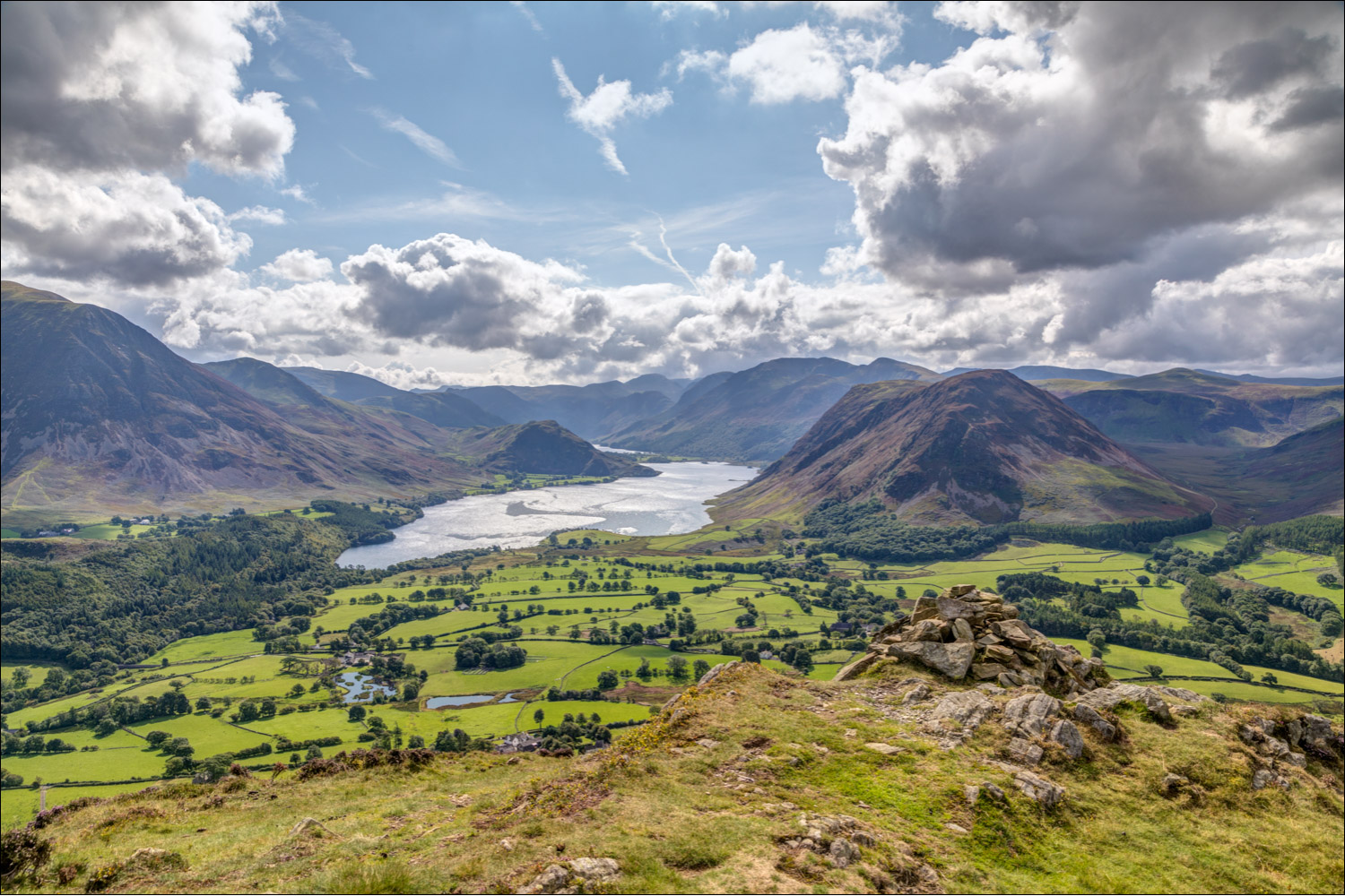
Anyone visiting Low Fell for the first time should not stop at the north top, but should continue to the very end of the ridge where there is a cairn just below the south top. From here, in the words of Alfred Wainwright, ‘the view is of classical beauty, an inspired and inspiring vision of loveliness…a scene of lakes and mountains arranged to perfection’
I spent a heavenly half an hour here in complete isolation before retracing my steps back to the start
For a longer route, which also takes in Darling Fell and Loweswater click here and for a steep direct route descent click here
Click on the icon below for the route map (subscribers to OS Maps can view detailed maps of the route, visualise it in aerial 3D, and download the GPX file. Non-subscribers will see a base map)

Scroll down – or click on any photo to enlarge it and you can then view as a slideshow

The start of the walk as I enter Thackthwaite - I'll turn right in a few yards at a signpost by Thackthwaite Farm

The Low Fell ridge ahead

Looking across to Mellbreak

A view back to Lorton Vale

I follow a path which leads away from Low Fell at first, before trending left

Lorton Vale

A glimpse of Crummock Water looking back along the path

Fellbarrow to the right as I follow the easy path uphill

Looking back to Lorton and Lorton Vale

I pass through a redundant iron gate

After folllowing a zig zag path I approach the summit ridge

I follow the path along the undulating ridge...

Crummock Water on the left

Lorton Vale again


Descents back into Lorton Vale are possible from this side of the fell but they are exceptionally steep

North top of Low Fell, but it would be missing the whole point of the walk to turn back here

I continue along the obvious path to the south top of the fell

Late blooming heather on Low Fell

Cairn on the south top of Low Fell, looking towards the Irish Sea

Lorton Vale

The Solway Firth and Scotland in the distance

Looking down to Scale Hill and Brackenthwaite Hows

I descend to another cairn just below the south top, which offers a superlative view of Crummock Water and too many fells to list


Mellbreak

Loweswater

Grasmoor left of picture

That view again, and after spending a heavenly half hour here I retraced my steps back to the start
