
Route: Derwent Water – Low Brandelhow to Nichol End
Area: North Western Lake District
Date of walk: 25th July 2018
Walkers: Andrew, Gilly, Phoebe, Phil, Denise and Elsie
Distance: 2.5 miles
Ascent: 200 feet
Weather: Sunny and very warm
Gilly and I were looking after our granddaughter Phoebe, and Phil and Denise were visiting with their granddaugher Elsie, so Scafell Pike was not an option for today’s walk, especially on a very warm day such as this. We decided to resort to an old family favourite, a route we followed many times when our children were young
We parked at Nichol End Marina on the shore of Derwent Water with the aim of taking the Keswick Launch along the lake and walking back from one of the various jetties. As we were driving over, it occurred to us that some of the jetties, including Nichol End, might be inaccessible in view of the recent drought. A lack of rain for over two months has left water levels very low, lower than I can recall. Our prediction turned out to be correct, but disappointment was averted when the helpful and enterprising owner of Nichol End offered us a lift across the lake to Keswick in a smaller boat. From there we would be able to take the launch to Brandelhow and carry on with our planned walk. We figured that Low Brandelhow would be a good starting point, but there are other possibilities depending on the age and fitness of the party
After an enjoyable ride, with superb views from the boat, we disembarked and started the walk, initially along the shoreline of Derwent Water. The easy path then took us away from the lake and through woodland and parkland to Lingholm Kitchen and Walled Garden, where we were able to fulfil our promises of ice cream for the grandchildren. After strolling around the superb kitchen garden we followed an easy path back to the start of a perfect short family walk
For other walks here, visit my Find Walks page and enter the name in the ‘Search site’ box
Click on the icon below for the route map (subscribers to OS Maps can view detailed maps of the route, visualise it in aerial 3D, and download the GPX file. Non-subscribers will see a base map)

Scroll down – or click on any photo to enlarge it and you can then view as a slideshow

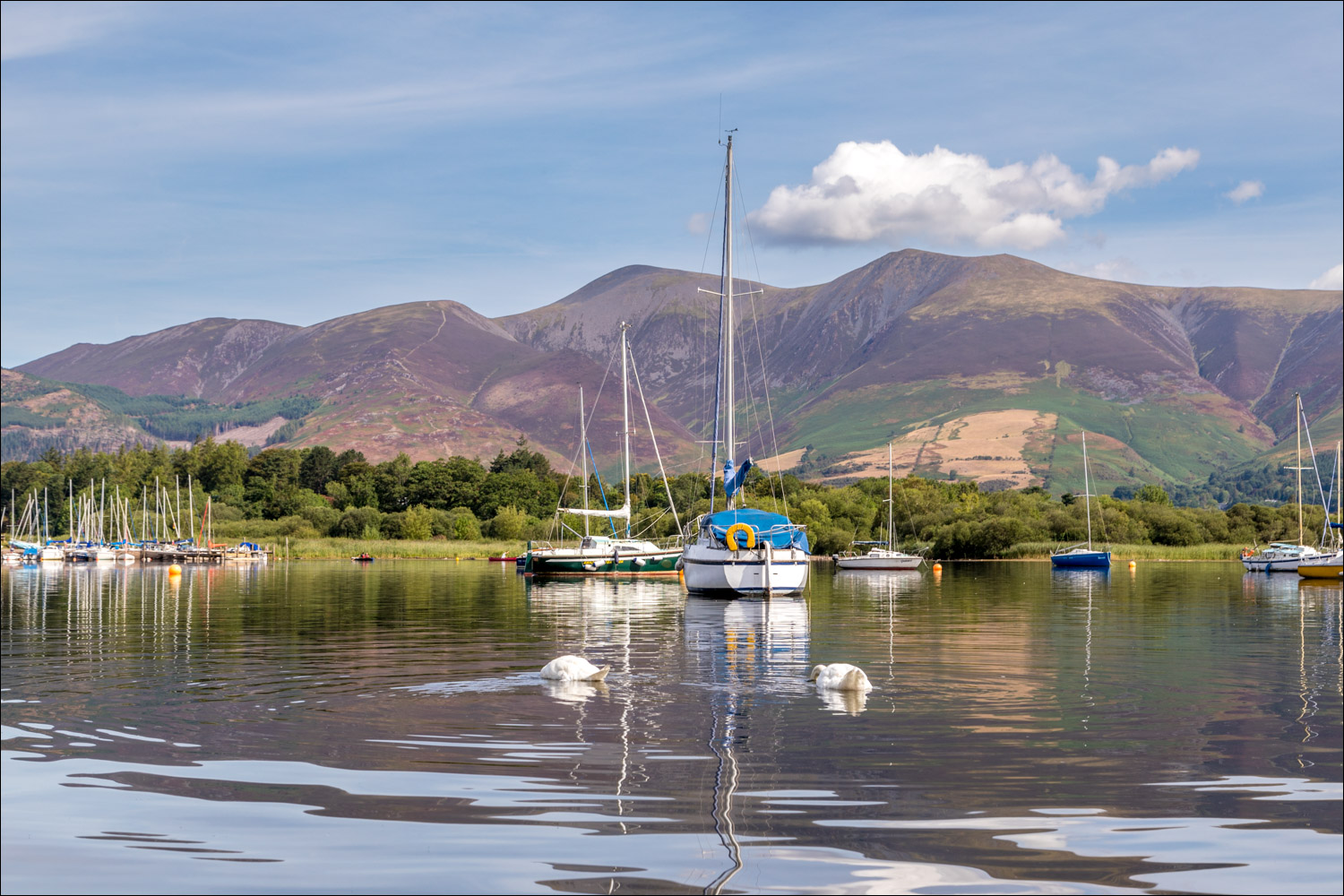
Nichol End Marina - the Keswick Launch is unable to stop here thanks to the low level of the lake, so the friendly owner gives us a lift to Keswick on the far side of the lake

Off we go

Looking across to Skiddaw

Catbells on the left

We arrive at the Keswick jetty, just as the launch - Lady Derwentwater - pulls in

Rampsholme Island and Borrowdale beyond

We disembark at Low Brandelhow

We follow the path towards Otterbield Bay

Phoebe jumps onto an improvised swing

Otterbield Bay

We follow the path around the bay

Catbells...


All too soon the path leaves the lakeshore and we head uphill past Hawes Outdoor Centre


A view back along the path

A walk in The Park...


Just as young legs are beginning to tire, we arrive at Lingholm, which has benefitted from a huge investment in recent years

The Walled Garden at Lingholm...


After a short stroll through the woodland in Fawe Park we arrive back at Nichol End

Later that day, it was wonderful to witness young red squirrels in the garden


