
Route: Ennerdale
Area: Western Lake District
Date of walk: 27th July 2018
Walkers: Andrew
Distance: 9.0 miles
Ascent: 600 feet
Weather: Cloudy with a few sunny spells, exceptionally warm
The weather forecast was for yet another hot day, potentially the hottest of the year, and so a fell walk was out of the question for golden retrievers and would probably be unpleasant for humans too. My thoughts turned to Ennerdale Water, the most westerly of the lakes and the most remote – there would be plenty of water for Bonnie and very few tourists around at what is the height of the season. The Ennerdale landscape is gradually being rewilded by the Wild Ennerdale Partnership – consisting of the National Trust, the Forestry Commission, Natural England and United Utilities – with the aim of shaping the landscape in a sympathetic manner in keeping with its remote location. To read more about this worthwhile endeavour click here
I parked in the Forestry Commission car park below Bowness Knott and set off along the wide track beside the shore of Ennerdale Water. Beyond the head of the lake the track continues past High Gillerthwaite, with ever improving views of Pillar ahead. Eventually I reached Middle Bridge, signalling the start of the return leg. Beyond the bridge there’s a choice to be made – a wide track above the River Liza or a narrow path beside it. My plan was to follow the path in order to remain closer to the water, but it’s easily missed and I had to retrace my steps to find it
Once located (immediately after the bridge) the path weaved its way in and out of woodland, with the River Liza on the right being a constant companion – much to the delight of Bonnie, who swam along most of this section of the walk. Just before the head of the lake I joined the wide track which crosses Char Dub via a concrete bridge, and from here I retraced my steps back to the start
During the course of 9 miles I saw very few other walkers, and along the return section beside the river I saw none, making this an ideal walk for anyone who wants to get away from the crowds
For other walks here, visit my Find Walks page and enter the name in the ‘Search site’ box
Click on the icon below for the route map (subscribers to OS Maps can view detailed maps of the route, visualise it in aerial 3D, and download the GPX file. Non-subscribers will see a base map)

Scroll down – or click on any photo to enlarge it and you can then view as a slideshow

The day before the walk - Peacock, Red Admiral, Tortoiseshell and a Hummingbird Hawk Moth feasting on the buddleia in the garden...

...and a baby red squirrel, one of three, feasting on nuts


Next day, the start of the walk from Bowness car park in Ennerdale

I head down the track towards Ennerdale Water, which is a glacial lake, 2.5 miles long 3/4 mile wide and 148 feet deep, and serves as a reservoir for the coastal towns of West Cumbria

In common with other lakes in the district, levels are exceptionally low thanks to a lack of rain for two months

Further along the easy track

After 20 minutes or so I arrive at the head of Ennerdale Water, with the shoreline more exposed than usual as a result of the drought

First view of Pillar, a scenic highlight of the walk

Char Dub, one of the many bathing and drinking opportunities for Bonnie


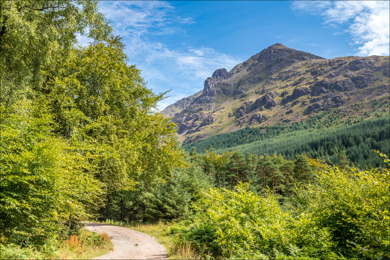
Pillar, with Pillar Rock protruding from its left flank

Looking along Ennerdale

A view back to Ennerdale Forest, which is gradually being rewilded

Views of Pillar...

...and Pillar Rock to the left


I branch off right here, the path to the left continues to Black Sail Hut and to some of lakeland's finest mountain scenery

I cross Middle Bridge to start the return leg - the narrow path is immediately beyond the bridge and is easily missed

Looking along the River Liza towards the head of Ennerdale from the bridge...

...and now looking in my direction of travel

Start of the path, which is not waymarked and is quite vague at times

Keep the river to your right and you can't go astray

It's a delightful path, with ever changing scenery...


Herdies


A view back along the river


Moss Dub near the head of Ennerdale Water

Crag Fell above a very dry river bed

I cross a footbridge to walk across the head of the lake

Looking back along Ennerdale

I reach the other side of the valley and cross the concrete bridge - this completes the circuit and from here I retrace my steps along the lakeshore track...


A last view back to Pillar as I approach Bowness and the end of the walk

Next morning, more welcome visits from the baby squirrels
