
Route: Lanthwaite Hill
Area: Western Lake District
Date of walk: 21st July 2018
Walkers: Andrew, Gilly and James
Distance: 2.1 miles
Ascent: 400 feet
Weather: Cloudy
There was only time for a short walk this afternoon, so we chose one of our favourite local spots – Lanthwaite Hill (shown on the OS map as Brackenthwaite Hows).
It’s a superb vantage point and hardly any effort is required to get to the top – what this walk lacks in distance it more than makes up for in the sheer beauty and variety of the terrain
We parked in the National Trust car park near Scalehill Bridge and instead of heading along the obvious path ahead turned steeply uphill to climb up through Lanthwaite Wood. There are a couple of short rocky sections to add interest, though they are very easy
The view from the top of Lanthwaite Hill was as beautiful as ever, with Lorton Vale, Loweswater, Crummock Water and the Buttermere fells displayed in all their splendour. We descended through Lanthwaite Wood to the boathouse by the shore of Crummock Water, and then followed the path to the foot of the lake to admire the view back to its head
From here we walked along the wide track back to the start of a short but sweet walk
For other walks here, visit my Find Walks page and enter the name in the ‘Search site’ box
Click on the icon below for the route map (subscribers to OS Maps can view detailed maps of the route, visualise it in aerial 3D, and download the GPX file. Non-subscribers will see a base map)

Scroll down – or click on any photo to enlarge it and you can then view as a slideshow

The night before the walk I left out a trail camera, which caught this welcome visitor to the garden

Early next day, red squirrels - a youngster on its parents back

More activity followed,,,,


Later that day, we visited the local Lorton dog show

Judging the beagles

The foxhound ring

The leading hounds following a scented trail around the local fells

There was just enough time left for a short walk - this is the entrance to Lanthwaite Wood from the National Trust car park at Scale Hill

Instead of following the obvious path ahead, which leads directly to Crummock Water, we branch off to the left to climb up to Lanthwaite Hill

A few minutes later we arrive at the deer gate at the edge of the wood

Birch trees on Lanthwaite Hill, looking towards Whiteside

Bonnie on Lanthwaite Hill (credit to James for this photo)

Looking along sweet Lorton Vale - the showground we'd visited earlier is upper centre of the picture

Loweswater

Lanthwaite Green at the foot of Grasmoor

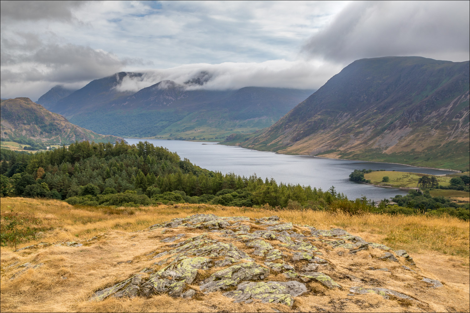
Crummock Water from Lanthwaite Hill

Zooming in over Lanthwaite Wood

Rannerdale Knotts

We descend initially in the direction of the Loweswater fells

We re-enter Lanthwaite Wood

The path then takes us around the edge of the wood...


A view across to Lanthwaite Green

We descend to Crummock Water

Boathouse at the shore of the lake


We follow the path beside the lakeshore


Foot of Crummock Water - the level of the lake is much lower than usual on account of the recent drought

We follow the track back through Lanthwaite Wood to the end of a lovely short walk
