
Route: Crummock Water
Area: Western Lake District
Date of walk: 7th January 2024
Walkers: Andrew
Distance: 2.5 miles
Ascent: 400 feet
Weather: Mostly sunny
After a seemingly endless period of rain and dull weather, the conditions improved at last and I decided to revisit one of my favourite short walks. Crummock Water is often overlooked thanks to the proximity of its sister lake, Buttermere. However it’s equally beautiful, far quieter and provides more varied walking opportunities. One of these is the approach via Lanthwaite Hill, also known as Brackenthwaite Hows. This walk has featured on my site many times, but I take the view that no two walks are ever the same – changing seasons and variations in the light and weather make for an infinite number of possibilities – and there’s always something new to be seen. This is only a short walk, but in the space of 2 miles manages to cram in a wide variety of scenery, all of it beautiful
I parked as usual in the National Trust car park at Scale Hill. Instead of taking the obvious track ahead, which leads directly to the north shore of Crummock Water, I turned left up a narrow path through Lanthwaite Wood. At a junction I turned left again to continue uphill, climbing a steep rocky staircase along the way
After leaving the woods via a deer gate I was soon at the top of the hill, admiring the views over Lorton Vale, Loweswater and Crummock Water. I then followed the easy path back down into Lanthwaite Wood, following a path which hugs the edge of the woods, giving good views across to Lanthwaite Green and Grasmoor
The path descends to the eastern shore of Crummock Water. The lake will undergo radical changes in the years to come. It is currently a reservoir but United Utilities plan to change it back to a natural lake and to remove the concrete infrastructure at its foot. This is to be welcomed in my opinion, though there will be a considerable period of disruption. Click here to read more about this
At the foot of the lake I made a short there and back diversion (not shown on the map) around the foot of the lake to a stony beach near the Pump House. An unusual combination of mist and sunset made for some good photo opportunities here. After retracing my steps to the foot of the lake I followed the wide track leading through Lanthwaite Wood (an alternative route follows the bank of the River Cocker). This brought me back to the car park and the end of a wonderful short walk
For other walks here, visit my Find Walks page and enter the name in the ‘Search site’ box
Click on the icon below for the route map (subscribers to OS Maps can view detailed maps of the route, visualise it in aerial 3D, and download the GPX file. Non-subscribers will see a base map)

Scroll down – or click on any photo to enlarge it and you can then view as a slideshow

Entrance into Lanthwaite Wood from the National Trust car park at Scale Hill. I turn left uphill immediately beyond the gate

I turn left at this junction and continue uphill

There are a couple of steep sections up a rough rock staircase

I pass through the deer gate to enter onto Brackenthwaite Hows, also known as Lanthwaite Hill

The ridge of Lanthwaite Hill, with Grasmoor in the background

Views from Lanthwaite Hill - looking north along Lorton Vale...

...Low Fell to the west...

...and Grasmoor to the south

Loweswater

Great Gable beyond Rannerdale Knotts

I descend from the hill and re-enter Lanthwaite Wood, following a dry stone wall around the edge of the wood

The foot of Grasmoor

Mighty Grasmoor

The path descends beside a beck to the shore of Crummock Water

I turn right on arriving at the boathouse

I follow the shoreline path to the foot of the lake

Looking back to the boathouse from the foot of Crummock Water

The light was very promising so I made a there and back diversion around the foot of the lake. The weir and its associated infrastructure are scheduled to be removed by United Utilities in a major project to re-naturalise the lake

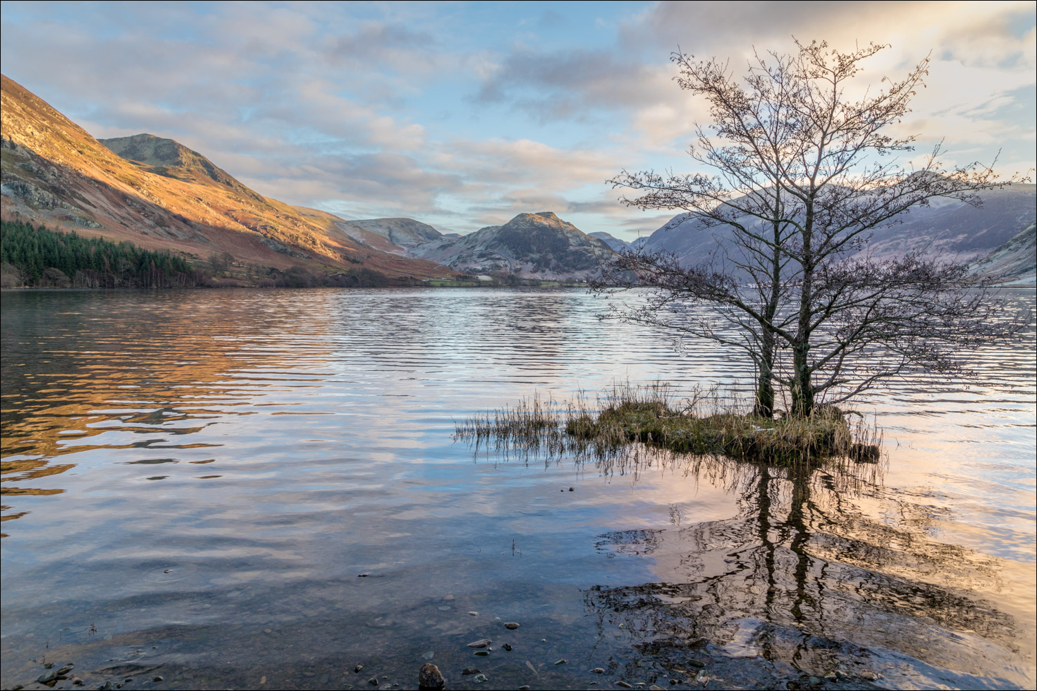
Patterns and reflections in Crummock Water as the sun begins to set...


The lake flows out into the River Cocker here, and I cross via two footbridges


Just before reaching this group of pines at the foot of Mellbreak, I turn back to retrace my steps along the lakeshore

Rannerdale Knotts at the head of Crummock Water

A few more photos in constantly changing light and mist...


Red Pike

Last of the light as I arrive back at the foot of the lake...


I head back to the car park along the track through Lanthwaite Wood

Next day, a red squirrel in the garden

Notice the long fingernails, which are essential for climbing trees
