
Route: Barrow and Outerside
Area: North Western Lake District
Date of walk: 15th January 2024
Walkers: Andrew
Distance: 5.3 miles
Ascent: 2,000 feet
Weather: Sunny, bitterly cold
The Mountain Weather Information Service forecast a sunny but very cold day, with temperatures of -5C and feeling like -15C on the summits. Suitably layered up, I parked in the attractive village of Braithwaite at the foot of the Whinlatter Pass. There were very few people around and so I had no difficulty finding a roadside parking place by the village school, where there is room for about 10 cars. At weekends and during school holidays I recommend parking at the school car park, where a donation of £5 cash is suggested. I walked out of the village and past the village shop in the direction of Newlands Valley, before turning off to join the track to Braithwaite Lodge
A slate sign on an ancient yew tree points the way through through the farm, after which I joined the path which leads up the ridge to the top of Barrow. It’s a straighforward climb and it would be impossible to go astray. There’s a false summit about half way up, so don’t celebrate success too early. Looking back there were lovely views of the Skiddaw fells
From the summit of Barrow I made my way down to Barrow Door. This holds the key to three possible routes – a quick descent back via Stile End, a longer one via Newlands Valley, or a continuation on to Outerside. In view of the lovely (though cold) weather I decided on the latter. The fell looks nearby on the map but on the ground appears to be a lot further away. I followed an easy path around the flanks of Stile End and Outerside and gained the summit via the back door. Outerside is well named as it stands isolated from its neighbouring fells. The views from the top were superb, especially those of the snow clad fells to the west
It was a long but straightforward descent back to Braithwaite via Long Moss and Stile End, with wonderful views of the Skiddaw fells ahead all the way down, a great finale to a great walk.
For other walks here, visit my Find Walks page and enter the name in the ‘Search site’ box
Click on the icon below for the route map (subscribers to OS Maps can view detailed maps of the route, visualise it in aerial 3D, and download the GPX file. Non-subscribers will see a base map)

Scroll down – or click on any photo to enlarge it and you can then view as a slideshow

Having parked by the village school I pass by Braithwaite Village Shop and follow the sign for Newlands

A few yards further along the road I turn off to follow the track to Braithwaite Lodge

Looking back over Braithwaite Lodge to Skiddaw

Here we go - a small wooden sign points the way up the ridge to Barrow

Keswick and a glimpse of Derwent Water beyond Swinside

Further along the ridge a false summit appears

Looking back over Braithwaite to the Skiddaw fells

Having reached the false summit, the true one appears

Looking across the Newlands Valley to Derwent Water

Skiddaw from the summit of Barrow

The summit is marked by a very insignificant cairn. In the distance are Causey Pike, Scar Crags, Sail and Crag Hill

Blencathra beyond Derwent Water, and the Pennines in the distance

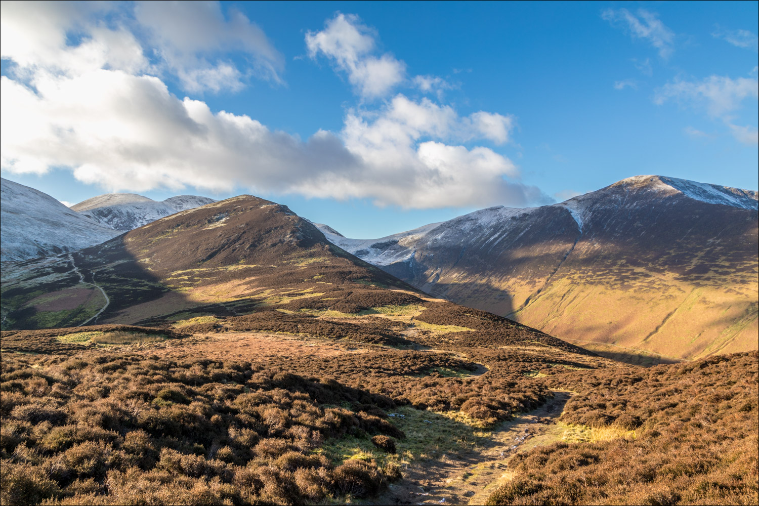
At this stage I hadn't decided on the rest of the route. All options involve a descent to Barrow Door below. In the event I opted to continue to Outerside, mid-picture

Derwent Water, and the long spine of the eastern fells including Helvellyn in the distance

Causey Pike

Barrow Door below, and in the distance is the path which leads to the summit of Outerside via the back door

Barrow Door at the foot of Stile End. I continue ahead in the direction of Outerside. The route may be shortened here by turning right to head back to Braithwaite, or by turning left to descend into Newlands Valley via Stonycroft Gill

A short rocky section along the flanks of Stile End

Outerside ahead

A light covering of snow as I look up to Sail and Crag Hill

The path gradually curves around to the right to climb up to Outerside

Looking back to Sail, Eel Crag and Sand Hill. The head of Coledale is below on the right

Summit of Outerside, looking towards Skiddaw

The small summit cairn on Outerside, with a view of Barrow beyond Stile End

The start of the return leg, which involves a descent and then an ascent of Stile End

Grisedale Pike on my left

Newlands Valley below and the snow clad eastern fells in the distance

I follow the path over Stile End, with Coledale below and Skiddaw and Blencathra in the distance

Further along Stile End, with Barrow just beyond it

Looking back to Outerside

Braithwaite below.

The gradient gradually levels out...


I pass through the gate ahead and follow the lane back into Braithwaite

I cross the bridge over Coledale Beck to return to the end of the walk

Next day, a red squirrel in the garden

