
Route: North Newbald to Brantingham (High Hunsley Circuit stage 3)
Area: East Yorkshire
Date of walk: 14th March 2021
Walkers: Andrew, Gilly and James
Distance: 8.4 miles
Ascent: 1,100 feet
Weather: Sunshine and blue skies at first, but then clouding over with some light rain
Today’s walk would take us on stage 3 of the High Hunsley Circuit. The route is a 25 mile circular walk devised by the late Dennis Parker, former Chairman of the Beverley Group of the Ramblers’ Association. Although it would be theoretically possible to complete the full walk in a day during the long days of summer, it’s usually broken down into stages. This means it becomes a series of linear walks, so that two cars or local transport are needed
We left one car in the nearby village of Brantingham, where there is parking at the village hall and the Triton Inn, and drove in the other to our start point, North Newbald
There is free parking in a field to the east of the village at the entrance to Swin Dale. We set off along Swin Dale, a classic dry chalk valley of the Yorkshire Wolds. The rolling landscape was shown at its best with sunshine and big skies, though sadly this wasn’t to last. At the end of the dale we climbed up to High Hunsley, the high point of the walk at 160 metres. From here we descended into East Dale, a wooded valley, where we followed the route of the Yorkshire Wolds Way, another long distance route which we’d completed nearly 5 years ago
At the end of East Dale there followed a series of ups and downs as we followed the undulating course of the Wolds Way. By now the weather had deteriorated, and the previously good light was replaced with flat white skies which did the scenery no favours at all. Eventually we arrived at journey’s end, the attractive village of Brantingham, where the Triton Inn is pleased to welcome thirsty walkers
Stage 1 – Skidby to Bishop Burton – 5.9 miles
Stage 2 – Bishop Burton to North Newbald – 8.2 miles
Stage 4 – Brantingham to Skidby – 7.5 miles
Click on the icon below for the route map (subscribers to OS Maps can view detailed maps of the route, visualise it in aerial 3D, and download the GPX file. Non-subscribers will see a base map)

Click here for a map of the full circuit
Scroll down – or click on any photo to enlarge it and you can then view as a slideshow

Some recent garden bird sightings during lockdown. A sparrowhawk....

Long tailed tit

Goldfinch

Male bullfinch

Naturalised crocus in the lawn...


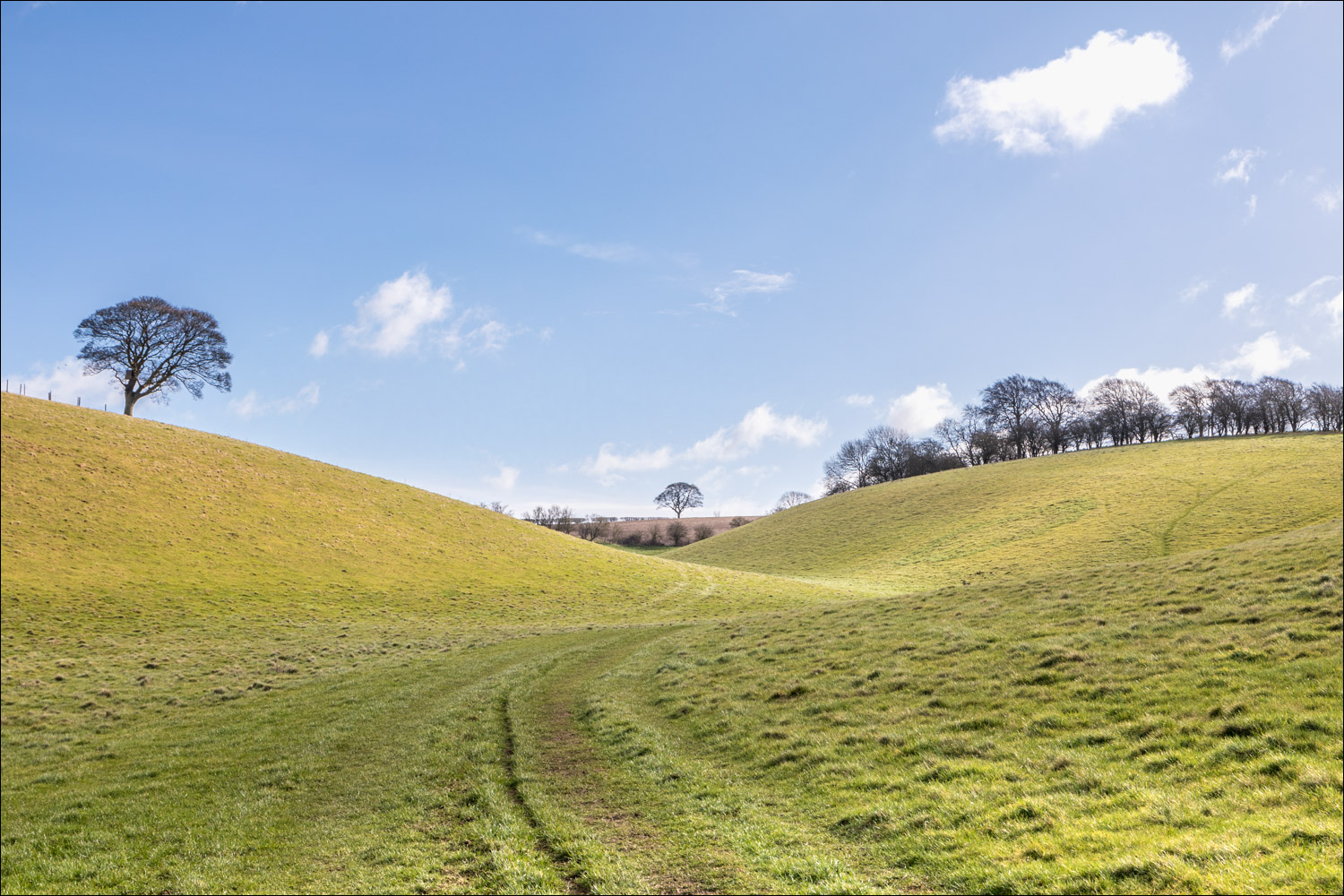
On with today's walk. We head down into Swin Dale on the outskirts of North Newbald

A gently curving path path takes us along the dry valley floor...


We leave the cultivated area of the dale to enter into green pastures....


Looking back

Just beyond the gate we turn right


We will climb out of Swin Dale at the line of trees ahead

Looking back along the dale - there's a short steep climb out of it at this point

On top of the wold now

A short section along a quiet lane near High Hunsley

We pass by High Hunsley Beacon, erected in 2002 to celebrate the Queen's Golden Jubilee

We head down into East Dale

We follow the path through mixed woodland in East Dale

We pass by an old boundary stone marked 'South end of Hunsley fence'


Looking back as we climb out of Comber Dale. Grey skies and flat light accompanied us for the rest of the way

We pass by Little Wold Vineyard - these chalky hills are ideal terrain for grape growing

The High Hunsley Circuit follows the route of the Yorkshire Wolds Way in part - this is one of the carved poetry benches along the Wolds Way

South Cave is on our right as we descend to the outskirts of the village, only to have to climb up Steep Hill mid left of picture

A view of the Humber as we follow the final section between South Cave and Brantingham

We pass by All Saints’ Church at the edge of Brantingham. The attractive church is 12th Century in origin and was restored in the late 19th Century

Journey's end - the Triton Inn Brantingham. Refreshments here will be a perfect way to end the walk once lockdown is over
Follow the link for more walks in East Yorkshire (117)
