
Route: Skidby to Bishop Burton (High Hunsley Circuit stage 1)
Area: East Yorkshire
Date of walk: 7th January 2021
Walkers: Andrew and Gilly
Distance: 5.9 miles
Ascent: 350 feet
Weather: Sunny, very cold
A good weather forecast enabled us to plan a walk today, one that we’ve not done before. We decided to follow the High Hunsley Circuit from Skidby to Bishop Burton. The route is a 25 mile circular walk devised by the late Dennis Parker, former Chairman of the Beverley Group of the Ramblers’ Association. Although it would be theoretically possible to complete the full walk in a day during the long days of summer, it’s usually broken down into stages. This means it becomes a series of linear walks, so that two cars or local transport are needed
We left one car in the nearby village of Bishop Burton and returned in the other to our start point, Skidby. The village is well known locally for its impressive four-sailed mill standing on top of a hill. Unlike most surviving mills it still has all of its original outbuildings around the courtyard. The Museum of East Riding Rural Life is located here. We’d normally have started the walk here, but there was no point as the Museum is closed on account of the Covid virus, and the mill has had its wings clipped – the sails have been removed recently, presumably for maintenance
We left Skidby and headed across the fields towards Risby. An overnight frost meant that the otherwise muddy paths were as hard as rock. The path then took us through the lovely countryside of Risby Park and into the village of Walkington, the half way point of today’s route. Beyond Walkington we walked over Bishop Burton Wold and into the lovely village of Bishop Burton to complete an enjoyable walk and stage 1 of the High Hunsley Circuit
Stage 2 – Bishop Burton to North Newbald – 8.2 miles
Stage 3 – North Newbald to Brantingham – 8.4 miles
Stage 4 – Brantingham to Skidby – 7.5 miles
Click on the icon below for the route map (subscribers to OS Maps can view detailed maps of the route, visualise it in aerial 3D, and download the GPX file. Non-subscribers will see a base map)

Click here for a map of the full circuit
Scroll down – or click on any photo to enlarge it and you can then view as a slideshow

Some photos of recent short walks in East Yorkshire...

North Cliffe Wood, looking magical in the mist

Big skies over Beverley Minster seen from Beverley Westwood

More skyscapes, looking west from a walk over the Humber Bridge

On with today's walk - we started from St Michael's Church in the village of Skidby

Looking back to Skidby at the start of the High Hunsley Circuit

We head north out of Skidby

Risby, the site of a deserted village and former stately home

We follow the lane towards Little Weighton for a short distance

We turn off the lane here to follow a track to the west of Risby Park

Looking across to Risby Park

The track takes us through Risby Park Farm

Halfpenny Gate Cottage ahead

A little further ahead we leave the track and pass to the right of Halfpenny Gate Cottage

Risby Park....


We arrive in the village of Walkington, roughly half way along our route

All Hallows Church Walkington

We turn left at the Dog and Duck Inn

Walking out of Walkington

On top of the wold as we pass by Westfield Farm on our left

A short road section before Crawberry Dale

Having left the road, we continue north, here looking across Bishop Burton Wold

The final section of the walk is along a quiet lane into Bishop Burton - All Saints Church is on the right between the hedge gap

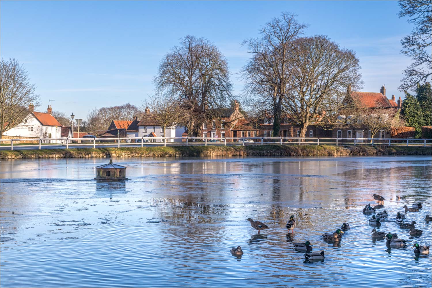
We arrive in Bishop Burton

The village green and All Saints Church

The end of the walk as we reach the partially frozen village pond in Bishop Burton...

Follow the link for more walks in East Yorkshire (117)
