
Route: Bishop Burton to North Newbald (High Hunsley Circuit stage 2)
Area: East Yorkshire
Date of walk: 9th January 2021
Walkers: Andrew and Gilly
Distance: 8.2 miles
Ascent: 700 feet
Weather: Sunshine and blue skies, cold
A couple of days ago we’d walked from Skidby to Bishop Burton, stage 1 of the High Hunsley Circuit. The route is a 25 mile circular walk devised by the late Dennis Parker, former Chairman of the Beverley Group of the Ramblers’ Association. Although it would be theoretically possible to complete the full walk in a day during the long days of summer, it’s usually broken down into stages. This means it becomes a series of linear walks, so that two cars or local transport are needed
We left one car in the nearby village of North Newbald and returned in the other to our start point, Bishop Burton
We parked by the smaller of the two ponds in the picturesque village and walked out of it to join a quiet lane heading due west over Bishop Burton Wold. At the end of the lane we continue heading west along a succession of paths and tracks. On reaching Hessleskew Lane our direction of travel changed, and we headed due south. This was the highest point of the walk, at a dizzying altitude of around 150 metres, or 500 feet. Nearby Sober Hill Wind Farm was clearly located here to take advantage of its lofty position on the top of Newbald Wold
We then descended gently from the wold, following a lovely path between hedgerows. On reaching the road, we left the official High Hunsley Circuit to walk back into North Newbald. I’d planned the route assuming that this would be the nearest place to park, but had forgotten about a parking area at the entrance into Swin Dale. Anyone following this walk is recommended to park there instead – the OS grid ref is SE926 373. This would reduce the length of the walk by 1 mile
We were in no hurry, and were perfectly content to stroll back along the lane into North Newbald to complete an enjoyable walk and stage 2 of the High Hunsley Circuit
Stage 1 – Skidby to Bishop Burton – 5.9 miles
Stage 3 – North Newbald to Brantingham – 8.4 miles
Stage 4 – Brantingham to Skidby – 7.5 miles
Click on the icon below for the route map (subscribers to OS Maps can view detailed maps of the route, visualise it in aerial 3D, and download the GPX file. Non-subscribers will see a base map)

Click here for a map of the full circuit
Scroll down – or click on any photo to enlarge it and you can then view as a slideshow

The day before the walk, a short circuit of North Cliffe Wood, managed by Yorkshire Wildlife Trust...


The start of today's walk from the smaller of two ponds in Bishop Burton


We head west out of the village

We walk past the cottages beyond the larger pond

At the edge of the village we turn right at this barn

We follow a lane which climbs gently up the wold

Courtgarth Rush on our right and Johnie Wood to the left

Looking back along Courtgarth Rush

Bishop Burton Wold

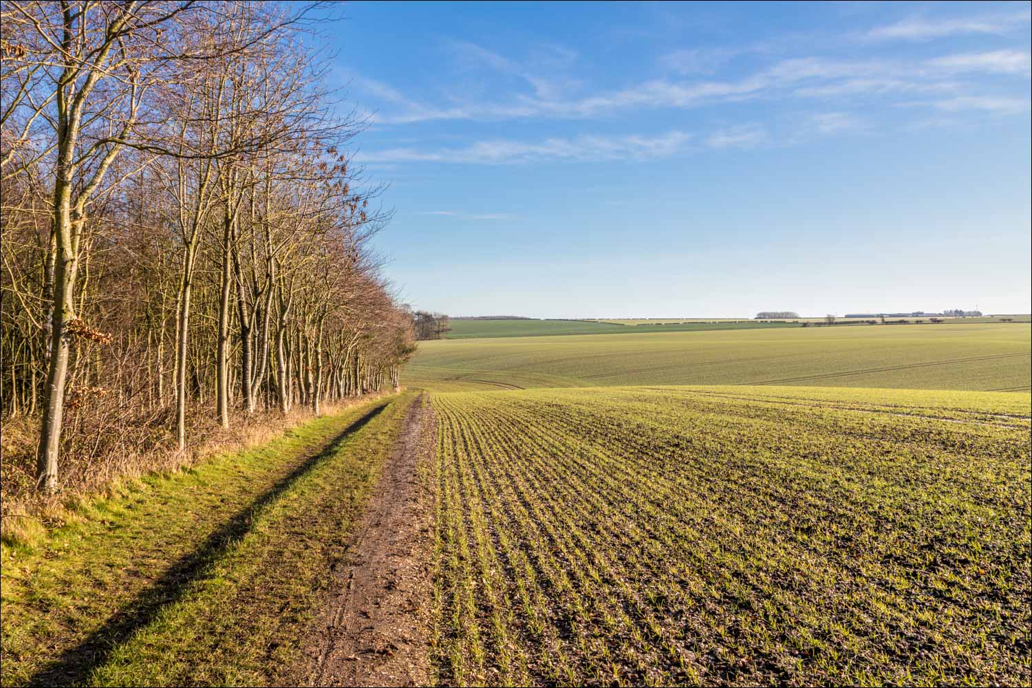
A view back along the path

We descend to Deepdale Plantation and turn left on reaching it

Looking back to Deepdale Plantation

A view back over Bishop Burton Wold as we approach Newbald Lodge

Views back to Newbald Lodge as we continue along the High Hunsley Circuit...


We arrive at a crossroads near Hessleskew and turn left to follow the route of the Yorkshire Way. This is the highest point of the walk, with a wind farm on top of the wold

We pass by an OS trig point (grid ref SE 9284638737 in case you're lost)...


The start of the descent from the wold, heading south into glaring sunlight

We'll turn right when we reach the valley floor - the rest of the High Hunsley Circuit lies ahead


We arrive at the lane leading into North Newbald

Had we known, we could have shortened the walk by parking here, below Woodgate Hill. The High Hunsley Circuit continues along this track, but here we made a 1 mile detour in order to return to our starting point in North Newbald

We arrive in North Newbald

Journey's end - the parish church of St Nicholas
Follow the link for more walks in East Yorkshire (117)
