
Route: Lorton Vale
Area: Western Lake District
Date of walk: 12th December 2018
Walkers: Andrew, Gilly and David
Distance: 6.7 miles
Ascent: 900 feet
Weather: Cold wind, cloudy with sunny patches
Lorton Vale is one of Lakeland’s longest valleys, and stretches from the Honister Pass though to Cockermouth. It contains Buttermere, Crummock Water, and Loweswater. Today’s walk would take us along the central part of the valley. Our nephew David was staying with us and we took advantage of the extra car by planning a linear route, which would start at a church and end at a pub
Having left one car at Church Bridge, next to the famous Kirkstile Inn, we drove back along the valley to the start of the walk and parked by St Cuthbert’s Church on the edge of High Lorton. From the church we followed a path through the fields which brought us to the road leading into High Lorton. We walked through the unspoilt village and turned left to pass by the Lorton Yew Tree immortalised by Wordsworth. This ancient tree is now a shadow of its former self, having been battered by countless storms over the years
After leaving the road and walking through Scales we joined the delightful mid-level path which runs along Lorton Vale, giving good views across the valley all the way. Beyond High Swinside we forded Hope Beck which was much trickier than usual on account of recent heavy rain. Safely across the beck we continued along the undulating valley path, eventually arriving at Lanthwaite Green. From here we descended to the shore of Crummock Water and walked round the foot of the lake until we reached Park Beck. We followed a path and a quiet lane beside the beck to reach our destination – the Kirkstile Inn – in perfect time for lunch and refreshments. The walk had taken about 3 hours in all and, apart from a small handful of walkers around Crummock Water, we hadn’t seen another soul
For other walks here, visit my Find Walks page and enter the name in the ‘Search site’ box
Click on the icon below for the route map (subscribers to OS Maps can view detailed maps of the route, visualise it in aerial 3D, and download the GPX file. Non-subscribers will see a base map)

Scroll down – or click on any photo to enlarge it and you can then view as a slideshow

Having left car 1 near the Kirkstile, we drove in car 2 to High Lorton, enjoying this wonderful view over Crummock Water along the way. The outlines of Haystacks and Great Gable are just visible in the distance

The start of the walk from St Cuthberts Church High Lorton

Looking across Lorton Park as we walk towards the village

High Lorton, Lorton Dodd and Whiteside

We turn left and follow the lane beside these buildings

"There is a yew-tree, pride of Lorton Vale, which to this day stands single, in the midst of its own darkness, as it stood of yore..."

Looking back over the village to Hatteringill Head as we gain height

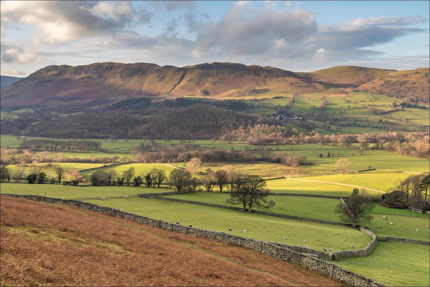
Mellbreak further along the valley

We pass through the metropolis of Scales

We're now on the elevated path along Lorton Vale, which we'll follow as far as Crummock Water

Our route takes us through High Swinside Holiday Cottages, set in a wonderful position with views along the valley

We follow the drive from the cottages, with Mellbreak in the background

After walking along the gated road for a short distance, we turn off towards Hope Gill

Looking across the gated road to Low Fell on the far side of Lorton Vale

A view back to High Lorton. On a clearer day the Solway Firth and Scotland would be visible from here

We arrive at Hope Beck, normally an easy hurdle, but the rocks are slippery and it takes us a few moments to find a suitable place to cross

Safely over the beck we carry on along the valley, with lovely views across to Fellbarrow and Low Fell...


Looking back to Lorton

A couple of inquisitive herdies

This dry stone wall is our constant companion for much of the way

Low Fell again

Red Pike amidst some dramatic sun rays

We continue along the foot of Whiteside

A view back along the path

Red Pike again

We've been heading south until now, but here we turn west to walk towards the Loweswater fells - a glimpse of Crummock Water on the left

We cross the footbridge over Liza Beck

Lanthwaite Green Farm

Crummock Water on our left

Lanthwaite Green

Having crossed the Buttermere road we enter Lanthwaite Wood

We follow the path down through the wood

The boathouse on the east shore of Crummock Water

We follow the path beside the shore of the lake

The foot of Crummock Water, with Rannerdale Knotts in the centre of the picture

The boathouse and Rannerdale Knotts

Grasmoor seen as we walk around the headland

The high level of the lake has formed an island around this tree

Gilly teeters along a concrete wall, with wind borne waves on the left and floodwaters on the right

Waves overlapping the wall filled our boots on this short section

Looking past the Pump House to the foot of Mellbreak

Grasmoor

At this point we head away from the lake in the direction of Loweswater

A glance across to Crummock Water, with Haystacks and Great Gable in the distance

Looking back along Park Beck towards Grasmoor...

...and now looking back to Whiteside as we join the lane which leads to our destination - the famous Kirkstile Inn

A golden end to a golden walk
