
Route: Tealby and Walesby
Area: Lincolnshire Wolds
Date of walk: 27th December 2020
Walkers: Andrew, Gilly and James
Distance: 4.7 miles
Ascent: 600 feet
Weather: Sunny
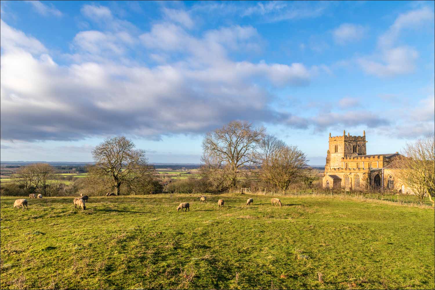
Tealby is a picture postcard village on the edge of the Lincolnshire Wolds, and located in an Area of Outstanding Natural Beauty. We parked near the village hall and walked past Tealby Church (The Church of All Saints) which dates back to the 12th century. Just beyond the church we turned right at a small cottage and joined the long distance Viking Way. Huge views opened up as we followed the grassy path gently uphill. We passed by Castle Farm, so called because its unusual shape resembles a castle, and then continued along the track towards Risby Manor. The ground was sodden after recent heavy rain, and the path was exceptionally muddy in places
After passing by Risby Manor (where there is a small kiosk selling refreshments), we continued along the Viking Way in the direction of Walesby. Before long All Saints Church came into view. The church is set on top of Walesby Escarpment, overlooking the village below, and has wonderful views over the surrounding countryside. It was renovated in the 1930s and has become known as the Ramblers Church. We left the church grounds and joined a track which took us gently down into the village of Walesby, the starting point for another walk in this area which I’d completed 2 years ago
After a short detour to see St Edmund’s Church we walked back along the road and located the path back to the start, which starts at a squeeze stile in a dry stone wall. As we walked through the fields we spotted a herd of red deer – this was no surprise as we’d seen deer fencing along the way, and were aware that there is a deer park in the area. After a short section along Catskin Lane we joined a path through the fields, which took us beneath Castle Farm where we’d been walking earlier. Just before Tealby we rejoined the Viking Way and strolled back into the village to complete a lovely walk
Click on the icon below for the route map (subscribers to OS Maps can view detailed maps of the route, visualise it in aerial 3D, and download the GPX file. Non-subscribers will see a base map)

Scroll down – or click on any photo to enlarge it and you can then view as a slideshow

Earlier in the week, 4 members of the tit family in the garden - long tailed tit, blue tit, great tit and coal tit

Two days later, welcome to Tealby - the villages in these parts are all adorned with signs like this, each one individually designed

We pass by The Church of All Saints at the start of our walk

A short distance from the church we leave Tealby via this gate by a cottage

On the Viking Way now, and heading north west with Bedlam Plantation on the right

We pass by Castle Farm

Beyond Castle Farm we continue in the same direction towards Risby

We're on the edge of the Lincolnshire Wolds, and so enjoy huge views over the Lincolnshire plain

We pass by this pond - possibly an old dew pond similar to the one seen on my last walk from Fridaythorpe

We can just make out Lincoln Cathedral mid left of picture, some 25 miles away

Our path will take us to the right of the woodland in the background

The view on our left as we cross this lane near Risby

A down and an up ahead - the down proving quite tricky in slippery mud

The view on our left

A deer fence on our right as we walk through the deer park, part of Risby Manor

Beyond Risby, more big views on our left

A kestrel hovers above our heads

A glimpse of the tower of All Saints Church 'The Ramblers Church'

The path takes us into the church grounds...


View across the Lincolnshire plain

We leave the church grounds via the gate on the right of the picture

After a short walk down the lane into Walesby, we make a short there and back detour to St Edmund's Church

We retrace our steps into Walesby and walk along a path leading to Catskin Lane, here looking back up to The Ramblers Church

Having already walked through the deer park, we thought we'd missed our chance of a sighting, but the park extends further than we'd thought. Time to get out the telephoto lens...


At the edge of the park, a buzzard...


We pass by a herd of the rare breed Lincoln Longwool sheep

A short section along Catskin Lane. The lane can be followed back into Tealby if desired...

...but we preferred to join a path beside the lane which shortens the walk but has better views. Tealby is ahead on the right


Looking back along the path

Another view back as we complete our circuit and from here we retrace our steps into Tealby

The circuit is complete as we arrive back at Tealby Church
Follow the link for more walks in Lincolnshire (26)
