
Route: Fridaythorpe Circular
Area: East and North Yorkshire
Date of walk: 22nd December 2020
Walkers: Andrew
Distance: 8.4 miles
Ascent: 900 feet
Weather: Sunny at first, gradually clouding over
Fridaythorpe is the highest village on the Yorkshire Wolds, standing at 561 feet above sea level. Its history can be traced back to Viking times. The oldest building in the village is St Mary’s, a 12th century Norman Church. The church is close to the village green, which was the starting point for today’s walk. There is some roadside parking opposite the green and the village pond, which was renovated in 2008 thanks to a grant from the National Lottery Fund
After a quick visit to the lovely small church I walked north west for a short distance and left the road at a large industrial grain mill to join the Yorkshire Wolds Way. I’d followed this path in April 2015 as one of the legs of the Wolds Way, a long distance walk which I can highly recommend (follow this link for stage 1 which in turn links to the other stages)
I walked across Brubberdale Hill and then descended into Brubber Dale. There followed a climb back up onto the wold and after passing by Gill’s Farm, I arrived above Thixen Dale. I stopped here to admire the view, and also one of the Yorkshire Wolds Dew Ponds. These are historic artificial ponds traditionally created by farmers to water their livestock, but which now provide an oasis for wildlife
After walking along Thixen Dale, Bradeham Dale and Wayrham Dale I climbed out of the valley and crossed the A166 to start the return leg to Fridaythorpe. Part of this is along tarmac, but it’s a country lane and there is very little traffic. Along the way there are a number of stone bollards with Latin inscriptions. At first glance they appear to be ancient, but were placed by a local farmer in the 1960s to mark entrances to his fields. After a mile or two I left the road to follow the track through Wold House Farm. This took me across the top of Huggate Wold, and from here I descended into Holm Dale for a short distance before joining a track which took me back into Fridaythorpe
For other walks here, visit my Find Walks page and enter the name in the ‘Search site’ box
Click on the icon below for the route map (subscribers to OS Maps can view detailed maps of the route, visualise it in aerial 3D, and download the GPX file. Non-subscribers will see a base map)

Scroll down – or click on any photo to enlarge it and you can then view as a slideshow

The start of today's walk - by the village pond in Fridaythorpe

I head out of the village past these buildings

A quick detour to see the Norman church of St Mary's - the nave and chancel were built in the early 12th century and the tower was added later. The clock is dated 1903 and bears the motto “Time is short. Eternity is long”

Having left the village, I head west across the wold

I arrive at the edge of Brubber Dale and West Dale

Looking into the side valley of Horse Dale

I follow the grassy path down into Brubber Dale

After a short distance I climb out of the dale up Cowland Leys

Looking back along the path

I follow the track towards Gill's Farm

A view back in the direction of Fridaythorpe

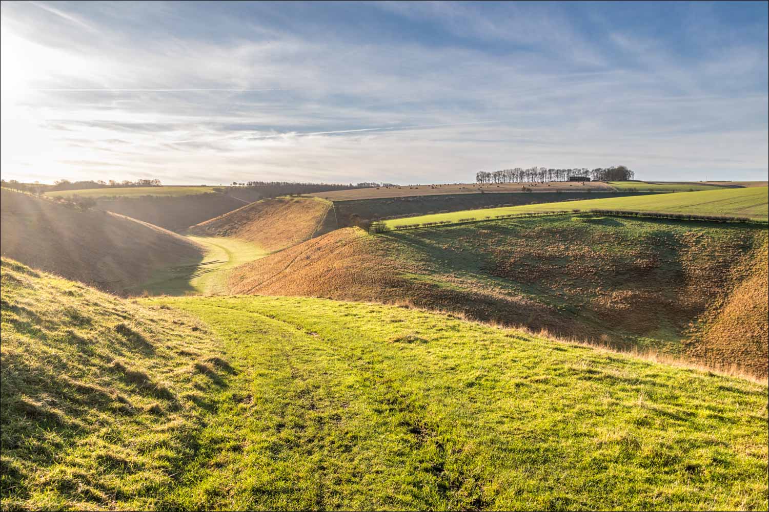
Beyond Gill's Farm, Thixen Dale lies below

An attractive carved wooden sign announces one of the medi dew ponds...

One of the historic dew ponds which stretch for 20 miles from Thixendale to Fordon. The ponds were created in the 18th and 19th centuries to provide water for livestock in the dry wolds landscape. Few are used by livestock today, but they are a haven for wildlife and an important feature of the landscape

I follow this grassy path which descends gently to the floor of Thixen Dale

Thixen Dale below

On the valley floor lies an art installation 'Waves and Time' by landscape artist Chris Drury...


I pass by another part of 'Waves and Time', here looking into Worm Dale

Thixen Dale

Looking back to Thixen Dale over another restored dew pond

An unattractive section of the walk - an alien conifer plantation in Wayrham Dale, which presumably provides cover for game birds but detracts from the landscape

It's a relief to emerge from the conifer plantation into more typical wolds scenery

I climb out of Wayrham Dale

After crossing the A166 I join a country lane which heads east - this marks the start of the homeward leg of the walk

One of the many stone bollards hereabouts - each bears a quasi-Latin inion. They appear to be ancient, but are made of concrete and were placed here in the 1960's by a farmer with a sense of humour

On top of the Yorkshire Wolds

More bollards...


I leave the lane to turn right along a track which takes me through Wold House Farm

Beyond the farm, and in fading light, I walk towards the head of Holm Dale

Holm Dale lies below, but I keep to the contour and follow the higher path round to the left

Looking along Holm Dale - I turn my back on the dale and from here it's a short stroll back into Fridaythorpe
Follow the link for more walks in North Yorkshire (152)
Follow the link for more walks in East Yorkshire (117)
