
Route: Tangasdale and Dun Ban
Area: Isle of Barra, Outer Hebrides
Date of walk: 4th September 2022
Walkers: Andrew and Gilly
Distance: 3.3 miles
Ascent: 300 feet
Weather: Mostly sunny
On the first morning of our first visit to the Isle of Barra, we awoke to dark skies, heavy rain and strong winds. Not a promising start, but the weather forecast was for an improvement later on. Sure enough, breaks in the clouds appeared before lunch and so without ado we set off from our base in North Bay to nearby Tangasdale (in truth, on Barra, everything is ‘nearby’. One narrow road 14 miles long serves the entire island)
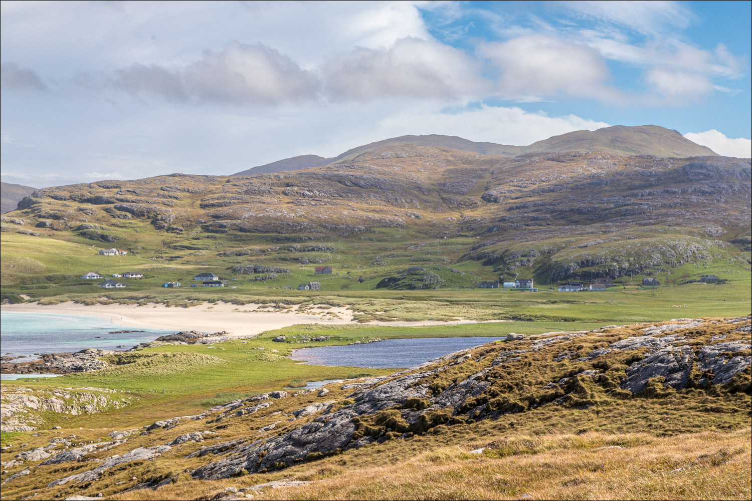
We parked by a red telephone box and passed through a gate near some marker signs. We followed a faint path across the machir – grassland which is covered with wild flowers in the summer. This brought us to the shore of Loch Tangasdale, beneath the rugged slopes of Beinn Tangabhal. There is a tiny sandy beach here. From the beach we aimed for a marker post beside a stile. We crossed the stile and then a footbridge to follow a path leading through the right side of a tiny glen beneath Beinn Tangabhal and Beinn na Leig. The path eventually peters out and the ground becomes rockier and more undulating. Occasional marker posts aided navigation. There were good views over Halaman Bay as we gained height.
We followed a rough and rocky path along the coast to the ruins of the iron age fort at Dun Ban, dating back 2,000 years. There’s little to be seen of the structure, but the setting is magnificent with views along the cragged coastline in both directions. From here we retraced our steps for a short distance before veering left to continue along the coast, passing by the deep inlet of Diorlinn where there is a stony beach. We continued to an idyllic and deserted sandy beach and then carried on to the white sands and turquoise waters of the main beach at Halaman Bay, which was also deserted. From here we made our way up through the dunes and back to Tangasdale to end a wonderful start to our week on the Isle of Barra
Click on the icon below for the route map (subscribers to OS Maps can view detailed maps of the route, visualise it in aerial 3D, and download the GPX file. Non-subscribers will see a base map)

Scroll down – or click on any photo to enlarge it and you can then view as a slideshow

The start of the walk from the red phone box in Tangasdale


We follow a faint path across the machair towards the rugged slopes of Beinn Tangabhal

Looking back to the start after passing through a gate

We walk past the shore of Loch Tangasdale

Looking back to Tangasdale from a small sandy beach

Looking back to Loch Tangasdale after crossing a small footbridge

We climb up through a small glen beneath Beinn Tangabhal and Beinn na Leig

Looking back to Loch Tangasdale

The path peters out as we gain height, but the occasional marker post helps to keep us on course

Loch na Doirlinn and Halaman Bay on our right - we'll be walking around the bay later

We reach the coast and follow a faint path heading west

Halaman Bay again


We make a short there and back detour to Dun Ban...


We follow the marker post towards Dun Ban

We arrive at the ruins of the iron age fort or broch of Dun Ban, dating back some 2,000 years

Views from the well positioned fort


Looking back to the ruins of the fort as we retrace our steps to continue the circuit

We follow the vague coastal path towards Halaman Bay

We pass by a small rocky cove...


Halaman Bay ahead

The two sandy beaches are separated by Halaman Skerry


Looking back along the smaller of the two beaches

A lovely end to the walk as we stroll along the larger beach on Halaman Bay


We head up through the dunes to return to the start

A final glance back to the sea

Tangasdale ahead, and the end of our first walk on Barra

Later on, sunset seen from our base in nearby Northbay...

Follow the link for more walks in Scotland (44)
