
Route: Vatersay
Area: Outer Hebrides
Date of walk: 5th September 2022
Walkers: Andrew and Gilly
Distance: 5.0 miles
Ascent: 300 feet
Weather: Sunny
Vatersay is the southernmost inhabited island in the Outer Hebrides. It is linked to Barra by a causeway which was completed in 1991. The causeway is not tidal, so there’s no fear of getting stranded. Having driven over the causeway we continued to the south of the island and parked by the community hall, which is on a strip of land separating the two beaches at the narrow point on the island. There is a cafe and toilets here
After walking along the road very briefly we located a faint path leading across grassland. This soon brought us to a gate and steps leading down onto the first of the beaches on our itinerary – Tràigh Siar. We walked along the beach and climbed up the grassy slopes beyond it. Cattle had churned up the boggy ground and progess wasn’t easy at first. The going became easier as we gained height and we made a short there and back detour to a standing stone, the significance of which is unknown. The views from the rocky hill by the stone were superb. From here we returned to the main route and followed the marker posts in a southeast direction gently downhill towards the coast to reach a tiny secluded sandy cove on the edge of Bagh a Deas, with the island of Sandray visible ahead
At the end of the beach we headed inland and uphill, passing above the remains of the village of Eorisdale. We headed towards the imposing face of Am Meall and turned left before reaching it to follow a path along the coast, where we saw several seals in the sea below. The path eventually arrived at Vatersay Bay and the final beach of the day. We walked along the white sands and at the end of the beach climbed up through the dunes to reach the end of the walk
Click on the icon below for the route map (subscribers to OS Maps can view detailed maps of the route, visualise it in aerial 3D, and download the GPX file. Non-subscribers will see a base map)

Scroll down – or click on any photo to enlarge it and you can then view as a slideshow

The morning of the walk, and sunrise from our base in Northbay on the Isle of Barra

On the way to Vatersay we stop at Castlebay to admire the view of Kisimul Castle - Vatersay is in the background and is linked to Barra by a non-tidal causeway

The start of the walk from Vatersay Community Centre, where there is a cafe (only open in summer). This is also the starting point of the long distance Hebridean Way

We walk away from the nearby beach and follow a track across grassy land. This leads to the other side of Vatersay at its narrowest point

We soon arrive at the white sands of Tràigh Siar

We descend the steps and walk along the pristine beach...


At the end of the beach we climb uphill, passing by a herd of cows

Looking back to Tràigh Siar

We climb up to Dun Vatersay, a defensive iron age fort which has also been found to contain a bronze age burial cairn

We head south over some rough crofting land

Occasional marker posts are an aid to navigation - there's no path for much of the way

Looking over a ruined house to Castlebay on Barra

Looking back to the ruined house

A minor down and up detour to visit the standing stone ahead

View from the standing stone, the origins of which are unknown...


We retrace our steps to the depression and turn right at the marker post

We follow a juicy and pathless course towards Bagh a Deas

Bagh a Deas ('bagh' being the Gaelic for bay)

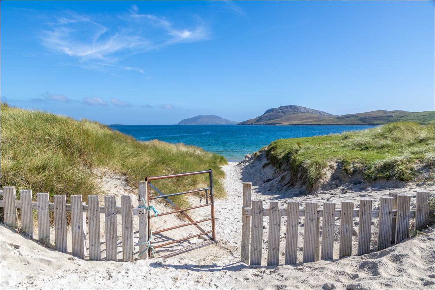
We pass through the gate and walk along the secluded beach...


Views back to the beach as we climb away from it...


We pass above the remains of the village of Eorisdale where the struggle for land resulted in the Vatersay Raiders taking control. The Government's response was to compulsorily purchase Vatersay in 1909 and divide it into crofts

We head towards the imposing face of Am Meall and will turn left before reaching it

Vatersay Bay comes into view and we head for the sandy beach in the distance

We pass above a stony beach

Looking back to Am Meall

We descend to the beach...


A stroll along the beach, with The School House on the right and the Community Centre to its left


A final look back as we climb up through the dunes to the end of the walk

Later that day, sunset from our base on Barra
Follow the link for more walks in Scotland (44)
