
Route: Ullock Pike, Long Side, Carl Side and Skiddaw
Area: Northern Lake District
Date of walk: 9th January 2019
Walkers: Andrew
Distance: 7.4 miles
Ascent: 3,300 feet
Weather: Sunny, bitterly cold at times
I’d had to abort a walk up Ullock Pike last month, after getting blown off my feet by gale force winds. Today was a sunny day with light winds, and it was time for another attempt. I hadn’t decided at this stage whether to include Skiddaw in the round, and would wait until reaching Carl Side before making my choice
I parked in one of the roadside spaces on the A591, just before the Ravenstone Manor Hotel, and joined a path through the woods beside the hotel. A steady ascent up the lower flanks of Ullock Pike brought me onto The Edge, the start of a long ridge which leads up to Carl Side. A bitterly cold wind from the east made the wind chill factor several degrees below zero, and I was grateful for all five layers of top clothing I was wearing. Ullock Pike obscured the sun until I reached its summit after a steepish rocky climb at the end. The views from here were good, but better was to come
I continued along Longside Edge to the summit of Long Side, which is hardly noticeable as a separate fell, and then carried on to the wide grassy summit of Carl Side which is reached after a very easy climb. There are wonderful views into lakeland from here although, as Wainwright remarks, ‘unfortunately too much of the summit plateau appears in the scene’. At this point it was decision time – I could simply descend from Carl Side via Dodd and Thornthwaite Forest, or I could take advantage of the conditions and ascend Skiddaw. It didn’t take me long to decide on the latter
I set off up the slanting path up the scree slopes, which looks impossible to climb seen from a distance, but which is quite easy for most of the way. The final section however is unremittingly steep, and involves a significant huff and puff factor. It was a relief to make it to the summit ridge on Skiddaw. Before visiting the main summit cairn I made a quick there and back detour to enjoy the superlative views from the south end of the fell. I then retraced my steps and went on to Skiddaw Man, the true summit. From here I started the long descent, heading north at first. The Solway Firth and Scotland could clearly be seen ahead most of the way down
After following the path towards Bakestall for a while, I veered off east to head down into Barkbethdale. I recall this as being an easy route, but today my progress was tortuously slow thanks to the frosty and slippery path. This is a very remote area, and would be a bad place to suffer an injury. Eventually I made it down to Barkbethdale, and from there followed the path around Watches where I rejoined my original ascent route and retraced my steps back to the start
For other walks here, visit my Find Walks page and enter the name in the ‘Search site’ box
Click on the icon below for the route map (subscribers to OS Maps can view detailed maps of the route, visualise it in aerial 3D, and download the GPX file. Non-subscribers will see a base map)

Scroll down – or click on any photo to enlarge it and you can then view as a slideshow

Lovely weather in the west of the district the day before the walk...

Lanthwaite Green from Lanthwaite Hill

Next day, the start of the walk from a small car park behind the bus stop near Ravenstone Manor Hotel

After climbing through some woodland next to the hotel I look across Bassenthwaite Lake to Sale Fell, the subject of my last walk

Views back along the path as I gain height...


Criffel in Scotland appears to the right of the picture

I arrive on The Edge and look up to Skiddaw

Bassenthwaite Lake again

Looking back to the hills of Scotland in the distance

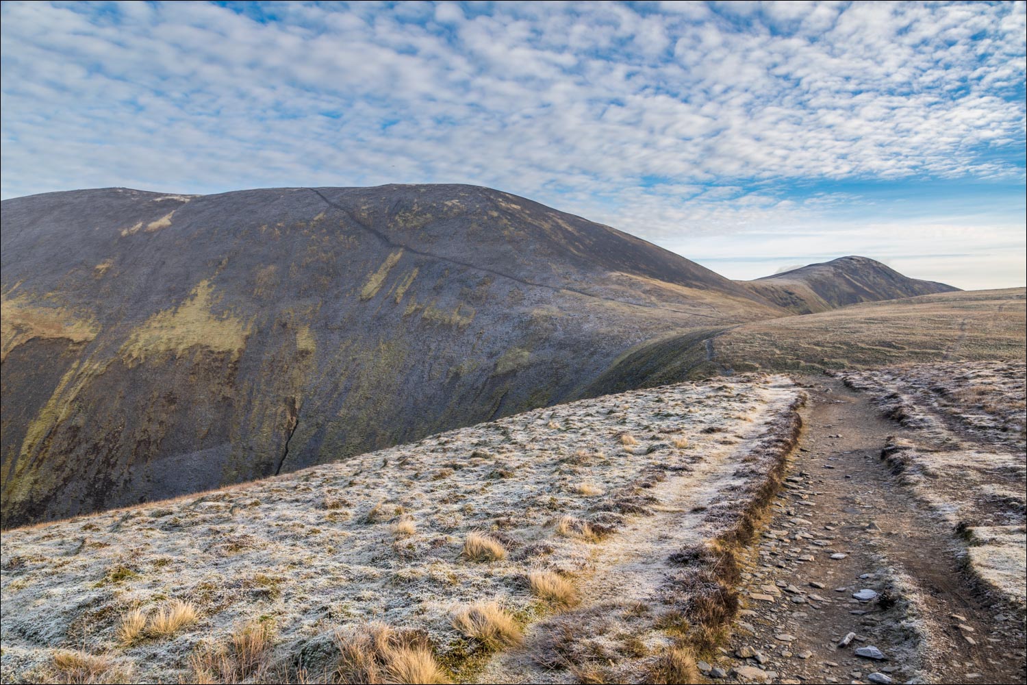
Ullock Pike ahead, with Skiddaw to the left

Looking out to the Irish Sea from a rocky section near the summit of Ullock Pike

Longside Edge and Long Side from Ullock Pike

Bassenthwaite from the summit

Looking back to Scotland and the summit of Ullock Pike

Head of Bassenthwaite and the north western fells

I continue along Longside Edge towards Long Side

Skiddaw up on the left

Head of Bassenthwaite Lake beyond Dodd Wood

Looking back to Ullock Pike

Newlands Valley

The path from Carl Side to Skiddaw, looking very intimidating seen from here...

...but I've walked it before and know it to be safe, despite appearances

Summit of Long Side

I continue along Longside Edge towards Carl Side on the right

From Carl Side, looking back to Long Side and Scotland

The seemingly impossible path to Skiddaw looks far less forbidding from this angle

Off we go - this is looking back along the ridge from the start of the climb

Another view back as I gain height - Newlands Valley below

North Western fells

After a steep section near the top I emerge panting on the summit ridge of Skiddaw, here looking towards the Blencathra group

I detour to the south end for a view of Skiddaw Little Man and the eastern fells

North Western fells from a frozen cairn on the south end of Skiddaw

A low glaring sun made photography difficult here, but it's still a splendid view of Keswick, Derwent Water and Newlands

Blencathra again

Skiddaw Little Man again, with Keswick on the right and Helvellyn in the distance

I make my way back north along the top, with views of Scotland ahead

Summit cairn on Skiddaw, with the Solway Firth and Criffel in Scotland clearly visible

Zooming in on Scotland with a telephoto lens (this photo was taken on the way down)

Shelter at the summit

Looking over the ridge which I'd traversed earlier

Start of the descent as I head north along a gentle grassy path

Ullock Pike and Bassenthwaite

I continue north towards Broad End

Heading west now, and I'll be following the dry stone wall in the centre of the picture, which involves a short climb past Little Knott

Looking along Barkbeth Gill towards Skiddaw

I follow the wall to the next fell, which is the big toe of Ullock Pike. It's possible to climb over it to reach the end of the walk, but I follow an easier though longer path to the right

I follow the wall downhill, with Bassenthwaite village on the right

I arrive back on the path below Ullock Pike, and from here retrace my steps back to the start of a wonderful walk
