
Route: Sizergh Castle
Area: Southern Lake District
Date of walk: 26th September 2019
Walkers: Andrew and Gilly
Distance: 3.4 miles (this includes the walk and also the meander around the gardens)
Ascent: 400 feet
Weather: Mixed sunshine and clouds and a couple of showers
Sizergh Castle and Garden is a stately home and garden at Helsington, about 4 miles south of Kendal. The castle, a grade I listed building, is in the care of the National Trust along with its garden and estate. It has been the home of the Strickland family for over 760 years. The 1,600 acre estate includes limestone pasture, orchards and woodland. We’ve not been here for many years and were keen to revisit the gardens, in particular the famous limestone rock garden
We spent an hour or two wandering around the formal area of the gardens (I’ve not shown this on the route map, as there’s no point following a fixed route here). The herbaceous borders were still showing well and the kitchen garden looked superb. The star of the show, as we’d hoped, was the limestone rock garden, where a variety of acers were coming into their full autumn colour and were a wonderful sight
It had poured with rain during the journey to the castle, and we were doubtful as to whether we’d be able to include a walk. By a stroke of good fortune the conditions improved on our arrival and we decided to set off on one of the walks illustrated in a leaflet which is available at the entrance. We left the castle and set off along a waymarked track through the fields heading gently uphill and passing by Holeslack Farm. This brought us to Helsington Church, otherwise known as St John’s Church. The church is set in an elevated position on Church Fell, with huge views over the Lyth Valley to Morecambe Bay looking one way and to the Lake District fells looking the other. Low cloud and haze restricted the views today, but they were good nevertheless
We retraced our steps for a short distance and then followed a path through the fields which took us back to Sizergh Castle to end a day well spent
Click on the icon below for the route map (subscribers to OS Maps can view detailed maps of the route, visualise it in aerial 3D, and download the GPX file. Non-subscribers will see a base map)

Scroll down – or click on any photo to enlarge it and you can then view as a slideshow

Rannerdale Knotts at dusk on the day before the walk...

...and the head of Crummock Water

Next day, at the other end of the Lake District, the old bank barn at the entrance to Sizergh Castle gardens

Looking across the estate

Avenue of clipped yew leading to Sizergh Castle

We enter the gardens...

We follow the path beside the herbaceous border on the left...


Looking back along the border

Stairs to the castle

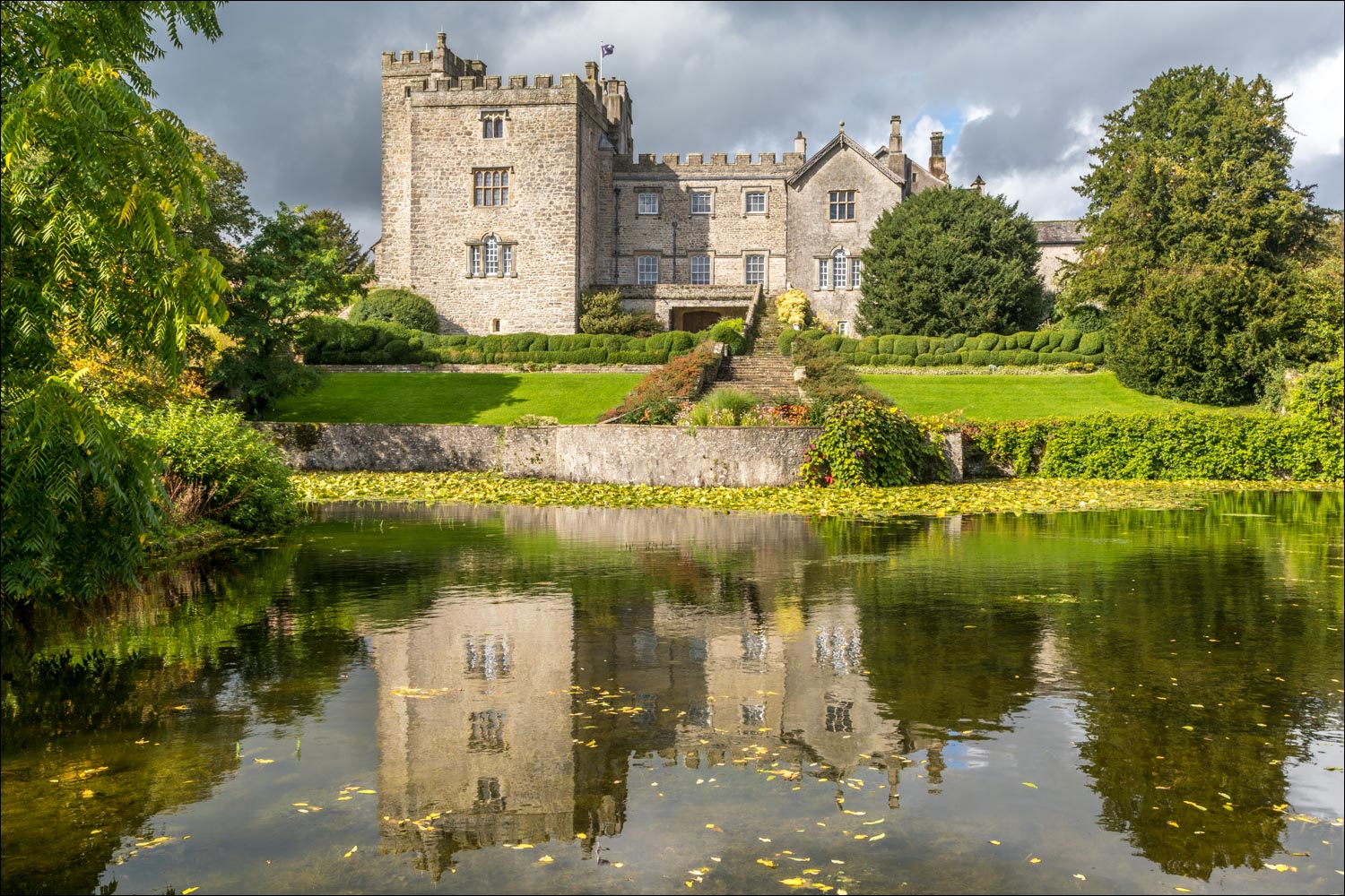
View from the castle across the lake

We walk around the lake, which has good views back to the castle...


We enter the rock garden, which was constructed in the 1920s and is the largest limestone rock garden belonging to the National Trust

The acers are a special feature of the garden at this time of the season...


The ornamental vegetable garden...


We leave the garden area to start the walk to Helsington Church

We follow the waymarked track across the fields...


We pass by Holeslack Farm

Helsington Church ahead

Views towards the Lake District over the Lyth Valley as we approach the church...


Morecambe Bay in the distance

Helsington Church, or St John's Church...


We return via a path which descends gently through the fields...


The end of a lovely short walk is just around the corner
