
Route: Hutton-le-Hole to Lastingham
Area: North Yorkshire
Date of walk: 19th September 2019
Walkers: Andrew and Gilly
Distance: 5.1 miles
Ascent: 700 feet
Weather: Sunshine and blue skies
We last followed this route over 2 years ago, and a return visit was long overdue. On the previous occasion we’d started in Lastingham. Today we chose to start in the moorland village of Hutton-le-Hole, described by the Victorians as ‘an ill-planned and untidy village’. Today it’s regarded as one of the most attractive in the county, and is home to the Ryedale Folk Museum. We parked in the car park at the rear of The Crown, where the fee is £3, but it’s free if you dine there, something to be factored in when planning this walk
We turned left out of the car park, and after a few yards turned left again to follow a path around the village bowling green, and then into open countryside. After a short distance we arrived at Spaunton Moor and followed a path around its southern edge. There was a hint of purple in the landscape, but the heather had largely gone over by now
After an enjoyable moorland walk, we arrived above Lastingham and descended into the unspoilt village. We made a slight detour in order to visit St Mary’s Church. Simon Jenkins, author of England’s Thousand Best Churches, calls the Norman crypt of the church ‘one of England’s special places’. It lays claim to be the oldest Norman crypt in the world, and has not been altered since the time of William the Conqueror. This was a very worthwhile detour. The Blacksmiths Arms is opposite the church. It was a hot day, we were thirsty and so another short and very worthwhile detour was made
Suitably refreshed we climbed out of Lastingham and followed the lane through nearby Spaunton, where the sheep appear to outnumber the residents. Beyond the village we followed a path across the fields, with big views over the surrounding countryside. Eventually we arrived at Austin Head, and from here we descended back into Hutton-le-Hole to end a highly enjoyable walk
Click on the icon below for the route map (subscribers to OS Maps can view detailed maps of the route, visualise it in aerial 3D, and download the GPX file. Non-subscribers will see a base map)

Scroll down – or click on any photo to enlarge it and you can then view as a slideshow

The start of the walk as we pass by the Ryedale Folk Museum in Hutton-le-Hole

Hutton-le-Hole

Before reaching the edge of the village we turn left and follow a path across the fields...


Looking across to Bainwood Head as we reach the edge of Spaunton Moor...


A short section along a lane, and we branch off left just before the bridge on the corner

We follow a path around the southern edge of Spaunton Moor...


Looking back

Bench above Lastingham

A stone cross, part of the millenium commemorations

We arrive in Lastingham

St Mary's Church

Inside the church

We descend the steps to visit the ancient crypt...


After refreshments at the Blacksmiths Arms we start the return journey to Hutton-le-Hole

Looking back to Lastingham

A short road section, and we turn left here for Spaunton

We walk through the quiet village of Spaunton...

...where the sheep seem to outnumber the residents

After passing through Grange Farm we follow this farm track

We then join a path across the fields, with views over the surrounding countryside...


Descending back towards Hutton-le-Hole...


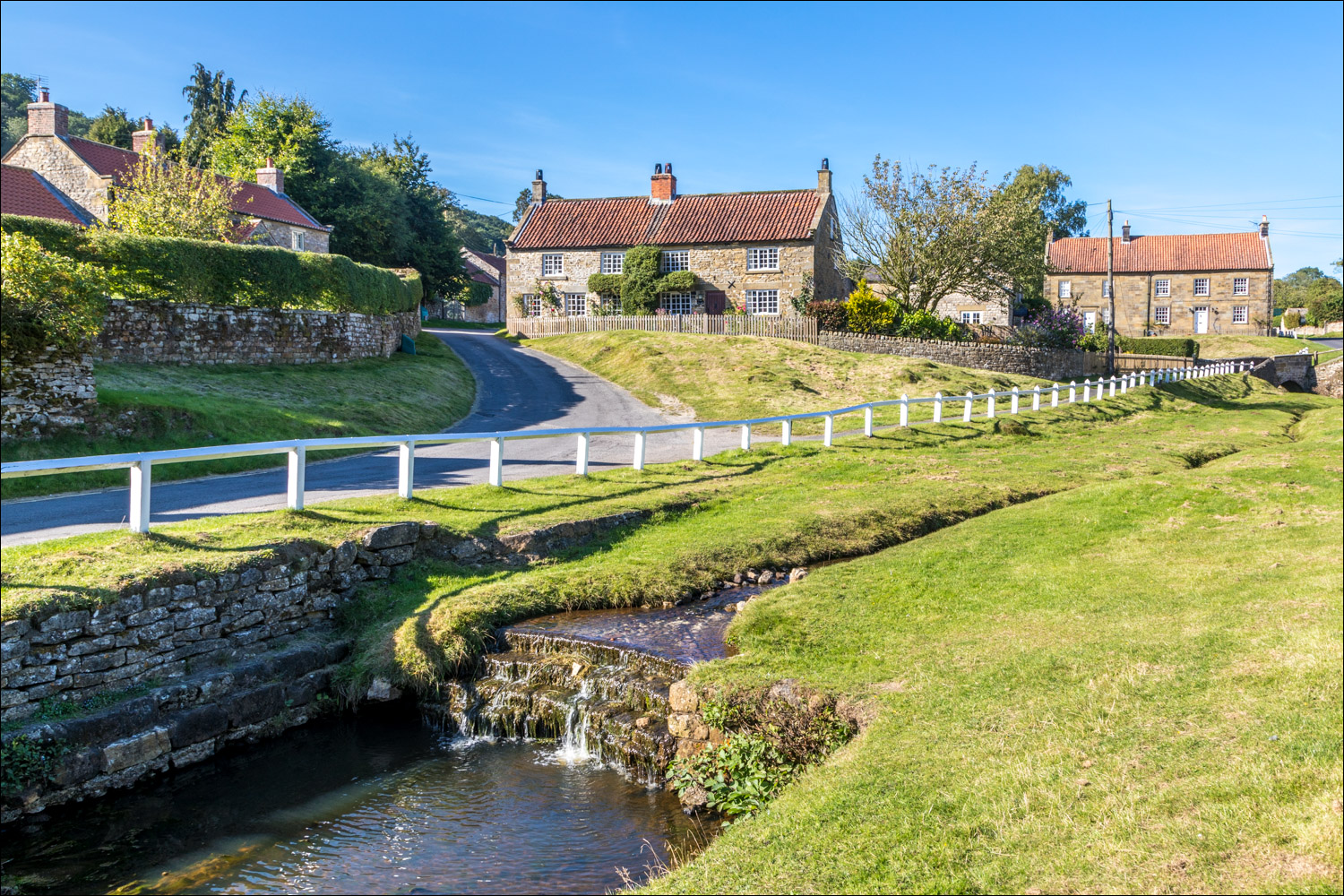
We arrive back in Hutton-le-Hole and cross over Hutton Beck

A few photos of the idyllic village...


We arrive back at the Crown, where our car is parked, to end a great walk
Follow the link for more walks in North Yorkshire (151)
