
Route: Seathwaite Fell
Area: Southern Lake District
Date of walk: 19th January 2022
Walkers: Andrew and Gilly
Distance: 6.3 miles
Ascent: 1,800 feet
Weather: Cloudy with some sunny patches, bitterly cold on the tops
It’s 8 years since I last walked up Seathwaite Fell, far too long an interval for such a wonderful place. We parked in one of the roadside spaces just before the small settlement of Seathwaite, which has an unenviable reputation for having the heaviest rainfall in the country. Today proved to be dry, although it was bitterly cold
Having walked through Seathwaite, we crossed over Stockley Bridge, a beautiful old packhorse bridge which is Grade II listed. We followed the well used path beside Styhead Gill and beyond Taylorgill Force waterfall we turned off left to join a faint path by an unnamed stream. This is easily missed, and the only sign of it is a small cairn. The path became steeper as we gained height but there were no undue difficulties. We followed the path to the summit cairn (which isn’t at the highest point of the fell) and savoured the wonderful views all around, especially those looking back into Borrowdale
We then set off along the lumpy summit ridge in the direction of Great End, which is the key to navigating this complicated area, where the paths are very faint. We passed by several attractive unnamed tarns before arriving at Sprinkling Tarn, set in an amphitheatre of some of lakeland’s finest fells. The tarn is accredited as the source of the River Derwent. We walked around the right of the tarn and then joined the Sty Head path which we followed to Ruddy Gill, turning left here to head back down into Borrowdale via the Grains Gill path
During the course of over 4 hours we only passed a few other walkers, and encountered no-one at all on Seathwaite Fell itself. It had been a wonderful walk
For other walks here, visit my Find Walks page and enter the name in the ‘Search site’ box
Click on the icon below for the route map (subscribers to OS Maps can view detailed maps of the route, visualise it in aerial 3D, and download the GPX file. Non-subscribers will see a base map)

Scroll down – or click on any photo to enlarge it and you can then view as a slideshow

The start of the walk as we pass through the farm at Seathwaite - our objective lies directly ahead

Seathwaite Fell on our right as we follow the Grains Gill path

Looking back along our path

Taylorgill Force - our route will take us above the falls


Seathwaite Fell ahead. We leave the path here and turn right to cross Stockley Bridge

Base Brown in the background


Looking up to Seathwaite Fell as we walk along its lower flanks, following the Styhead Gill path

Looking back to Seathwaite

More views of Base Brown as we continue uphill, passing by Taylorgill Force (which can't be seen from the path)...


The path curves around to the left

Looking back to Borrowdale

We leave the path here. The very faint path up Seathwaite Fell is easily missed - the small stream on the left is the key to locating it

The climb up the fell becomes steeper near the top

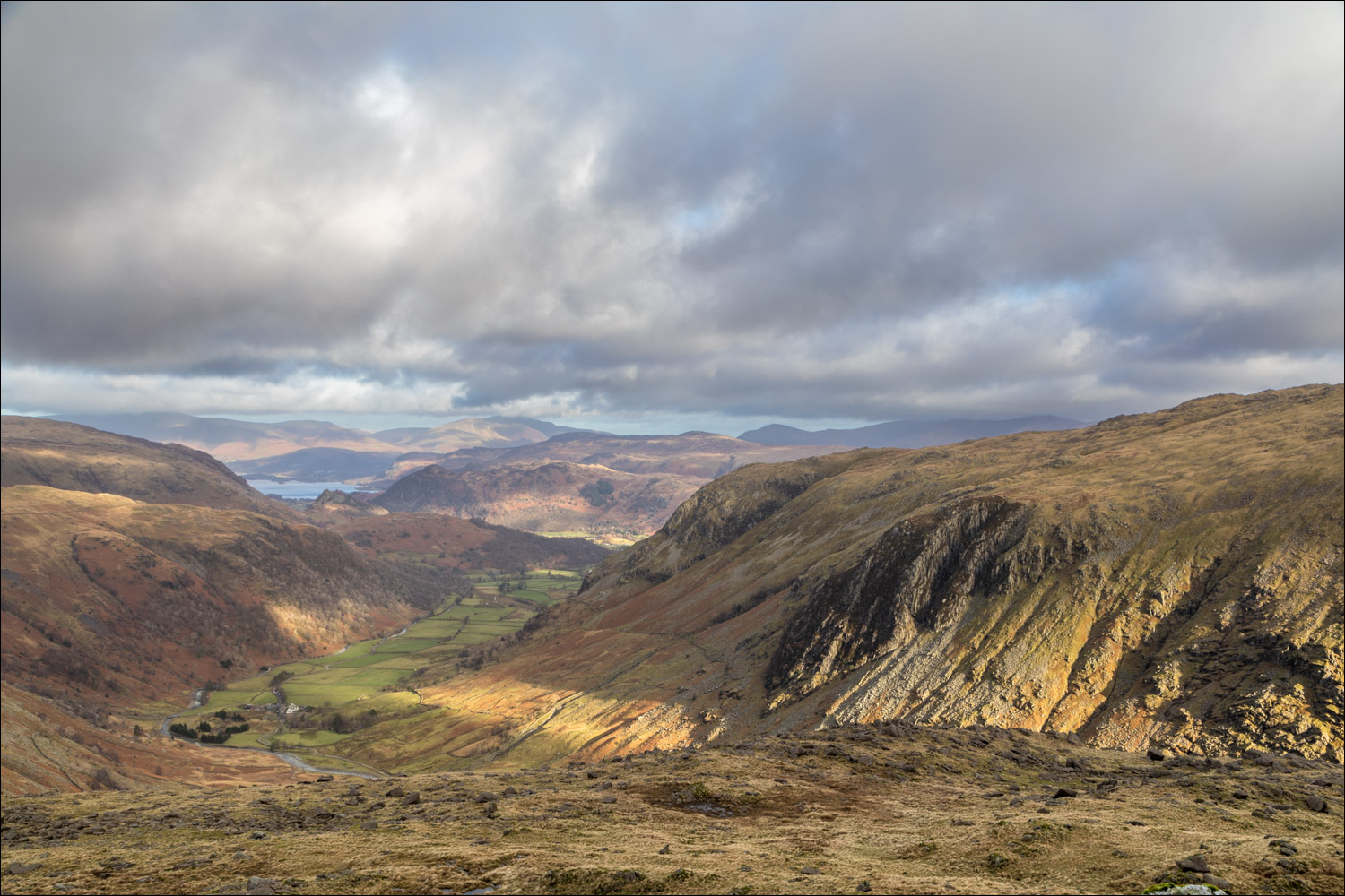
Nearly there - a glimpse of Derwent Water in the distance

Summit cairn on Seathwaite Fell - this isn't quite the highest point, but anyone who arrives here can claim to have climbed the fell

Derwent Water, Skiddaw and Blencathra in the distance

Strong winds on the top made for a high wind chill factor - it was bitterly cold, and time to get on with the walk. We head across the summit area towards Great End

Still some lingering snow on Great End, which faces north and receives little or no sunlight at this time of year

We pass by several small tarns, here looking towards Glaramara and Allen Crags...


Approaching the foot of the crags on Great End

We pass by Sprinkling Tarn

Looking across to Great Gable

Sprinkling Tarn again as we join the path from Sty Head

A view back to Great Gable

We pass by another small tarn

We turn left and ford Ruddy Gill to join the path running across the picture

Big drops into Ruddy Gill on our left

Views into Borrowdale accompany us for most of the descent...


We cross the footbridge over Grains Gill

Seathwaite comes into view

We complete the circuit by re-crossing Stockley Bridge, and from here we retrace our steps back to the start

Back to Seathwaite and the end of a wonderful walk
