
Route: Loweswater
Area: Western Lake District
Date of walk: 15th March 2013
Walkers: Andrew and Gilly
Distance: 5.8 miles
Ascent: 800 feet
It had been raining all morning but started to clear by mid-afternoon, so we decided on a local low level walk. We drove to Loweswater and parked at Maggies Bridge.
We then took the path through High Nook Farm and up along the top of Holme Wood. The weather improved as we went along (in stark contrast to yesterday’s walk) and we had great views of the Solway Firth looking forward and Grasmoor and Whiteside looking back.
The path then took us through Holme Wood and along the shore of Loweswater back to Maggies Bridge.
We’ve done this walk several times before and never tire of it – it was a wonderful couple of hours
For other walks here, visit my Find Walks page and enter the name in the ‘Search site’ box
Click on the icon below for the route map (subscribers to OS Maps can view detailed maps of the route, visualise it in aerial 3D, and download the GPX file. Non-subscribers will see a base map)

Scroll down – or click on any photo to enlarge it and you can then view as a slideshow

At Maggies Bridge car park, we took the path to High Nook Farm and would return via Water Gate Farm

Crossing over Dub Beck

The path to High Nook Farm, it was overcast but things improved...

The first hint of sunshine, on Low Fell

Approaching the head of the valley

Low Fell and Lorton Vale

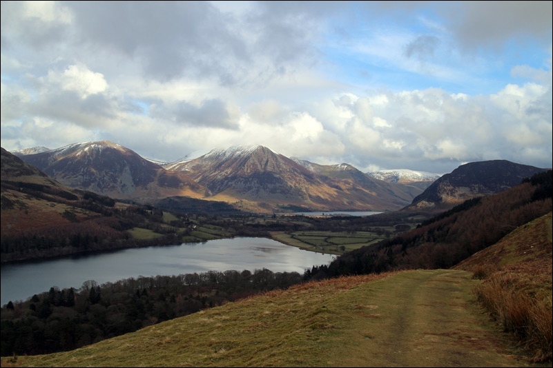
Whiteside and Grasmoor, with Crummock Water making an appearance

Looking back down the path above Holme Wood

Loweswater

Another lovely view back to Loweswater, with Whiteside on the left and Grasmoor centre stage

Looking ahead this time, across the Solway plain towards Scotland

A contented fell pony

Loweswater, with Whiteside and Grasmoor again in the background

Inquisitive youngsters

On the return leg towards Loweswater


Down to the shore of Loweswater

The lakeside path through Holme Wood

We knocked on the door but nobody was in

The Holme Wood pixies at work again

The lakeside bothy can be rented from the National Trust - this is the swing in the front garden

A rowing boat can be hired too

The track back to Maggies Bridge

Walking can be thirsty work, so on the way back we dropped off at the Kirkstile Inn for refreshments
