
Route: Loweswater and Holme Wood
Area : Western Lake District
Date of walk: 13th April 2021
Walkers: Andrew and Gilly
Distance: 5.7 miles
Ascent: 1,000 feet
Weather: Mostly sunny, clouding over later on
This is one of our favourite local walks which, in the space of 6 miles, manages to cram in a huge variety of scenery including farmland, ancient woodland, a lake, a tarn, open moorland and a lonely valley. Along the way there are wonderful views over the Solway Plain looking north (including Scotland in clear weather) and to the high lakeland fells looking south
We parked as usual at Maggie’s Bridge where there is space for 8-10 cars. Instead of heading directly to Loweswater we followed the track to High Nook Farm, where Alfred Wainwright used to stay when he was researching his Guide to the Western Fells. After passing through the farmyard we carried on to the head of the valley before joining the wonderful terrace path above Holme Wood. The path is commonly described as the Old Coffin Road, reputedly an ancient coffin road from Loweswater to St Bees. I was contacted a year or so ago by Alan Cleaver, author of The Corpse Roads of Cumbria. His research suggests that the terrace path was only cut in the 1964, and the local vicar in 1929 said that the tradition was that the corpse road went beside the lake through Holme Wood. This makes sense, as the terrace path involves an ascent of almost 1,000 feet. Alan thinks that the National Trust promoted it as a corpse road in the 1970’s, and the error had been repeated ever since. Whatever the truth, the views from here are superb
The path contours around the sides of Carling Knott and Burnbank Fell and reaches a height of over 1,000 feet – higher than one or two lakeland fells. However the climbing is so gentle that it’s hardly noticed. We carried on towards Fangs Brow, on the very edge of the Lake District, before turning back at Iredale Place and following the path past Jenkinson Place and Hudson Place. We then walked back through Holme Wood, and along the shore of Loweswater, passing by the bothy as we did so
The last section was an easy stroll along the track between Watergate Farm and Maggie’s Bridge. We’ve followed this route on numerous occasions at every time of the year and never tire of it
For other walks here, visit my Find Walks page and enter the name in the ‘Search site’ box
Click on the icon below for the route map (subscribers to OS Maps can view detailed maps of the route, visualise it in aerial 3D, and download the GPX file. Non-subscribers will see a base map)

Scroll down – or click on any photo to enlarge it and you can then view as a slideshow

The night before the walk, a skyful of stars over Lorton Vale...


Next day, the start of the walk from Maggie's Bridge car park. Beyond the gate we turn left, and will follow a path above the 'Loweswater Pheasant' - can you spot it?

Views back to Low Fell as we follow the track to High Nook Farm...


Highnook Beck on our right as we walk towards the head of the valley

Looking back into Lorton Vale

Low Fell on the left

Black Crag below Gavel Fell

Approaching the valley head, at which we'll turn sharp right

We make a short detour (not shown on the route map) to visit High Nook Tarn. The tarn is not named on the OS maps, but is known as such to the local farmer

We cross the small footbridge over High Nook Beck, at which point the old coffin road (so called) rises to contour around the fellside

Looking across Lorton Vale to Whiteside and Grasmoor

A view back to High Nook Tarn and Black Crag

Mellbreak on the right as we reach the edge of Holme Wood - our path will follow the edge of the wood for a while

We contour around the fellside, but for anyone looking to shorten the walk, it's possible to descend through Holme Wood via this gate...

...but at the cost of missing this view of Loweswater, Whiteside and Grasmoor

Zooming in on Holme Wood and reflections in Loweswater

Loweswater is unusual, in that it drains back into the Lake District, so this is the head of the lake, and not its foot as would be expected

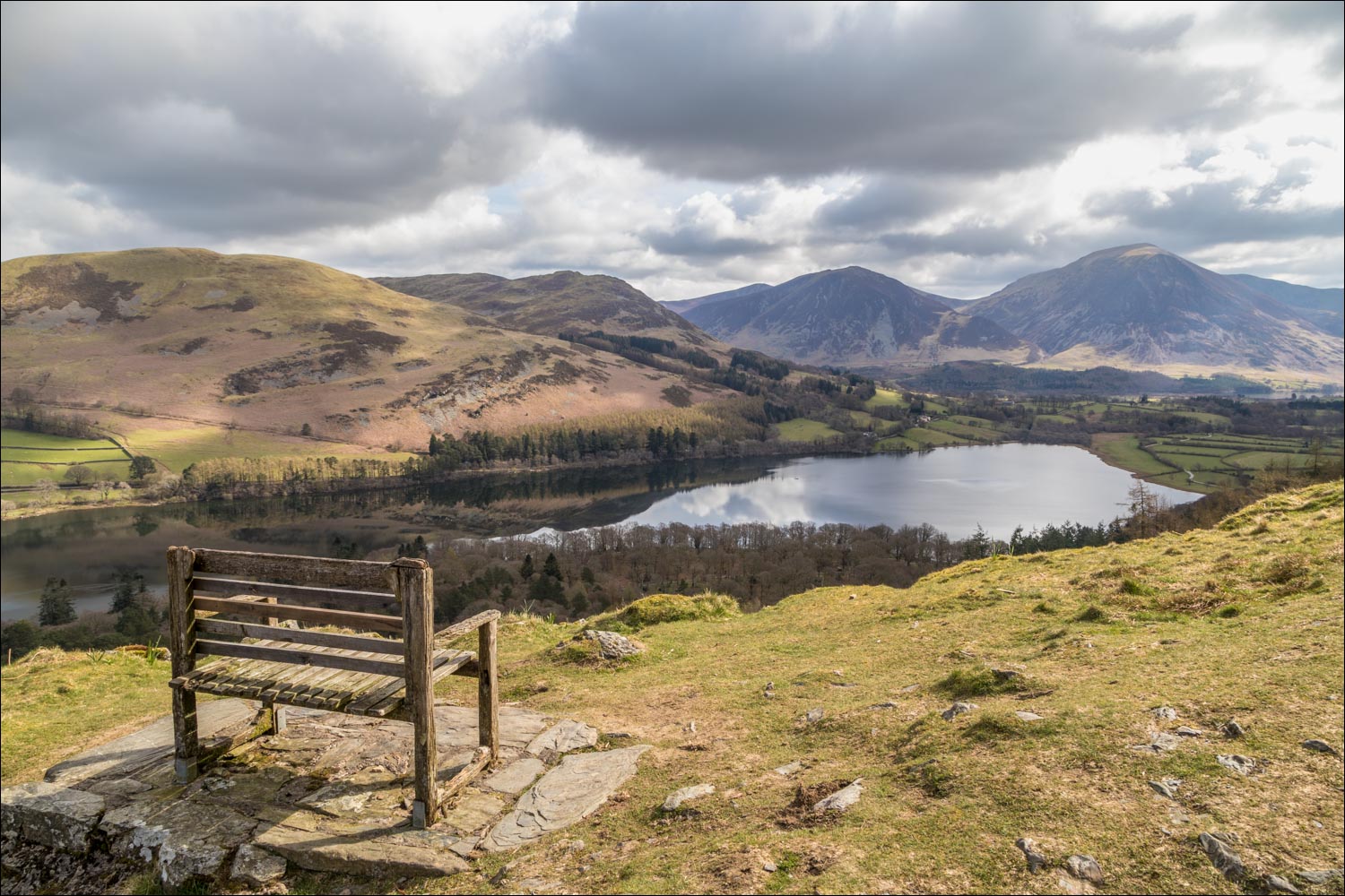
The Bench

Holme Wood, Loweswater and Darling Fell

On the fringes of the Lake District now, as we head towards Fangs Brow, with a hazy view of the Irish Sea, the Solway Firth and Scotland in the far distance

These horses are often to be found grazing here, and it was good to see them again...


Fangs Brow Farm ahead, but just beyond the hill on the right we'll fork off to start the return leg of the walk

Heading towards Mosser Fell as the path gradually curves round in the direction of Loweswater

We pass above Iredale Place

Loweswater comes into view

We arrive at the lane leading to Hudson Place and turn right here

Belted Galloway cattle

We descend to Holme Wood and follow the lakeshore path beside Loweswater

Holme Wood, managed by the National Trust

Loweswater, looking towards Whiteside and Grasmoor

The foot of Loweswater near Watergate Farm

Beyond Watergate Farm we follow the track back to Maggie's Bridge and the end of the walk
