
Route: King’s How on Grange Fell
Area: Central Lake District
Date of walk: 12th April 2021
Walkers: Andrew and Gilly
Distance: 3.5 miles
Ascent: 1,100 feet
Weather: Sunshine and blue skies
At long last! The end of lockdown caused by the global Covid 19 pandemic and hopefully the beginning of a return to normality. Instead of seeking new routes to walk it seemed more appropriate today to revisit one of our old favourites, a place we could never tire of. Grange Fell is a lowly fell but what it lacks in height it makes up for in beauty, being set in the heart of Borrowdale, one of the loveliest valleys in the Lake District. It’s a superb craggy little fell with three separate widely scattered tops – Ether Knott, Brund Fell and today’s destination King’s How. We parked in the National Trust Bowderstone car park and from here followed a path which goes through ancient woodland, which is classified as temperate rainforest. The woodland path gradually curves around the steep crags above – a direct assault on the fell would be impossible for ordinary walkers
After walking through Cummacatta Wood we arrived at the steep rocky staircase which leads to Long Moss near the summit of King’s How. From the summit there is a superb view over Derwent Water looking one way and Borrowdale looking the other
A direct descent from the summit is out of the question thanks to the crags on the west, so we followed a narrow path which snakes round the other side of the fell and which descends steeply, eventually ending at the Borrowdale road. We followed the road for a short distance – there’s a narrow footpath most of the way – then crossed over at the sign indicating the Bowderstone. we followed this path through the woods, past the massive Bowderstone and back to the car park. During the course of the walk we didn’t see another soul until we arrived back near the start
For anyone following this walk, I’d mention that although the route is only 3.5 miles long, it is likely to take as much time as one twice its length. It’s best to set aside a full morning or afternoon. The terrain is rocky and complicated and there are very few sections where it’s possible to get into a proper stride. Walking poles are a very useful piece of kit to bring along
For other walks here, visit my Find Walks page and enter the name in the ‘Search site’ box
Click on the icon below for the route map (subscribers to OS Maps can view detailed maps of the route, visualise it in aerial 3D, and download the GPX file. Non-subscribers will see a base map)

Scroll down – or click on any photo to enlarge it and you can then view as a slideshow

A couple of days before the walk, a fox reflected in the pond

The start of today's walk as we leave the National Trust Bowderstone car park to enter into Cummacatta Wood

The sun was still below the fells and it was a bitterly cold start

Looking back along the path to the distinctive outline of Castle Crag

We continue through Cummacatta Wood

A view back along the path

Castle Crag again...


Looking across to the ridge between Maiden Moor and High Spy

It would be easy to miss the junction here - before this gap in the wall we turn sharp right to start the steep but easy ascent

Onwards and upwards

As we gain height there are views through the trees towards Skiddaw and Derwent Water

King's How ahead

After traversing a boggy area known as Long Moss we follow a narrow path to the summit of King;s How

Gilly admires the view of Keswick and Derwent Water

A few paces later, and we're on the summit of King's How on Grange Fell, here looking to the head of Borrowdale

Looking across the complicated expanse of Grange Fell to one of its other summits, Brund Fell

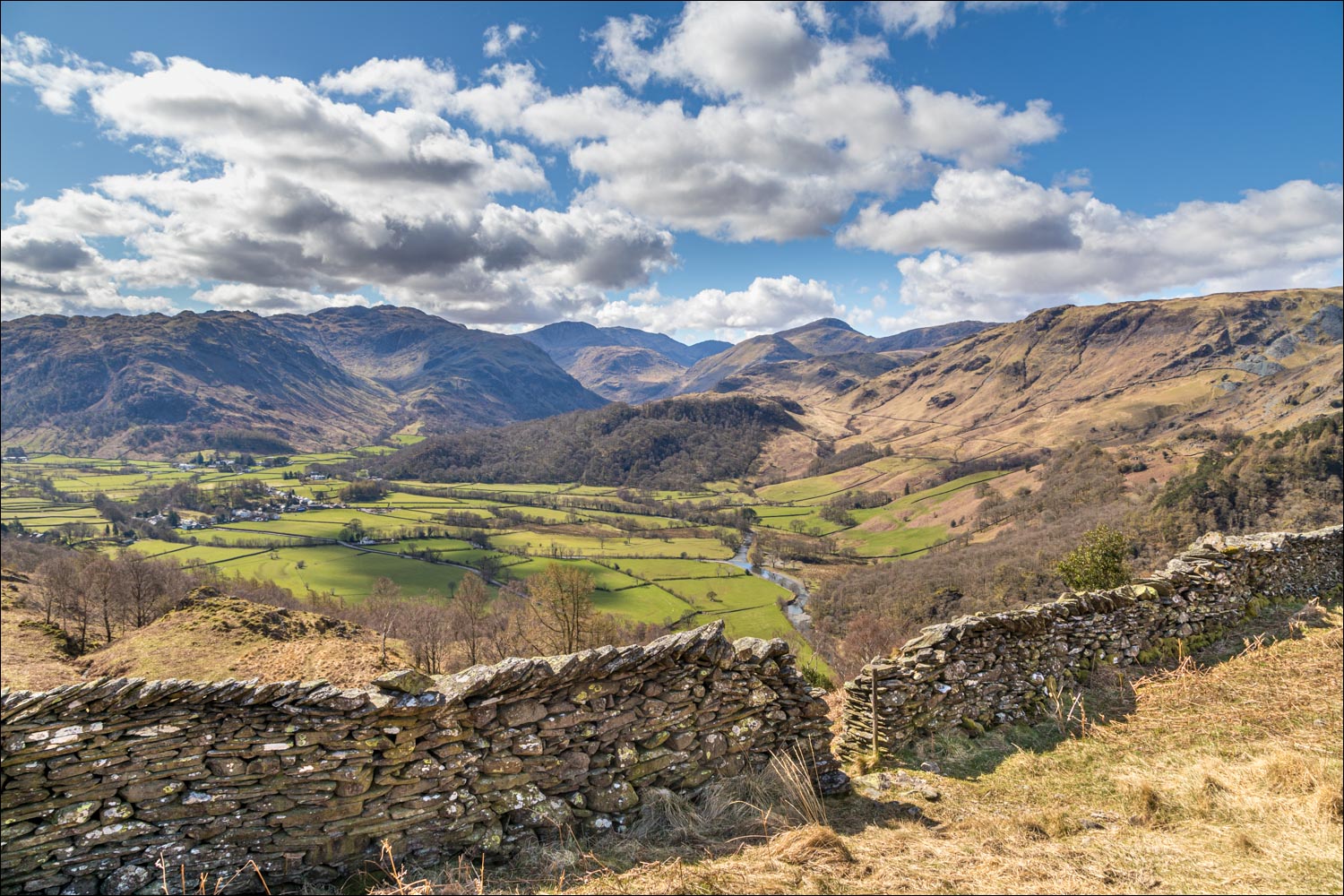
Borrowdale in all its glory - these views accompany us during much of the descent...


Rosthwaite and the River Derwent below

Rosthwaite Fell at the head of Borrowdale

Borrowdale and the Derwent again

Looking across to Castle Crag and High Spy beyond it

The last of the views of Borrowdale before we descend into the woodland below

We follow a rocky path through the trees

We arrive at the Borrowdale road - the short road section can be avoided by following an up and down path on the right

A short diversion to the bank of the River Derwent

We leave the road here to follow a path on the right

The famous Bowderstone, vital statistics: length 62 feet, height 36 feet, circumference 89 feet and weight nearly 2,000 tons

Looking across Borrowdale at its narrowest point, constricted by its jaws - Castle Crag and King's How

Nitting Haws between Maiden Moor and High Spy

Back to the Bowderstone car park and the end of a wonderful little walk
