
Route: Low Fell
Area: Western Lake District
Date of walk: 16th November 2018
Walkers: Andrew
Distance: 4.5 miles
Ascent: 1,500 feet
Weather: Sunny
The weather was dull and dreary in the morning, but as forecast the clouds broke up and disappeared by early afternoon, which left just enough time for a short fell walk. I could think of no better destination than Low Fell, one of my favourite places and the fell which I chose for my 1,000th Wainwright ascent last May.
I parked as usual in one of the few roadside spaces outside the little village of Thackthwaite on the west side of Lorton Vale. I walked into the village and turned right at a signpost between the houses, following a rocky lane uphill. The leads out onto the fields and from here I followed a line of old oak trees up to the intake wall. There are lovely retrospective views from here.
On reaching the intake wall I turned right to follow a grassy path which curves around the fellside into a small raised valley, where the views are lost – this is a rather dreary section in truth, but it’s soon over and before long I was on the ridge line, heading south into a blinding low sun (which explains the lack of photos in my direction of travel).
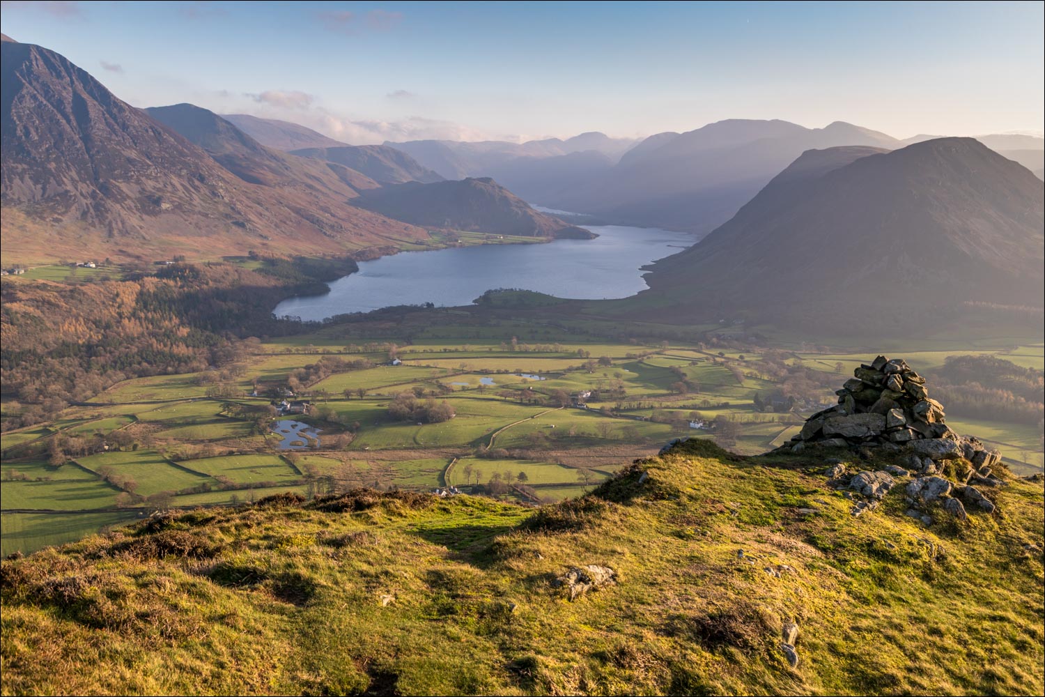
The views from the ridge get better and better, and anyone visiting Low Fell for the first time should not stop at the north top, but should continue to the very end of the ridge where there is a cairn just below the south top. From here, in the words of Alfred Wainwright, ‘the view is of classical beauty, an inspired and inspiring vision of loveliness…a scene of lakes and mountains arranged to perfection’. The conditions were rather hazy today and the view was not seen at its magnificent best, but I had no complaints, it was still a wonderful sight.
With more daylight available I’d normally make a circuit of the route by walking over Darling Fell and returning via Loweswater and the Thackthwaite Lane. It is possible to descend from the top directly into Lorton Vale but it’s a horribly steep route and not to be recommended, and so I simply retraced my steps back to the start
For other walks here, visit my Find Walks page and enter the name in the ‘Search site’ box
Click on the icon below for the route map (subscribers to OS Maps can view detailed maps of the route, visualise it in aerial 3D, and download the GPX file. Non-subscribers will see a base map)

Scroll down – or click on any photo to enlarge it and you can then view as a slideshow

View across Lorton Vale from the parking space near Thackthwaite

Thackthwaite

After leaving the village I follow this line of oak trees - the Low Fell ridge line is to the left

Looking back to Whiteside on the far side of the valley

Great Gable in the distance, and Haystacks below it

Looking back to Lorton Dodd

Whiteside and Grasmoor to the left

I arrive at the intake wall, and turn right

Looking back across Lorton Vale

The Dodd ridge leading up to Whiteside and behind it Ladyside Pike leading up to Hopegill Head

Broadmoor Hill on my right as I plod up the slopes

A hint of things to come, with Crummock Water coming into the picture

Whiteside and Grasmoor on the other side of Lorton Vale

Scales and the Whinlatter Pass

Looking back to Hatteringill and Broadmoor Hill from the zigzag path up Sourfoot Fell

Crummock Water as I gain the ridge to the summit - sadly the view is a hazy one today

Views on my left - Whiteside...

...and Grasmoor

Cairn on the north top - it would be a mistake to 'tick off' Low Fell here, so I carry on along the undulating ridge

Crummock Water

Mellbreak to the right

Looking across to Darling Fell - beyond it lies the coast and Irish Sea, but it's too hazy to see them today

South top of Low Fell

The cairn below the south top, looking down into Lorton Vale...

Loweswater village - the lake is to the right but impossible to photograph against the glaring low sun

...and finally that view. I stand here for a while in quiet contemplation before retracing my steps back to the start
