
Route: Catbells
Area: North Western Lake District
Date of walk: 15th November 2018
Walkers: Andrew and Gilly
Distance: 5.6 miles
Ascent: 1,500 feet
Weather: Sunny with a cold wind on the tops
The ascent of Catbells (spelt ‘Cat Bells’ on the OS map) makes for an almost perfect short fell walk. The climb is an exciting one and the views throughout are superb. However these virtues, and its proximity to Keswick, bring with it a drawback – the fell is too popular for walkers who prefer to walk in relative peace and quiet. It’s therefore best to visit the fell early and/or out of season. With that in mind we were under starter’s orders by 9am, having parked in the small car park at the foot of the fell, near Hawse End.
The climb starts immediately and is a delight every step of the way. There are a couple of steep rocky sections where hands need to be taken out of pockets, the first being by the memorial tablet to Thomas Arthur Leonard, and the second being just below the top, but these are easily surmounted and there are no dangers. I’d describe it as a clamber rather than a scramble. Before long we were at the summit of Catbells enjoying the wonderful views over Derwent Water to the east and Newlands Valley to the west.
A bitingly cold wind meant that we didn’t linger long, and we set off down the easy descent path which has been much improved in recent years. On reaching Hause Gate we left the ridge path and continued to descend towards Manesty. We followed a track through Manesty Park and arrived at Myrtle Bay on the shore of Derwent Water. We’ve followed the lakeshore path many times before, although today the level of the lake was higher today than I’ve seen it. The path was flooded in places, and the landing stages for the Keswick Launch were partly underwater and inaccessible to the boats.
After passing by Otterbield Bay we left the shore of of the lake and walked past Hawse End Outdoor Centre, over the big toe of Catbells, and back to the start of a wonderful walk
For other walks here, visit my Find Walks page and enter the name in the ‘Search site’ box
Click on the icon below for the route map (subscribers to OS Maps can view detailed maps of the route, visualise it in aerial 3D, and download the GPX file. Non-subscribers will see a base map)

Scroll down – or click on any photo to enlarge it and you can then view as a slideshow

Red squirrel on a rainy day yesterday

Next day, looking back to Skiddaw at the start of the walk

A little higher up, Keswick and Derwent Water come into view

Swinside on the left, and a glimpse of Bassenthwaite

The memorial to Thomas Arthur Leonard, which can reached by clambering up the rocks

Derwent Water and its islands

The summit of Catbells comes into view beyond Skelgill Bank

Newlands Valley on our right, and the knobbly peak of Causey Pike

The Blencathra range in the distance

Newlands Valley again

Looking across Derwent Water - we'll be walking back along the shoreline below at the end of the walk

Derwent Water

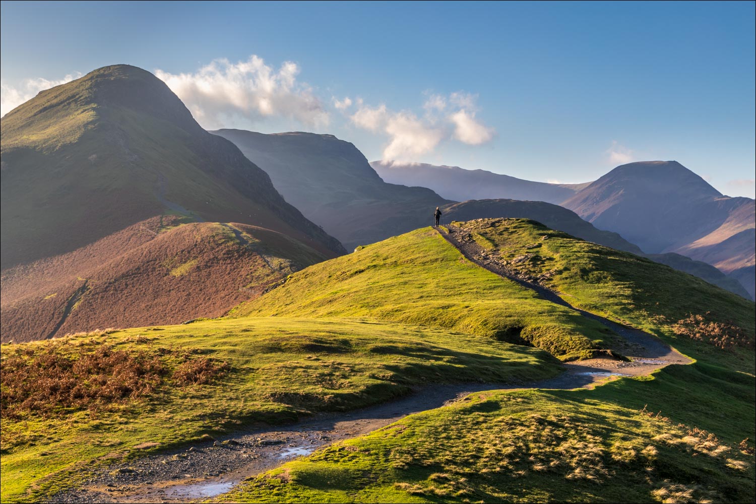
Path to Catbells

Looking back

An easy section before the rocky climb to the summit

Brandelhow Park below


The new summit cairn on Catbells, here looking into Newlands...

....and now towards Keswick

Hindscarth and Robinson as we start the descent

We arrive at Hause Gate and follow this new sign pointing to 'the lake'

Head of Derwent Water from the improved path beyond Hause Gate

The path zigzags back and forth, taking the sting out of the gradient

Looking into Borrowdale - the low sun made it impossible to take photos looking south

Manesty Park below, which we'll be walking through shortly

Descending to Manesty

Head of Derwent Water

Borrowdale

We arrive at the valley road, which we follow for about 250 yards before turning into Manesty Park

Looking back to the distinctive outline of Castle Crag

We turn off the road at the crest of this small hill

Golden larch needles on the track through Manesty Park

Myrtle Bay, and we turn left here to walk along the west shore of Derwent Water

Following recent heavy rain, the level of the lake is a couple of feet higher than usual

We pass by the Teddy in the Window...

...and some of his fan mail from around the world

The landing stage at Brandelhow is partially submerged and not in use today

The hands sculpture 'Entrust', commissioned to celebrate the birth of the National Trust in the Lake District - in need of a manicure now

Looking across Derwent Water

We continue along the shoreline path through Brandelhow Park

A view back to Catbells

One of the Keswick launches passes by

Otterbield Bay, at which point we leave the lakeshore and walk towards Hawse End Outdoor Centre

We pass by this atmospheric old barn near Hawse End

A last look back to Derwent Water - the end of the walk is a short stroll from here
