
Route: Rannerdale Knotts
Area: Western Lake District
Date of walk: 17th November 2018
Walkers: Andrew and Gilly
Distance: 4.8 miles
Ascent: 1,200 feet
Weather: Sun and blue skies – not a cloud in sight
Rannerdale Knotts is relatively short in stature at 1,160 feet, but what it lacks in height it more than makes up for in its rugged mountainous character and the beauty of its surroundings
This is a fell we’ve climbed numerous times and we could never tire of it
We usually park in the National Trust car park at Hause Point, but today parked at Cinderdale Common – this would add a couple of miles to the itinerary, but as it was a glorious morning we were in no hurry. We forded Cinderdale Beck and followed the path into High Rannerdale, crossing Squat Beck via the wooden footbridge. From here we walked to Hause Point to begin the ascent of Rannerdale Knotts
This starts quite gently and is followed by a steep section up a gully. This was once a scrambly affair, but progress has been made much easier in recent years by the addition of rock steps. Before long we arrived at the north top, from where there are some lovely views over Crummock Water. We carried on along the knobbly summit ridge known as Low Bank and at the end of the ridge we were faced with two possible routes back. We could have made the obvious choice and walked back along Rannerdale, but the valley is in shade during winter months. Instead we descended towards Buttermere, turning right before the village to follow a faint path above Great Wood and along the lower flanks of Rannerdale Knotts. Such a choice would be unthinkable in May, when the famous Rannerdale bluebells are in flower, but it was a good decision today
When we reached Hause Point we briefly retraced our steps to the foot of the fell and then walked back to Cinderdale Common along the valley road
For other walks here, visit my Find Walks page and enter the name in the ‘Search site’ box
Click on the icon below for the route map (subscribers to OS Maps can view detailed maps of the route, visualise it in aerial 3D, and download the GPX file. Non-subscribers will see a base map)

Scroll down – or click on any photo to enlarge it and you can then view as a slideshow

A visit to Crummock Water on the dawn of today's walk - the silhouette of Rannerdale Knotts is on the left

Mellbreak plunging into the lake

Silver birch and a ghostly boathouse

View across the lake from the boathouse

An hour or so later, a red squirrel in the garden...

....and a stoat helping itself to the bird food

The start of the walk, looking along the Buttermere road from the car park at Cinderdale Common

We cross Cinderdale Beck

Whiteless Pike on our left as we walk from Rannerdale towards High Rannerdale

Looking back to Crummock Water and Mellbreak...


We enter the bluebell area in High Rannerdale...

...and cross the footbridge over Squat Beck

Squat Beck

We follow the path around the foot of Rannerdale Knotts and will start the ascent from Hause Point

Low Fell, the subject of yesterday's walk, seen at the start of the climb

Looking back to Mellbreak

Fleetwith Pike and Haystacks at the head of Buttermere

Start of the steep climb up a rocky gully

Mellbreak from the top of the gully

Low Fell again and the foot of Crummock Water

Looking back along the Buttermere road to the start of our walk

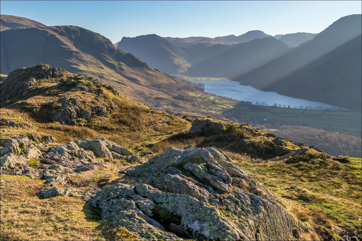
Buttermere from the summit of Rannerdale Knotts, with Great Gable in the background

The summit cairn, looking towards High Snockrigg and Robinson

Buttermere again

Whiteless Pike on the left

Buttermere village and the lake beyond

We follow the path along the undulating ridge

Looking down to the head of Crummock Water

Further along the ridge

Herdies basking in the sun...


We follow the grassy path along the ridge

The left fork would take us back into Rannerdale, but we take the path on the right

Descending towards Buttermere

We turn right to head back towards Crummock Water

We follow a faint path above Grassgarth Coppice and Great Wood

Great Wood

Rannerdale Knotts is up on our right

Beyond the wood the path contours around the lower flanks of the fell

There's a wider path below, and we gradually descend towards it

A short break in order to enjoy the view looking back along Crummock Water

Wood House, set in a wonderful position at the head of the lake

We descend to the Buttermere road, which we'll follow for half a mile or so

A splendid Herdwick ram near Rannerdale Farm...

...and now looking back to Rannerdale Knotts as we arrive back at the start
