
Route: Lanthwaite Hill
Area: Western Lake District
Date of walk: 10th July 2020
Walkers: Andrew and Gilly
Distance: 2.1 miles
Ascent: 400 feet
Weather: Mostly sunny
Lanthwaite Hill, also known as Brackenthwaite Hows, is one of my favourite places in the Lake District. This walk has featured on my site many times, but I take the view that no two walks are ever the same – changing seasons and variations in the light and weather make for an infinite number of possibilities – and there’s always something new to be seen. It was especially good to be back today after the enforced absence caused by the Covid-19 lockdown
We parked as usual in the National Trust car park at Scale Hill. Instead of taking the obvious track ahead, which leads directly to the north shore of Crummock Water, we turned left up a narrow path through Lanthwaite Wood. At a junction we turned left again to continue uphill, climbing a steep rocky staircase along the way
After leaving the woods via a deer gate we were soon at the top of the hill, admiring the superb views over Lorton Vale, Loweswater and Crummock Water. We then followed the easy path back down into Lanthwaite Wood, following a path which hugs the edge of the woods, giving good views across to Lanthwaite Green and Grasmoor
The path descends to the eastern shore of Crummock Water, and when we arrived at the lakeshore we followed the path to the foot of the lake, from where there were more good views towards Mellbreak and Rannerdale Knotts. We wandered along the lakeshore for a short distance (not shown on the route map) and then retraced our steps to the foot of the lake. From this point there are two ways back to the start – a path which follows the bank of the River Cocker, and the wide track leading through Lanthwaite Wood. Today we followed the main track back to the start of the walk
For other walks here, visit my Find Walks page and enter the name in the ‘Search site’ box
Click on the icon below for the route map (subscribers to OS Maps can view detailed maps of the route, visualise it in aerial 3D, and download the GPX file. Non-subscribers will see a base map)

Scroll down – or click on any photo to enlarge it and you can then view as a slideshow

Looking across the River Cocker to Mellbreak from the car park at Scale Hill

We follow a narrow path on the left leading to the top of Lanthwaite Hill

We exit Lanthwaite Wood via this deer gate

Whiteside beyond Lanthwaite Hill

Sweet Lorton Vale from the top of the hill

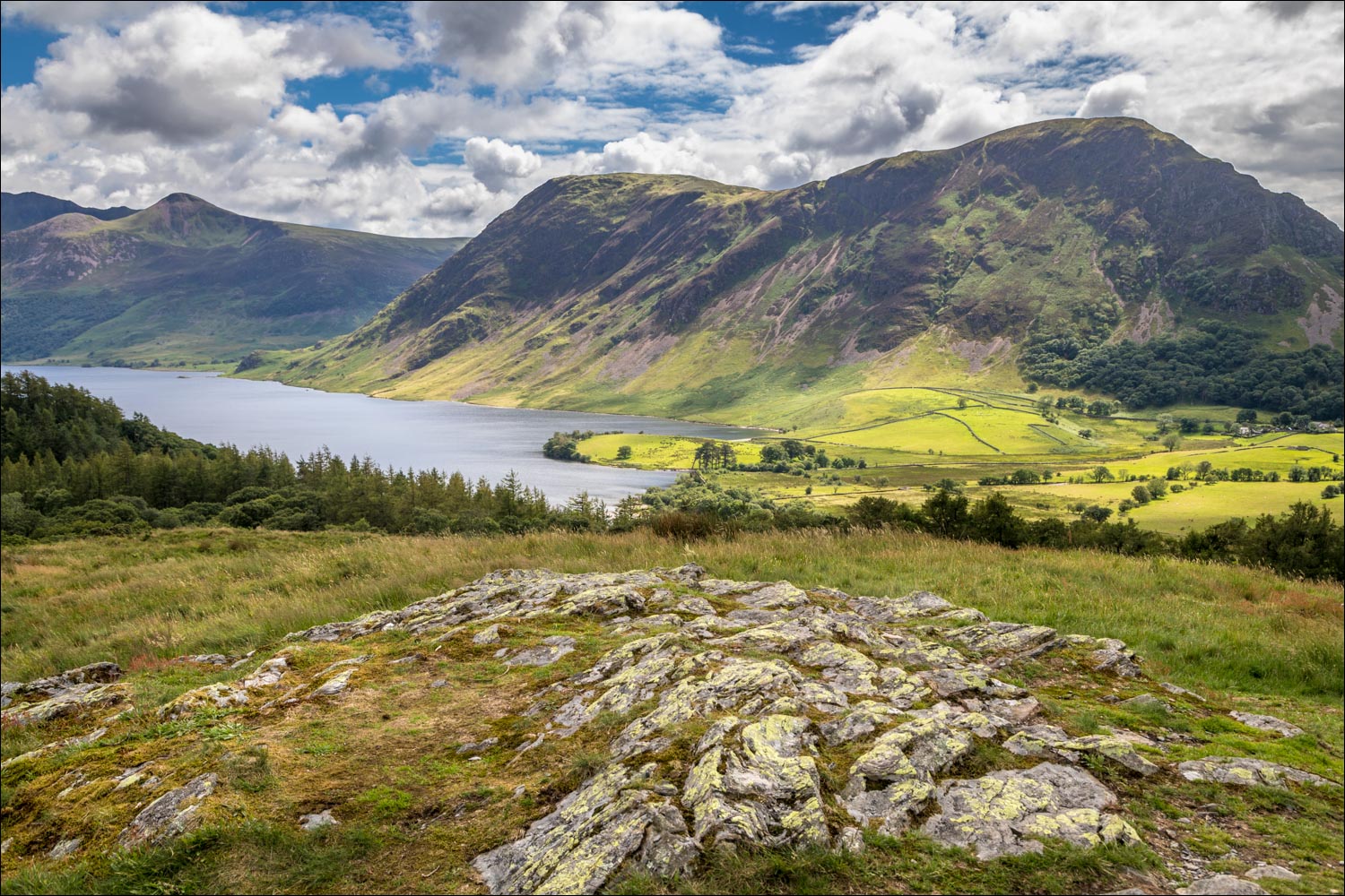
Looking the other way, Crummock Water

Mellbreak and Crummock Water

Looking west now towards Loweswater

Lanthwaite Green

Lanthwaite Wood below

Shown as 'Peel' on the OS map, the promontory is the site of a medi moated manor house known as Loweswater Pele, thought to be the home of Ranulphe de Lindesaye who was connected with Loweswater during the mid-12th century

Rannerdale Knotts, and Great Gable in the background

Low Fell on the right, were we'd walked a couple of days ago

We descend towards Crummock Water

Rannerdale Knotts beyond Lanthwaite Wood...


We follow a delightful path which skirts around the edge of Lanthwaite Wood...


Lanthwaite Green on our left...

Lanthwaite Green again, at the foot of Grasmoor


Shelter in the wood

We descend to the shore of Crummock Water

Looking across the lake to the lower slopes on Mellbreak

Boathouse on a pebble beach by the lake

We follow the path to the foot of the lake

The foot of Crummock Water...


Red Pike on the left, as we make a there and back detour as far as the Pump House...


Windswept pine trees at the foot of Mellbreak, and from here we retrace our steps to the foot of the lake

We follow the track through Lanthwaite Wood back to the start of a wonderful short walk
