
Route: Haystacks
Area: Western Lake District
Date of walk: 21st July 2020
Walkers: Andrew
Distance: 5.2 miles
Ascent: 1,800 feet
Weather: Cloudy with sunny intervals
Haystacks was the favourite fell of Alfred Wainwright and it’s one of mine too – it’s a fascinating place and there’s always something new to see. Today would make it my 19th time up here, and I could never tire of it. I made an early start and parked in the car park at Gatesgarth Farm just after 8am (note the parking fee is currently £4, cash only). I walked through the farm and crossed Peggy’s Bridge at the head of Buttermere. The climbing starts below a small triangular shaped copse, and from here I followed the easy path up to Scarth Gap
Beyond Scarth Gap the going gets much steeper and rockier, and there are are five or six scrambly sections where hands are needed. There are no dangers though, and it’s an enjoyable clamber. A final steep section brought me to the summit area, which is full of interest. The light had been good to this point, but at the summit grey skies rolled in and it was was rather dull. I’d normally have wandered around here as it’s a fascinating place full of bumps and hollows, with different views from each. In view of the weather I carried on without ado
A direct descent from the summit is impossible and it’s necessary to walk across some complicated knobbly terrain – Haystacks is a bad place to be if lost in mist. I soon arrived at the contradiction in terms which is Innominate Tarn but the light was still dull so I continued to follow the path in the direction of Dubs Quarry. Eventually I arrived at one of the two possible descent paths to Warnscale Bottom. I normally take the first one, but was in no hurry, so carried on to join the alternative path on the far side of Warnscale Beck. This provides an easy way down, with wonderful views ahead along Warnscale Bottom and Buttermere for most of the way
It was another wonderful visit to this special place
For other walks here, visit my Find Walks page and enter the name in the ‘Search site’ box
Click on the icon below for the route map (subscribers to OS Maps can view detailed maps of the route, visualise it in aerial 3D, and download the GPX file. Non-subscribers will see a base map)

Scroll down – or click on any photo to enlarge it and you can then view as a slideshow

The start of the walk as I pass through Gatesgarth Farm and follow the track across the head of Buttermere - ahead is High Crag Butress (spelt with one 't' on the OS map)

My target - Haystacks...


I cross the footbridge over Warnscale Beck, here looking towards Buttermere...

...and now looking towards Haystacks, right of picture

Looking back to Gatesgarth at the start of the climb

The bothy at the head of Buttermere, the 'White Hut'

Looking back to Buttermere

Haystacks ahead....


Views back to Buttermere...


Haystacks again as the clouds start to drift in

Looking back along the path

The head of Buttermere

Zooming in, with Hassness centre of the picture

I reach a grassy plateau. This is Scarth Gap Pass, an important junction as it provides access to the valleys of Ennerdale and Wasdale

Pillar on the right as I start the steep ascent from Scarth Gap

One of several scrambly sections where hands are needed

Sadly the light has become flat and grey as I reach the summit of Haystacks, here looking over Buttemere and Crummock Water, with Scotland in the far distance

Robinson centre picture

In view of the grey skies I don't linger, and set off towards the contradiction in terms that is Innominate Tarn

Great Gable

My route will take me around Green Crag ahead

Looking down a fearsome gully, with my eventual return path stretching across it

Blackbeck Tarn

Looking back along the path

Warnscale Beck flowing into Buttermere

After fording Warnscale Beck via some stepping stones, I start the descent into the valley via a path on the right of the beck

Green Crag and Haystacks

It's a rocky path, but set at a relatively easy gradient

Haystacks

Buttermere and Crummock Water

High Crag

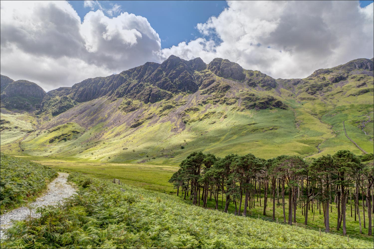
I reach the valley floor, and follow the path past a group of Buttermere pines...


Looking back to Haystacks

Buttermere

A final glance back to Haystacks as I arrive at Gatesgarth at the end of a wonderful walk
