
Route: Haystacks
Area: Western Lake District
Date of walk: 22nd June 2022
Walkers: Andrew and Gilly
Distance: 5.6 miles
Ascent: 1,900 feet
Weather: Mixed sunshine and clouds
Haystacks was the favourite fell of Alfred Wainwright and it’s one of mine too – it’s a fascinating place and there’s always something new to see. We parked as usual in the car park at Gatesgarth Farm (note the parking fee is currently £4, cash only). We walked through the farm and crossed Peggy’s Bridge at the head of Buttermere. The climbing starts below a small triangular shaped copse, and from here we followed the easy path up to Scarth Gap
Beyond Scarth Gap the going gets much steeper and rockier, and there are are five or six scrambly sections up rock steps where hands are needed. There are no dangers though, and it’s an enjoyable clamber. A final steep section brought us to the summit area, which is full of interest. We wandered around here for a while. It’s a fascinating place full of bumps and hollows, with different views from each, though it was a shame that the clouds rolled in bringing indifferent light with them
A direct descent from the summit is impossible and it’s necessary to walk across some complicated knobbly terrain – Haystacks is a bad place to be if lost in mist. We soon arrived at the contradiction in terms which is Innominate Tarn and continued to follow the path in the direction of Dubs Quarry. Eventually we arrived at the first of the two possible descent paths to Warnscale Bottom, and chose this for the descent. The alternative path is a little further on and follows the far side of Warnscale Beck. Both paths meet up at valley level, and both provide an easy way down, with wonderful views ahead along Warnscale Bottom and Buttermere for most of the way
It was another wonderful visit to this special place
For other walks here, visit my Find Walks page and enter the name in the ‘Search site’ box
Click on the icon below for the route map (subscribers to OS Maps can view detailed maps of the route, visualise it in aerial 3D, and download the GPX file. Non-subscribers will see a base map)

Scroll down – or click on any photo to enlarge it and you can then view as a slideshow

After passing through Gatesgarth Farm we follow the track in the direction of High Crag

Our objective - Haystacks - on our left

Herdwick sheep, Buttermere Pines and Warnscale Bottom

Buttermere and Warnscale Beck from Peggy's Bridge

From the same spot, looking the other way towards Haystacks

Haystacks again

Looking back to our starting point, Gatesgarth Farm, at the start of the climb

The White Hut bothy at the head of Buttermere...


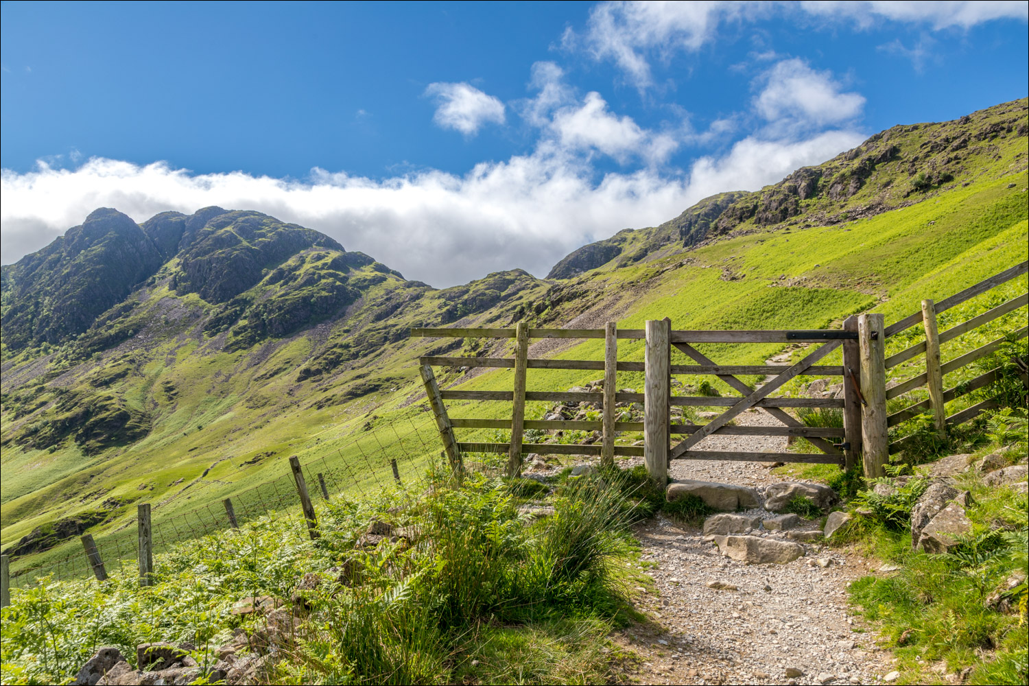
We pass through this gate to enter onto open fellside

The big toe of Fleetwith Pike and a group of pine trees, which we'll pass by at the end of the walk

We aim for Scarth Gap, to the right of the picture, with Haystacks on the left

Looking down to the head of Buttermere

Scarth Gap, an important junction in these parts, as Ennerdale and Wasdale may be accessed from here

Beyond Scarth Gap, the going gets rougher and hands need to be taken out of pockets


Buttermere and Crummock Water

Looking across to Fleetwith Pike

A view back into Ennerdale

Summit area of Haystacks - sadly it clouded over at this point and the light was uninspiring


Haystacks is a very complicated place, especially in mist. In clear weather the key to the descent is Innominate Tarn

An unnamed tarm, but not Innominate

We follow a path to the left of Innominate Tarn

Dramatic rock scenery as we follow a path towards Green Crag

Looking down to one of the two descent paths

Fearsome gullies on our left, none of which provide a safe way down

Green Crag. Our descent path lies just beyond it


Looking back to Haystacks

A cairn marks the start of the descent

A short diversion to admire the view from Warnscale Bothy

Views along Warnscale Beck flowing into Buttermere, and Crummock Water beyond,,,


We arrive back at valley level

Looking back

We cross the footbridge over Warnscale Beck

Dry stone wall in Warnscale Bottom

The High Stile Range, consisting of High Crag, High Stile and Red Pike

A final look back to Haystacks at the end of the walk
