
Route: Grisedale Pike, Hopegill Head and Whiteside
Area: North Western Lake District
Date of walk: 26th March 2022
Walkers: Andrew
Distance: 6.2 miles
Ascent: 2,800 feet
Weather: Mostly sunny, warm
Today’s walk was a linear one linking two valleys, the Vale of Keswick and Lorton Vale. In order to make that possible, either two cars or a lift are necessary. Mrs Andrewswalks kindly volunteered to drop me off at the start and to pick me up at the end, which is the small car park on the gated road near High Swinside. I was dropped off by the car park just above the village of Braithwaite. The climb up the subsidiary hill of Kinn starts immediately and before long I was enjoying views back towards the Skiddaw fells and Keswick
As I slogged up the slopes in very warm weather, I found myself being overtaken by a number of fell runners, and as I approached the summit their numbers increased. There must have been 200-300 runners in all. This wasn’t an issue, though I did have to keep well to the side to avoid obstructing their progress, which was a little tricky on the steep rocky section at the end of Sleet How, just below the summit of Grisedale Pike. I guessed that they would be running the Coledale Horseshoe, so that when I trended right to aim for Hopegill Head the runners would trend left towards Coledale Hause. This proved to be the case and I soon had the path back to myself
From the summit I followed the path above the awe inspiring chasm of Hobcarton Crag, which took me to the next fell, Hopegill Head
From the small summit on Hopegill Head I followed the thrilling narrow ridge to Whiteside east top, one of my favourite miles in lakeland. I then descended the northern flank of the fell in the direction of Lorton Dodd, and as I did so I spotted my taxi driver climbing up to meet me. Thanks Gilly. We climbed back down to the col in front of Dodd and we turned right to follow the valley path, fording Hope Beck to return to the car park at High Swinside
It had been a wonderful outing in perfect walking weather
For other walks here, visit my Find Walks page and enter the name in the ‘Search site’ box
Click on the icon below for the route map (subscribers to OS Maps can view detailed maps of the route, visualise it in aerial 3D, and download the GPX file. Non-subscribers will see a base map)

Scroll down – or click on any photo to enlarge it and you can then view as a slideshow

The start of the walk from the car park above Braithwaite

An early view back to Skiddaw over Braithwaite How


Braithwaite below

I pass through this gate to enter onto open fellside

Skiddaw again, and a glimpse of Derwent Water

The way up to Grisedale Pike is now in full view

Looking back along the Sleet How ridge

Coledale below on my left

On the final steep section I became caught up in a fell race

A long line of runners stretching along the ridge behind me

Summit of Grisedale Pike. The fell runners will peel off to the left shortly


Looking back to Grisedale Pike as the fell runners turn off to Coledale Hause. Son James had been at this spot at dawn earlier in the week, and it's worth sharing his video....

Next target, Hopegill Head in the centre of the picture above the fearful chasm of Hobcarton Crag

There's a choice of paths, and no sense of exposure from the one on the left. I can't vouch for the other, never having tried it

Ladyside Pike on the right of Hopegill Head

Approaching the summit of Hopegill Head

looking back to Grisedale Pike

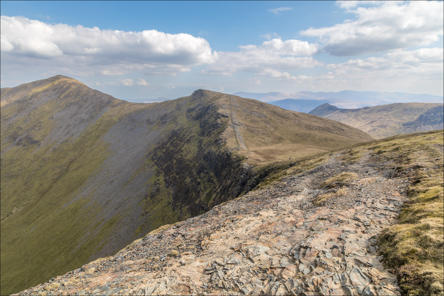
From the small summit on Hopegill Head, a view along the wonderful ridge leading to the final fell, Whiteside

A down and up along the ridge

Whiteside has two tops - the distant one on the west and the nearer east top. I'll descend from the east top


Looking back to Hopegill Head

The Dodd ridge, which I'll use for the descent, comes into view

A final look back to Hopegill Head

The west top of Whiteside from the east top, and this is where I leave the ridge

The Lorton Dodd route provides a good way off the fell, and isn't too steep. There are good views over Lorton Vale along the way. Scotland can be seen from here, but not today as it was too hazy

Lorton Dodd - on reaching its foot I'll turn right to contour around the hillside

Looking back up to Hopegill Head

Having met up with Gilly's Taxis a few minutes earlier, we aim for Hope Gill, passing by this old sheepfold

Hope Gill below, which we'll ford and then follow the path mid-picture


We arrive at the gated High Swinside road, and the small car park is just to the left
