
Route: Machir Bay
Area: The Rhinns of Islay
Date of walk: 23rd March 2022
Walkers: Andrew and Gilly
Distance: 2.1 miles
Ascent: 150 feet
Weather: sunny but hazy
Earlier in the day we’d completed a short walk at Portnahaven on the Rhinns Peninsula, which left time for another short walk in this remote part of the world. Machir Bay beach, also known as Kilchoman beach, is considered to be one of the most beautiful beaches on Islay, with a spectacular sweep of white sands extending over a mile. The name of the bay derives from the coastal grass known as machair.
We parked at the end of a track off the public road to Kilchoman. From here the beach is a short three minute stroll. Instead of the direct approach we preferred to follow a circular route, and so passed through a gate beside an information board and headed along an easy inland track. We had to divert from our route at one stage to avoid a large herd of cows with calves, but regained it near the sand dunes.
The southern end of Machir Bay came into view and as we rounded a corner there was a fabulous view along the beach. We passed through a metal gate and descended onto the beach to begin a heavenly walk along its pristine sands, which were all but deserted. For anyone following this route, don’t be tempted to go for a swim – strong rip tides make swimming here extremely dangerous.
All too soon we reached an obvious break in the dunes just before the far end of the beach. We reluctantly turned our backs on the sea and returned to the nearby parking area. It had been a superb short walk.
Click on the icon below for the route map (subscribers to OS Maps can view detailed maps of the route, visualise it in aerial 3D, and download the GPX file. Non-subscribers will see a base map).

Scroll down – or click on any photo to enlarge it and you can then view as a slideshow

The start of the walk as we pass through this gate to follow a track above the sand dunes on our right...


We had to divert at one point to circumvent a herd of cattle with calves, but gradually regained our course

We follow the path around the corner to an access gate to the beach

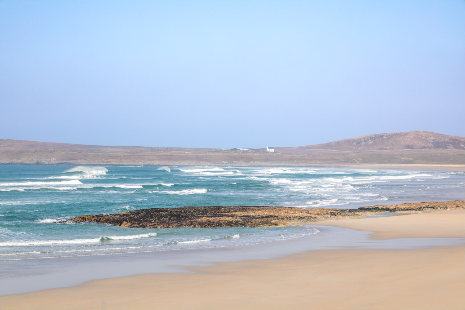
Machir Bay comes into view

We descend to the beach

Coull Farm on the far side of the bay


The start of a heavenly walk along the white sands of Machir beach, or Traigh Mhachir...


We pass by the wreck of an old steamship, believed to be that of the Patti, wrecked in the 1840's

It's possible to walk further along the beach, but we turn away from it here at an obvious break in the dunes

Looking back to the wreck of the Patti

The end of a superb short walk is ahead

The next day, our planned walk was scuppered by a herd of cattle with calves blocking access to our route, so instead we visited another lovely beach, known as the Big Strand. It's worth sharing a few photos of the place

The Big Strand runs for 7 miles and is the longest beach on Islay. It stretches from Laggan Point in the north to Kintra and the Oa Peninsula in the south


We then went in search of wildlife...

Heron

Dawn on our last day on Islay, and no time for a walk as the ferry leaves shortly. Some final views across Kilnaughton Bay from the holiday cottage where we'd been staying this week...


A short while later our ferry arrives at nearby Port Ellen

Leaving Islay, and looking back to the Carriag Fhada lighthouse

Looking across to Jura...


The Scottish mainland comes into view at the end of a wonderful walking holiday
Follow the link for more walks in Scotland (44)
