
Route: Derwent Water from Grange
Area: North Western Lake District
Date of walk: 11th January 2017
Walkers: Andrew
Distance: 6.4 miles
Weather: very mixed
The mountain weather forecast didn’t mince its words – phrases such as ‘zero visibility’ ‘appalling conditions’ and ‘severe gales’ persuaded me that a low level walk would be a sensible option for today’s walk.
I decided to revisit Derwent Water and after joining up a few paths on the OS map I came up with a route I’ve not followed before, though I’ve walked most of the paths in different combinations on previous occasions.
I drove over to the pretty village of Grange and parked in the small car park by the double-arched bridge over the River Derwent. After crossing the bridge I followed the path beside the Borrowdale road, before turning off towards the head of Derwent Water
At the head of the lake I crossed the Chinese bridge and walked along the boardwalk into Manesty Park, and from there into Brandelhow Park. On reaching Hawes End Outdoor Centre I set out on the return leg along an elevated path running along the foot of Catbells – a wonderful section of the walk, with glorious views all around
The path gradually descended into Borrowdale and Grange to end a superb circuit. The photographic record of the walk has a few gaps as there were several violent showers accompanied by gale force winds and horizontal sleet, making it hard to stand up at times, let alone take photos
For other walks here, visit my Find Walks page and enter the name in the ‘Search site’ box
Click on the icon below for the route map (subscribers to OS Maps can view detailed maps of the route, visualise it in aerial 3D, and download the GPX file. Non-subscribers will see a base map)

Scroll down – or click on any photo to enlarge it and you can then view as a slideshow

The day before the walk, a few pictures of ‘Blade’ in Hull City Centre, conceived by artist Nayan Kulkarni for Hull 2017

The blade is 75 metres long, 3.5m in diameter at the root and weighs 25 tonnes

It is the largest single-cast product in the world

Over the course of 2017, hundreds of blades will be made in the new Siemens factory in Hull

Next day, on the other side of the country a red squirrel in the garden

The start of today’s walk as I cross the double-arched bridge on the way out of Grange

From the riverside path, looking back to Grange along the River Derwent

Walking beside the Borrowdale road towards Derwent Water

Maiden Moor on my left

Just before High Lodore I leave the road to follow the path to Derwent Water

Comb Gill

Shepherds Crag on my right

Looking back

A passing sleet shower obscures the views of Skiddaw


The Chinese Bridge (I think the name derives from its low curving shape)


Looking towards Derwent Water from the bridge…

…and looking the other way into Borrowdale

The excellent boardwalk, without which this part of the walk would be impossible…


Manesty Park

Brandelhow Landing Stage, one of the stages used by the Keswick Launches as they ply their trade round the lake

Further along the lakeshore path, part of the Cumbria Way

View back along Derwent Water

Blencathra in the distance

Abandoned jetty at Victoria Bay

Brandelhow Park

Either path can be taken here, I go left which avoids a ‘there and back’ at Otterbield Bay

Old Brandelhow barn

Beyond Hawse End Outdoor Centre I start the return leg

Looking back to the unmistakeable outline of Causey Pike…

…and now looking back to Skiddaw from the start of the return path

Derwent Water islands and Blencathra

Catbells

The path contours around the fellside above the road

Another view back to Keswick, Skiddaw and Blencathra

Brandelhow Point

A well located house

Looking back

Brandelhow Point again


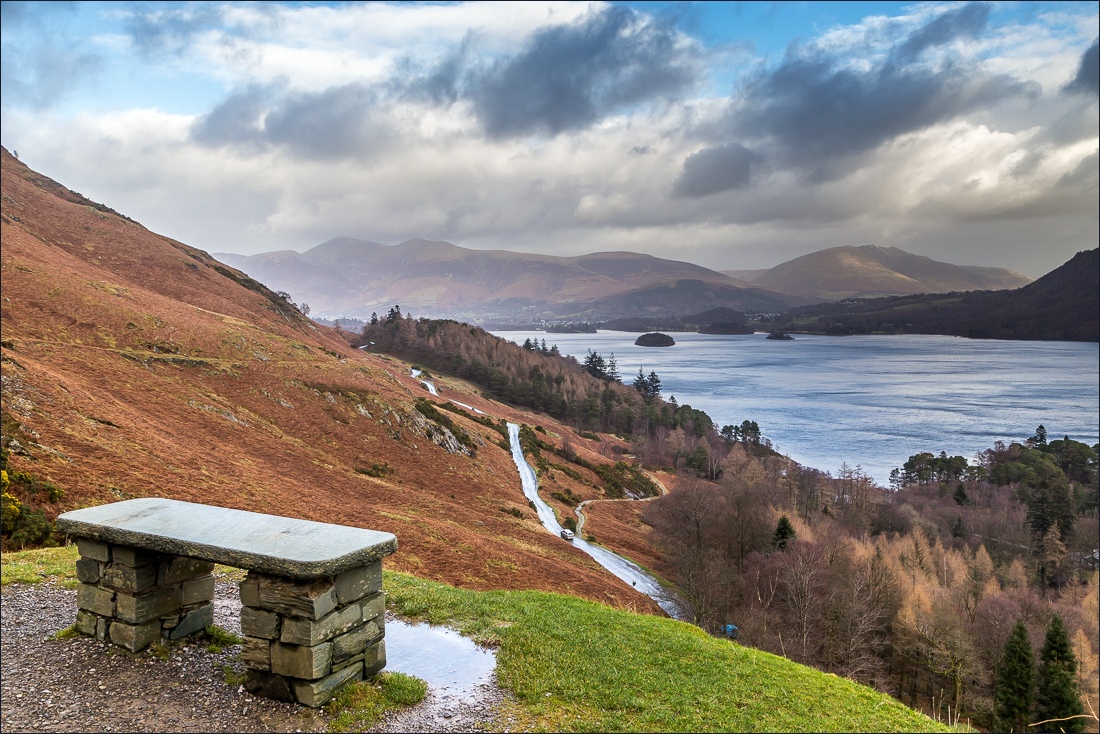
Stone bench…


The start of the descent into Borrowdale


Castle Crag, seen as I reach the road back into Grange

Grange, and the end of a great walk…

…but not the end of the day, as I then drove over to Whitehaven to catch the sunset


