
Route: Derwent Water
Area: North Western Lake District
Date of walk: 8th November 2023
Walkers: Andrew and Gilly
Distance: 5.8 miles
Ascent: 650 feet
Weather: Cloudy, improving later on
Today’s walk was a new one for us. We’ve followed the individual paths along it on numerous occasions but as part of different routes. The route which we plotted today would enable us to follow one of the best sections of the long distance Cumbria Way beside the west shore of Derwent Water, and to return at higher level with wonderful views over the lake. We hoped that the autumn colours would be showing well and we were in luck, they were at their peak
We parked in one of the roadside spaces near Hawes End at the foot of Catbells (room for six cars only). We were out of season and arrived early but at other times parking here may be difficult thanks to the popularity of Catbells. There are other roadside spaces near the route but no car parks so I recommend an early start to be sure of finding a space. A preferable and much more interesting alternative would be to use the services of the Keswick Launch, which could be taken from any of the landing stages around the lake and to disembark at Hawes End
We set off in a clockwise direction, passing through Hawes End Outdoor Centre, and reached the shore of Derwent Water at Otterbield Bay. The Cumbria Way weaved in and out of rocky coves as we followed the delightful path to the head of the lake. On reaching it we turned right to head towards Manesty. A very short and quiet road section brought us to the Hause Gate descent path from Catbells. We climbed uphill for a while and at a junction turned right to start out along an elevated path which contours around the lower flanks of Catbells. The views over Derwent Water towards Skiddaw and Blencathra are wonderful. All too soon we arrived back at the roadside above Hawse End and from here it was a short stroll back to the start
For other walks here, visit my Find Walks page and enter the name in the ‘Search site’ box
Click on the icon below for the route map (subscribers to OS Maps can view detailed maps of the route, visualise it in aerial 3D, and download the GPX file. Non-subscribers will see a base map)

Scroll down – or click on any photo to enlarge it and you can then view as a slideshow

The start of the walk as we follow the path to Hawes End

We arrive at the shore of Derwent Water

We pass by Otterbield Bay

Old barn in Brandelhow Park

View along the shoreline of Derwent Water

We are now on the Cumbria Way, which we will follow to the head of the lake

The hands sculpture known as 'Entrust', which has been moved to a different position since we were last here

We follow the lovely path through the woods in Brandelhow Park,,,


The landing stage at Brandelhow

Autumn colours along the shoreline

Brandelhow Point

We pass by the home of the Teddy in the Window, who receives greetings for all over the world...


Abbot's Bay and Otter Island

Abbot's Bay

Trees in Manesty Park

Walla Crag on the far side of Derwent Water

We arrive at the head of the lake...


We follow the boardwalk across the juicy terrain

Looking across to Catbells on our right...

...and to the crags below Bleaberry Fell on our left

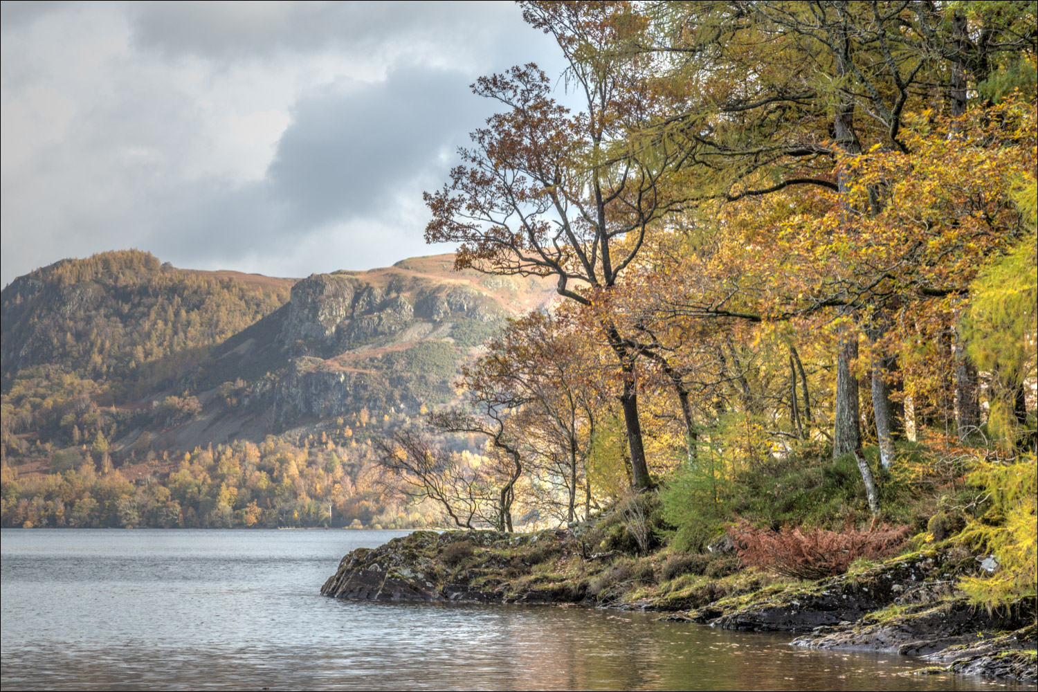
Walla Crag and Blencathra in the distance

The far point of the walk as we turn away from Derwent Water and head towards Manesty

We follow the lane to Manesty and will leave it just beyond the houses ahead

Autumn colours in the fields around Manesty

We leave the lane here and start a steady climb uphill

We follow the path up Manesty Band which leads to Catbells

Looking back into Borrowdale

The path on the left continues up to Hause Gate and the summit of Catbells, but we turn right here to follow a path above the woods

The start of a wonderful terraced path which contours along the flanks of Catbells

The memorial bench in honour of Sir Hugh Walpole

Looking over Manesty Park to Ashness Wood

Further along the terraced path

Autumn colours at their peak in the woods below

Brandelhow Point

A blaze of colour below Blencathra

A final glance back to Derwent Water as we descend into Newlands Valley and the end of the walk

The knobbly outline of Causey Pike on our left as we follow the lane back to the start...


The following day, a pair of red squirrels in the garden
