
Route: Tarn Hows
Area: Southern Lake District
Date of walk: 1st November 2023
Walkers: Andrew and Gilly
Distance: 3.5 miles
Ascent: 450 feet
Weather: Sunny patches, heavy rain at the halfway point
Tarn Hows is a well known beauty spot, perhaps too well known as it can be a little busy at times. The tarn is partly artificial, having been formed in the 19th century by the merging of three small tarns. When the Tarns and their setting came up for sale in 1929, they were bought by Beatrix Potter who sold the half containing Tarn Hows to the National Trust, and bequeathed the rest of the estate to the Trust in her will
We parked at the National Trust Glen Mary car park. The footbridge over Tom Gill was not in use but it was a simple matter to locate the path by the side of the gill. Keeping the gill on our right, we climbed up a rocky staircase passing by several impressive waterfalls. After about 20 minutes we arrived at the edge of Tarn Hows. We set off anti-clockwise along the wheelchair friendly path which runs around the tarn. After a short distance we left the main path to climb up to a higher path which enjoys better views. We lingered at a rocky viewpoint waiting for the light to improve, but it only worsened and we could see black clouds coming our way. We descended to the main path and followed it around Rose Castle Plantation, at which point it started raining quite heavily and the camera had to be stowed away
We arrived back at the outflow of Tom Gill but instead of retracing our steps beside it we sought out an alternative descent which is just as scenic, and much easier than descending the slippery rocks steps beside the gill. We passed by an atmospheric ruined barn and five minutes later we reached the Glen Mary car park – soaking wet, but it had been a wonderful walk despite the weather
For anyone looking for a longer walk, or seeking to bag a Wainwright, a visit to Tarn Hows can be combined with a climb up Holme Fell or Black Fell. There are numerous paths in the area giving rise to many possibilities – for a few more ideas visit the Find Walks page and search Tarn Hows in the Search Site box
Click on the icon below for the route map (subscribers to OS Maps can view detailed maps of the route, visualise it in aerial 3D, and download the GPX file. Non-subscribers will see a base map)

Scroll down – or click on any photo to enlarge it and you can then view as a slideshow

The start of the walk from Glen Mary car park. Tom Gill is behind the sign and we join a path on its far side

We climb up a rock staircase, quite slippery in these conditions...


The first in a series of waterfalls as we gain height

Autumn colours in Lane Head Coppice...


The gradient levels out briefly

We pass by some more waterfalls...


We arrive at the edge of Tarn Hows and follow the easy path anti-clockwise for a short distance

Looking down to the main path as we join a narrower one which ascends to an undulating ridge

The Langdale Pikes come into view

Looking across to the Yewdale Fells

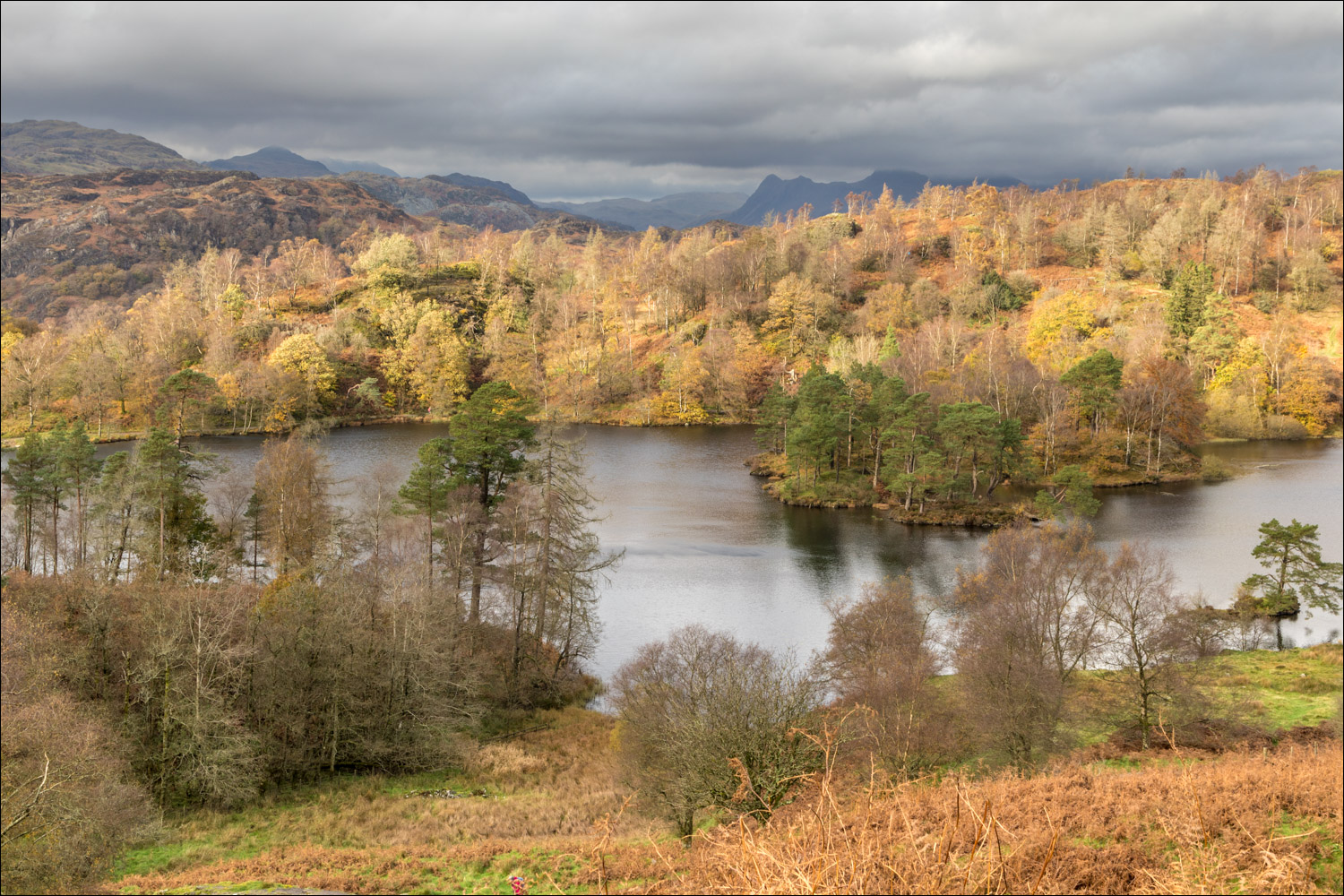
Tarn Hows below

Tom Heights, and the Langdale Pikes in the distance

Holme Fell beyond Tom Heights

The Old Man of Coniston is hidden behind the clouds, which were rapidly closing in

Last of the light as we continue along the ridge...


We leave the ridge to join a track which may be narrow for vehicles but it's wide for walkers

Looking back to Tarn Hows - the light had gone by this time

The main path is below and we descend to join it

We follow the easy path to complete the circuit of Tarn Hows. By now it was pouring and I had to put the camera away

A couple of grabbed photos to show the path back to the start...


We pass by a ruined barn at Lane Head, and the end of the walk is a short distance from here
