
Route: Catstycam and Birkhouse Moor
Area: Eastern Lake District
Date of walk: 21st March 2013
Walkers: Andrew
Distance: 8.1 miles
Ascent: 3,100 feet
I parked on the roadside in the centre of Glenridding (free until Easter), and left the village via Greenside Road. There was plenty of snow even at quite low levels, and I soon had to put the spikes on. I followed Red Tarn Beck as far as Red Tarn then turned uphill to join Swirral Edge, which leads to the summit of Catstycam
It was a real struggle getting to the top – deep snow, a very strong wind and bitterly cold. It was about -20C with the wind chill. I came back down the same way and then went across to the Hole in the Wall. The dry stone wall, about 5 feet high, was completely covered by snow in parts, and the driving wind made the otherwide easy walk to Birkhouse Moor quite arduous. I then came back down via Mires Beck
Despite the serious conditions, it was a wonderful walk with plenty of snow and blue skies, and some fantastic views
For other walks here, visit my Find Walks page and enter the name in the ‘Search site’ box
Click on the icon below for the route map (subscribers to OS Maps can view detailed maps of the route, visualise it in aerial 3D, and download the GPX file. Non-subscribers will see a base map)

Scroll down – or click on any photo to enlarge it and you can then view as a slideshow

Shortly after leaving Glenridding, along Greenside Road

Further along the road, looking back

First glimpse of Catstycam ahead

Further up the path

The going gets tougher

Approaching Swirral Edge, Helvellyn is to the left and Catstycam to the right

Helvellyn

Red Tarn - you’ll have to take my word for it!

Looking back along the line of ascent

Swirral Edge - at this point I turned sharp right, Helvellyn lies the other way

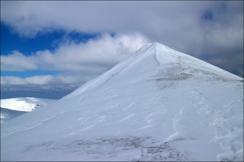
Catstycam - the photo can’t convey the strength of the wind at this point, nor the bitter cold

Ullswater from Catstycam summit

It was too cold to stop and stare, I took a quick snap and got back down as quickly as possible

Helvellyn again, Striding Edge on the left and Swirral Edge on the right

Looking back to Helvellyn and Catstycam

The Hole In The Wall - the ladder stile over the wall is redundant today!

Another view back to Catstycam

My descent route on the left, Helvellyn in the middle, and Catstycam on the right

Ullswater from Birkhouse Moor

Looking back along the dry stone wall - completely buried in snow for the most part

Looking east, over the wall

Heading back down towards Glenridding

Nearly back to Glenridding - it had been a fantastic day out in the fells
