
Route: Carsington Pasture
Area: Peak District
Date of walk: 7th June 2021
Walkers: Andrew and Gilly
Distance: 6.4 miles
Ascent: 1,000 feet
Weather: Mixed sunshine and clouds, very warm
It’s been five years since we last visited the Peak District and a return visit was well overdue. We decided to base our short stay in the south of the area so as to explore new territory
Today’s walk would visit the two small villages of Carsington and Brassington which once relied on lead mining, although the only visible signs of mining are now the lumps and bumps dotted along the route
We started from Carsington, where there is roadside parking near the Miners’ Arms pub. After climbing up some steps we left the village and started a steep climb up a grassy bank. There were good views back over the village and to Carsington Water, which has the appearance of a large lake, but is in fact a reservoir
We followed a path over Carsington Pasture (where a wind farm did the scenery no favours) and then joined the High Peak Trail, which follows the track of the former Cromford and High Peak Railway and passes by Harboro’ Rocks. Thanks to the level gradient we made quick progress along this section of the walk
After leaving the trail there was a short road section after which we walked through the fields to the unspoilt and attractive village of Brassington. From here we climbed uphill and then descended again to Carsington. Several of the fields were home to grazing cattle, but the natives were friendly and we had no issues. The final section back to Carsington was a highlight of the walk, with hawthorn blossom lining the way and enhancing the lovely views across Carsington Water
Click on the icon below for the route map (subscribers to OS Maps can view detailed maps of the route, visualise it in aerial 3D, and download the GPX file. Non-subscribers will see a base map)

Scroll down – or click on any photo to enlarge it and you can then view as a slideshow

The start of today's walk - St Margaret's Church Carsington, set in the heart of the village opposite the village green

A few yards further down the road we climb some steps at the start of a public footpath

We climb up the grassy bank, and a view of Carsington Water appears. This is a reservoir and a popular visitor attraction which was opened by the Queen in 1992

We continue to climb up Carsington Pasture

Miles of open countryside beyond Carsington

We walk by a wind farm

Looking across to Eniscloud Barn

We join the High Peak Trail, managed by Peak District National Park Authority. The trail follows the track of the former Cromford and High Peak Railway

We pass by Harboro' Rocks (or Harborough Rocks), a limestone outcrop popular with rock climbers

The trail curves round the base of Harboro Rocks

Easy walking thanks to the level gradient

Looking back to Harboro Rocks

We pass through a cutting in the rock

An old quarry near Longcliffe

At the former station near Longcliffe we leave the High Peak Trail

There follows a short road section, with good views on our right...


After about 10 minutes we leave the road here and take a path which leads to Brassington

Looking back to Pinder's Rock

We follow the path by the dry stone wall

Hawthorn blossom enhanced the scenery along the path to Brassington...


We pass through a squeeze stile above Brassington

We descend into the village of Brassington...


St James’ Church Brassington, which dates back to Norman times

We pass by the Miners Arms

We follow a public footpath between these houses, which leads gently uphill

The path contours around the hillside for a while and then turns left uphill...


Looking back over Brassington as we pass by a herd of friendly cows

We cross a lane by the dry stone wall ahead and climb up the hill ahead, populated by more contented cows

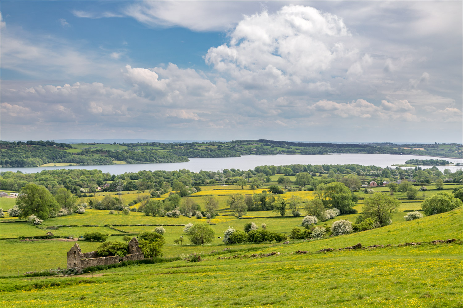
A view of Carsington Water appears from the top of the hill

The path follows the line of the hawthorn trees left of picture

More hawthorn blossom on the descent back into Carsington...


We pass through this gate and arrive in Carsington

From here it's a short stroll through the village back to the start...


Carsington village green, and the end of the walk
Follow the link for more walks in the Peak District (14)
