
Route: Dovedale
Area: Peak District
Date of walk: 8th June 2021
Walkers: Andrew and Gilly
Distance: 7.5 miles
Ascent: 1,200 feet
Weather: Sunny and warm
The lower reaches of Dovedale and its stepping stones are a honeypot location in the Peak District, so we made an early start in order to avoid any crowds. We parked in the picture postcard village of Ilam, where there were plenty of roadside parking spaces thanks to our early arrival
We followed the Thorpe road out of the village for a short distance before joining a path which climbed along the flanks of Bunster Hill. There were some lovely views back over Ilam as we gained height. We continued uphill to Ilam Tops, and skirted around Air Cottage, which is set in a wonderful position high above Dovedale. We then followed a path along the upper edge of Dovedale Wood. After about half a mile we had some moments of uncertainty before we located the path down into Dovedale. We passed by one unsigned path which looked exceptionally steep and continued above the wood in the hope of locating an alternative. None appeared and so we retraced our steps and set off down the path we’d passed earlier. It was an unpleasant descent, very loose and at a gradient of about 50%, or 1 in 2. At one point Gilly took a tumble – luckily only her pride was damaged. It’s possible that we took a wrong turn somewhere, as we emerged at Ilam Rock, a distinctive limestone rock tower by the bank of the River Dove. The correct exit should have been a little further upsteam, where there is a sign marked ‘Public footpath to Ilam (steep path)’
Safely down to the valley floor, we crossed the nearby footbridge and set off along the stunningly beautiful path along the floor of Dovedale. Thanks to the tortuous descent we’d lost the advantage of our early start and the path was a little too crowded for our taste though, thankfully, everyone was going in the opposite direction to us. We reached the famous stepping stones and here we turned away from the river to climb up Lin Dale. We enjoyed more good views as we climbed up to a col and then descended into the village of Thorpe
Beyond Thorpe we joined the Limestone Way, crossed Coldwall Bridge and walked back through the fields into Ilam. It had been an almost perfect walk in stunningly beautiful surroundings, but I have to deduct 1 star on account of the descent recounted above. Proper hiking boots are definitely needed and walking poles are a help, but if you’re properly equipped and used to rough walking don’t let this put you off – the rest of the route is more than ample compensation. Not an ascent (even less a descent) to attempt in wet weather though
If anyone follows this route I’d recommend reversing the direction of travel which we took. The steep climb would then become an ascent rather than a descent, and the path easier to locate thanks to the public footpath sign at its foot
Click on the icon below for the route map (subscribers to OS Maps can view detailed maps of the route, visualise it in aerial 3D, and download the GPX file. Non-subscribers will see a base map)

Scroll down – or click on any photo to enlarge it and you can then view as a slideshow

View from our parking space in the village of Ilam

Immaculately maintained cottages in Ilam

We follow the road out of the village, with the River Dove on our right, and will turn left uphill just beyond this cottage

We start the climb up the western flanks of Bunster Hill

We ignore the sign for the Stepping Stones and carry on along the track

Our path will take us through the gate ahead up to Ilam Tops in the distance

Looking back

We continue to climb up Bunster Hill beside the dry stone wall

Another view back, with Ilam in the centre of the picture

We arrive at Ilam Tops, and turn right at Ilamtops Farm

We follow a path around Air Cottage, which enjoys these views over Dovedale

Start of the path along the top of Dovedale Wood, with Dovedale below...


Hawthorm blossom lining our path

Looking across Dovedale

Somewhere around here, and after a there and back search, we located the descent path into Dovedale. It was very steep and loose. No photos as full concentration was needed

It was a relief to emerge at Ilam Rock, though the correct exit should have been a little further beyond the footbridge

Having crossed the footbridge, we have these views of Ilam Rock, which stands at 80 feet and is a popular place for climbers

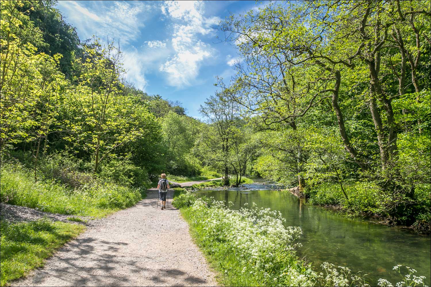
Start of a delightful section beside the River Dove...


Looking back to Tissington Spires


The River Dove curves round to the right here, and we leave its banks to proceed straight ahead, along Lin Dale

We pass by the famous Stepping Stones

We climb up Lin Dale...


Looking back to a hill known as Thorpe Cloud, around 1,000 feet above sea level

The village of Thorpe is ahead

We walk through Thorpe

St Leonard's Church

Beyond the village we join the Limestone Way

At the foot of the slope we'll be reunited with the River Dove

We cross Coldwall Bridge. The Limestone Way continues ahead, but we turn right beyond the bridge and follow the Manifold Trail back to Ilam

The River Dove from Coldwall Bridge

We follow the Manifold Trail...


The River Dove on our right

Buttercup meadow at the edge of Ilam

We pass by the memorial known as the Ilam Cross, which is Grade II listed, to end a memorable walk
Follow the link for more walks in the Peak District (14)
