
Route: Circuit of Buttermere
Area: Western Lake District
Date of walk: 19th January 2023
Walkers: Andrew and Gilly
Distance: 5.1 miles
Ascent: 400 feet
Weather: Mixed sun and clouds, snow on the tops, very cold
After a dusting of snow the lakeland fells were looking at their best this morning, so we decided to revisit Buttermere, one of the most beautiful places in the district. I was here exactly three months ago, but no two visits are the same and I could never tire of this walk
The classic circuit of Buttermere appears nearly 30 times on this site and is one of the finest walks in the Lake District. The beauty and accessibility of the walk is both a virtue and a problem in that the path can be too busy at peak times and, if you prefer to walk in relative solitude, then it’s best to choose a quiet day and time. Icy roads meant that several of the approach roads were closed today, so we knew that there would only be a few other folk around
We parked as usual in the National Trust car park at Long How, which was completely deserted for once. We walked through Buttermere village, passing by the Buttermere Court Hotel, and followed the path to the foot of the lake. We prefer to walk around Buttermere in an anti-clockwise direction in order to keep the best views ahead. After crossing the footbridge over Buttermere Dubs we set off along the lakeshore path which leads to the head of Buttermere
After crossing Peggy’s Bridge and passing by Gatesgarth Farm we started the return leg along the other shore, passing through the rock tunnel near Hassness along the way. We continued along the shoreline path and, where it forks off to the foot of the lake, carried on ahead. This brought us back into Buttermere village, to end another wonderful circuit of the lake
For other walks here, visit my Find Walks page and enter the name in the ‘Search site’ box
Click on the icon below for the route map (subscribers to OS Maps can view detailed maps of the route, visualise it in aerial 3D, and download the GPX file. Non-subscribers will see a base map)

Scroll down – or click on any photo to enlarge it and you can then view as a slideshow

The deserted car park at Long How at the start of today's walk

Herdwick sheep in the fields as we approach the foot of Buttermere

We follow the path across the foot of the lake

Fleetwith Pike at the head of Buttermere

Looking back to Buttermere village

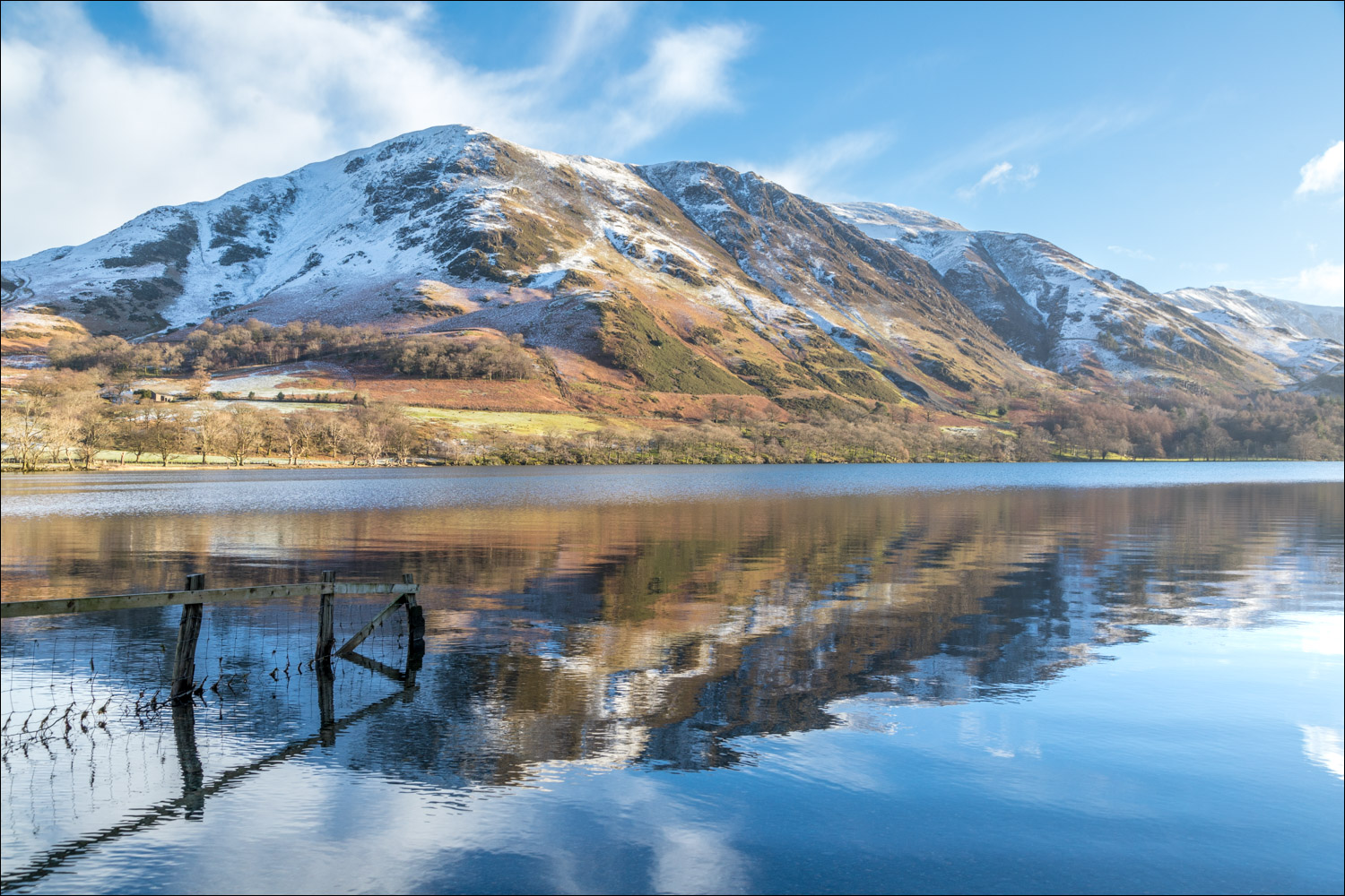
Reflections in Buttermere...


We follow the easy lakeshore path through a short woodland section...


At a junction we take a narrower path to keep to the lakeshore

Fleetwith Pike and Fleetwith Edge


A Typhoon jet flies overhead...

...followed by a Hercules (I think)...

Buttermere seems to be a favourite place for RAF pilots to hone their skills

After the entertaining flypast we continue to the head of Buttermere

The 'white hut' bothy

Looking back

We follow the path to Gatesgarth

From Peggy's Bridge, looking along Warnscale Beck to Wanscale Bottom

Looking the other way towards Mellbreak and Rannerdale Knotts

We pass by the bothy again, with Mellbreak beyond

Looking back to High Crag

Lone Herdwick and Buttermere pines

The start of the return leg involves a short road section

Hassness, which we'll walk around shortly

Looking across to High Crag as we pass by the head of Buttermere

Hassness, with High Stile beyond

Fleetwith Pike again

We follow the pebble beach around Hassness...


We pass through a short tunnel, made by a former owner of Hassness Estate so that he didn’t need to stray too far from the shore. A torch isn't needed but if you're over six feet tall mind your head

A last glance back to Fleetwith Pike as we walk back into Buttermere village

Back in Buttermere, a short detour to St James' Church to visit the Wainwright memorial tablet which faces his favourite fell (and mine), Haystacks
