
Route: Buttermere circuit
Area: Western Lake District
Date of walk: 4th November 2020
Walkers: Andrew and Gilly
Distance: 6.7 miles
Ascent: 500 feet
Weather: Mixed sunshine and clouds
The plan today was to climb Causey Pike, a wonderful knobbly fell in the Newlands Valley. On the way there, we passed by Buttermere and this caused us to change our plan. A new lockdown on account of the Covid-19 virus comes into force tomorrow, and it somehow felt more appropriate to revisit one of our favourite places, Buttermere. The path around the lake can be too busy at times, but we figured that it would be quiet today, admittedly for the wrong reasons, and this proved to be the case
After making a quick u-turn we parked in the National Trust car park at Long How. Instead of heading through Buttermere village as usual, we went in the opposite direction and passed through a gate in the car park which leads into Long How Wood. A lovely path through the wood brought us to Mill Beck, which we crossed, and then followed a path to Nether How at the head of Crummock Water. There was some lovely light around and we were glad to have made the short diversion. After admiring the views along the lake we walked around the other side of Nether How and beside Mill Beck into Buttermere village
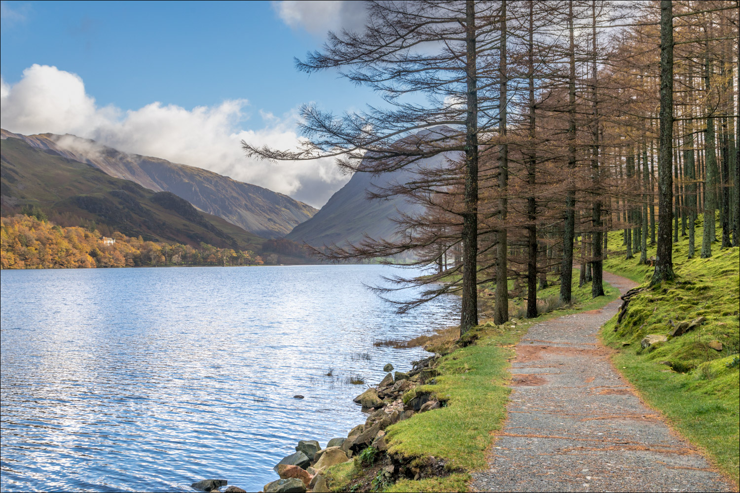
From here we set out on the classic circuit of Buttermere, passing the newly renamed Buttermere Court Hotel and following the path towards the foot of the lake. We crossed the bridge over Buttermere Dubs and set off along the shoreline path to the head of the lake. The views towards Fleetwith Pike and Warnscale Bottom were as good as ever – this is one of the finest paths in lakeland, and we felt lucky to be walking along it in such good weather
After crossing Peggy’s Bridge at the head of the lake, and passing by Gatesgarth Farm, we started the return leg along the other shore. We followed the sometimes rocky path back into Buttermere village, passing through the short tunnel in the rocks near Hassness along the way, to end a wonderful walk
For other walks here, visit my Find Walks page and enter the name in the ‘Search site’ box
Click on the icon below for the route map (subscribers to OS Maps can view detailed maps of the route, visualise it in aerial 3D, and download the GPX file. Non-subscribers will see a base map)

Scroll down – or click on any photo to enlarge it and you can then view as a slideshow

The start of the walk as we leave the National Trust car park and follow a path through Long How, which leads away from Buttermere

Mill Beck


We cross a small footbridge over Mill Beck and walk to the head of Crummock Water

Looking back to Fleetwith Pike

The head of Crummock Water, looking across to Holme Islands


Holme Islands, and Scale Knott below Mellbreak

A worthwhile diversion, after which we walk into Buttermere village, with Mill Beck on our left

Waterfall in Sourmilk Gill, on good form after recent heavy rain

We head towards the waterfall at the start of the classic circuit of Buttermere

The foot of Buttermere...


We follow the lakeshore path through Burtness Wood

Fleetwith Pike at the head of Buttermere

Looking across to Hassness

Views back to the foot of the lake...


This walk is beautiful throughout, but the section beyond this gate is possibly the highlight...

The bothy ('The White Hut') at the foot of Fleetwith Pike

Approaching the head of the lake

Turn right here if heading for Haystacks

The White Hut again, with Gatesgarth and the Honister Pass beyond

Gatesgarth Farm at the foot of Fleetwith Pike - this will mark the half way point of the walk

Buttermere pines in Warnscale Bottom, with Green Crag sandwiched between Fleetwith Pike and Haystacks

Fleetwith Pike

We cross the footbridge over Warnscale Beck

High Stile

Looking back along the path

The start of the return leg, initially along the Buttermere road...


Back on the footpath, looking back to the foot of Fleetwith Pike

Waterfall in Comb Beck on the far side of Buttermere

Looking back through the rock tunnel, carved out in the 19th century by a Manchester Mill owner

We pass by an old stone hut near Dalesgarth

Looking along the lakeshore towards Mellbreak

Pike Rigg

Looking back along Pike Rigg

Buttermere village comes into view

Looking across to the waterfall in Sourmilk Gill

We pass by Cragg House Farm at the end of another wonderful walk around Buttermere

Next day, a red squirrel in the garden, busy stockpiling hazelnuts in readiness for winter
