
Route: Millington Pastures
Area: East Yorkshire
Date of walk: 7th November 2020
Walkers: Andrew and Gilly
Distance: 3.7 miles
Ascent: 500 feet
Weather: Sunny
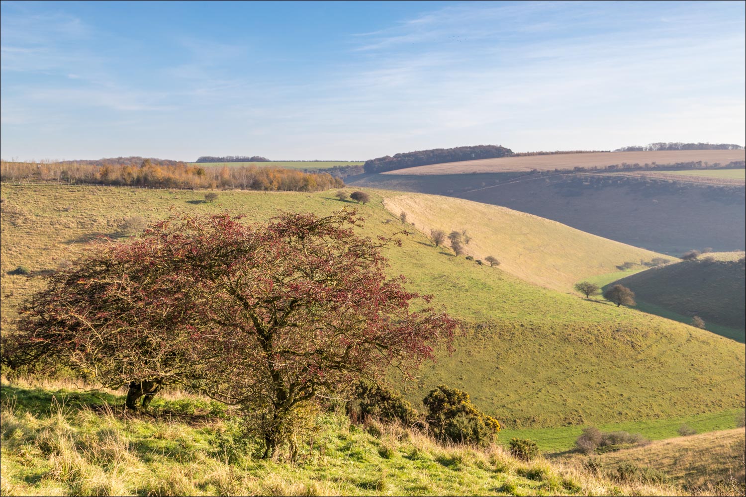
Millington Pastures is an area of special scientific interest and is a system of dry chalk valleys in the East Yorkshire Wolds. The grassland slopes are grazed by sheep and highland cattle and are crossed by sheep tracks, ancient Roman roads and long distance paths
We parked in the free car park at Millington Wood Nature Reserve. Instead of walking into Millington Wood (which is one of the few remaining wooded dales in the Wolds) we walked out of the car park and turned left onto the road. We then went through a gate on our left and climbed up the bridleway to the second gate. Instead of going through the gate, we turned right and followed the fence line along the edge of Millington Dale to Allison Nab. The path is not shown on the OS maps as a public footpath. It’s faint and little used but, once located, navigation is straightforward and consists of keeping the fence on the left. There were lovely views down into Millington Dale as we followed the contour line around the top of the dale
We followed the path beside the fence down into Scoar Dale, turning right at the bottom and from there walked along the valley floor to join the quiet road along Millington Dale. We had some good sightings of buzzards and red kites in the skies above, circling the dales in search of prey. We followed the road for a short distance before turning off to join a chalk track which is part of the route of no less than three long distance walks – the Yorkshire Wolds Way, the Chalkland Way and the Minster Way
The path took us gently uphill, with more big views across the Wolds, heading briefly into Sylvan Dale before descending back into Millington Dale. At the foot of the dale we joined the road and this took us back to the start of an excellent short walk
For other walks here, visit my Find Walks page and enter the name in the ‘Search site’ box
Click on the icon below for the route map (subscribers to OS Maps can view detailed maps of the route, visualise it in aerial 3D, and download the GPX file. Non-subscribers will see a base map)

Scroll down – or click on any photo to enlarge it and you can then view as a slideshow

The start of the walk from the car park at Millington Wood Nature Reserve

Instead of heading into the wood, we walk back to the road and immediately turn left through this gate

At the second gate we turn right and follow this faint path beside the fence

We keep the fence on our left as we contour around the side of the dale

Looking across to Sylvan Dale

We continue beside the fence

Looking back across Millington Dale

Wonderful views along Millington Dale as we follow the path...


Millington Dale below

Looking back along the path

Scoar Dale - we'll shortly be descending to the patch of chalk mid-right

A view back at the start of the descent into the dale

We head down into Scoar Dale

Our route will take us along the floor of the dale, bottom right

We turn sharp right below

We walk along Scoar Dale...

It was here that we saw several buzzards and red kites soaring overhead

We arrive at the road along Millington Dale and follow it for a short distance. On the right is one of eleven carved oak posts - a single letter is carved into each which, when read in sequence, spells GAIT IN WOLDS. This one is 'O'

Highland cattle, which graze the pastures

We continue along the road and just around the corner will leave it to climb uphill

A view back along Millington Dale

At Nettle Dale we leave the road and turn right uphill

Looking back as we gain height - we're now on the Yorkshire Wolds Way, the Chalkland Way and the Minster Way

The chalk track ends at a gate marked 'Private - no right of way' - but this path and gate is just above it and we continue along the Wolds Way

Bench with a view

Sylvan Dale below - the path heads into the dale for a short distance

We descend into Sylvan Dale...

...and then turn sharp right away from it

We reach the valley floor and follow the path back towards Millington Dale

We arrive at the road through Millington Dale and follow it back to the start

A final look back along the road at the end of the walk

....which vanished when this sparrowhawk appeared

A couple of days later, goldfinches in the garden...
Follow the link for more walks in East Yorkshire (117)
