
Route: Loweswater and Holme Wood
Area: Western Lake District
Date of walk: 30th October 2020
Walkers: Andrew, Gilly and James
Distance: 5.9 miles
Ascent: 1,000 feet
Weather: Mostly sunny
Today’s walk was a variation on one of our favourites, a delightful and varied route which we’ve walked many times. We bided our time, as the weather was poor in the morning, but forecast to improve later on. This proved to be a good decision, but it meant that our usual starting point – the small car park at Maggie’s Bridge – was full. As it was half term week this came as no surprise, so instead we drove to the head of Loweswater and parked in one of the roadside spaces there. Loweswater is unusual as it drains into lakeland and not away from it, as would be expected. We followed the path along the head of the lake to Hudson Place and decided to walk anti-clockwise for a change. This would keep the views into lakeland ahead of us
After a short climb we turned off at Hudson Place to follow a path through the fields, past Jenkinson Place and to the northernmost edge of the Lake District. The path took us to a track known locally as the Loweswater to St. Bees Coffin Road. It’s believed that the name is fanciful and was given by the National Trust in the 1970s to add a bit of romance. It would certainly be an odd choice of routes to carry a heavy coffin, as it involves climbing some 1,000 feet when a much easier way lies below along the Loweswater road
Whatever the truth, the coffin road contours around the fellside with some wonderful views, looking north to Scotland and the Solway Firth and south into the heart of Lakeland. We followed the path above Holme Wood and Loweswater and beyond the foot of the lake we descended towards High Nook Tarn. After crossing the small bridge over Highnook Beck we passed through High Nook Farm, and beyond the farm we descended towards Maggie’s Bridge. Note that the Maps Page shows a shorter alternative route, along a path to Watergate Farm. From Maggie’s Bridge we joined the track to Holme Wood, and walked through the wood to Hudson Place. From here we retraced our steps back to the start
This is a walk with a huge variety of scenery to be enjoyed along the way – fells, lakes, woodland, grazing land, meadows, valleys – all of it beautiful and shown in its best light in today’s weather
For other walks here, visit my Find Walks page and enter the name in the ‘Search site’ box
Click on the icon below for the route map (subscribers to OS Maps can view detailed maps of the route, visualise it in aerial 3D, and download the GPX file. Non-subscribers will see a base map)

Scroll down – or click on any photo to enlarge it and you can then view as a slideshow

Photos from a short walk to Crummock Water earlier in the week

Red squirrel in the rain yesterday

The start of today's walk from Waterend near the head of Loweswater

Looking across to Loweswater and Holme Wood as we walk across the head of the lake

Looking back along the path, with Darling Fell in the background

Just before Hudson Place we start to head away from Loweswater

A view back to Darling Fell...

...and to Loweswater

We pass above Jenkinson Place...

...and Iredale Place

A view back as we climb up the fields behind Iredale Place

We join the old coffin road and turn towards Loweswater

Looking back, the hills of Scotland can be seen in the distance

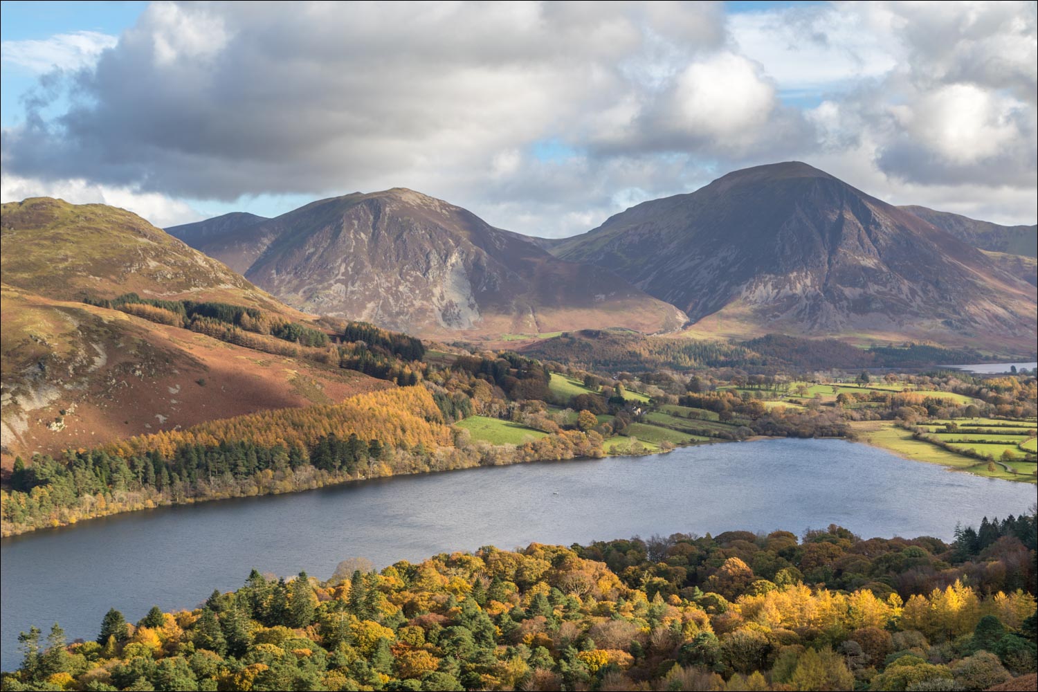
Loweswater comes into view, and Crummock Water beyond it

Low Fell and Whiteside

Grasmoor in the centre of the picture

Autumn colours in Holme Wood below - we'll be walking through there later

Low Fell, Whiteside, Grasmoor and Whiteless Pike

Gilly and James admire the view from The Bench

Grasmoor beyond the foot of Loweswater

Holme Wood

Wind battered trees on the edge of Holme Wood

We follow the path above Holme Wood. Anyone looking to shorten the walk could do so at this gate, but would miss some great views

We continue along the old coffin road above the wood...

Mellbreak ahead on the right

We reach the far end of Holme Wood, with a wonderful view across to Whiteside, Grasmoor, Whiteless Pike and Mellbreak

We descend towards High Nook Tarn, and will turn sharp left before reaching it

Looking across to Whiteside, Grasmoor and Mellbreak - we'll be following the path centre right of the photo shortly

We cross the footbridge over Highnook Beck

Lorton Vale

We follow the path towards Maggie's Bridge

Beyond Maggie's Bridge we join a track which leads to the foot of Loweswater

We walk through Holme Wood, owned and managed by the National Trust

Loweswater from the small beach by the bothy

Autumn colours in Holme Wood...


Grasmoor beyond the foot of Loweswater

A view back along the path

We retrace our steps across the head of Loweswater, here looking towards Mellbreak

Grasmoor

A final glance back to Loweswater and Holme Wood at the end of the walk

Next day, more red squirrel activity in the garden
