
Route: Budle Bay to Seahouses
Area: Northumberland
Date of walk: 16th March 2020
Walkers: Andrew and Gilly
Distance: 5.9 miles
Ascent: 200 feet
Weather: Mostly sunny
Last time we visited the Northumberland coast we’d walked from Budle Bay to Seahouses, and it was a superb route – one of the best. We decided to retread our footsteps. Click here for the earlier visit in 2017
As this is a linear walk, we drove over to Seahouses in good time to park there and catch the 8.51am Arriva bus from the Post Office bus stop (check the website for times, as these vary). We disembarked and started the walk from the track leading to Kiln Point. The place is shown as Budle on the OS map, though it’s not a village and there’s only a farm and a caravan park. After walking down the track we soon reached Budle Bay shoreline, where mile after mile of golden sand reached out into the distance, a glorious sight which was enhanced by sun and blue skies. As on the last occasion the tide was on its way out and so we were able to walk along the beach most of the way, and only once were we forced to follow a higher footpath over the dunes
After crossing Harkess Rocks, the thrilling sight of Bamburgh Castle appeared in the distance and we continued along the seemingly endless beach, passed by the ancient castle, and carried on to our destination – Seahouses
This was the end of a great walk, and for anyone following it, I’d recommended a boat trip to the Farne Islands from the harbour in Seahouses. We did this last time here and had some wonderful wildlife sightings, including seals, cormorants and puffins
Click on the icon below for the route map (subscribers to OS Maps can view detailed maps of the route, visualise it in aerial 3D, and download the GPX file. Non-subscribers will see a base map)

Scroll down – or click on any photo to enlarge it and you can then view as a slideshow

A promising start to the day as the sun rises on the Northumberland coast

The bus drops us off at Kiln Point, Budle - Budle Bay can be seen in the background


We follow the track leading to the bay

Looking across the bay to Lindisfarne Castle in the distance - we'll be walking around Lindisfarne later in the week

We make our way over the sand dunes to Budle Point...


We descend to the beach...


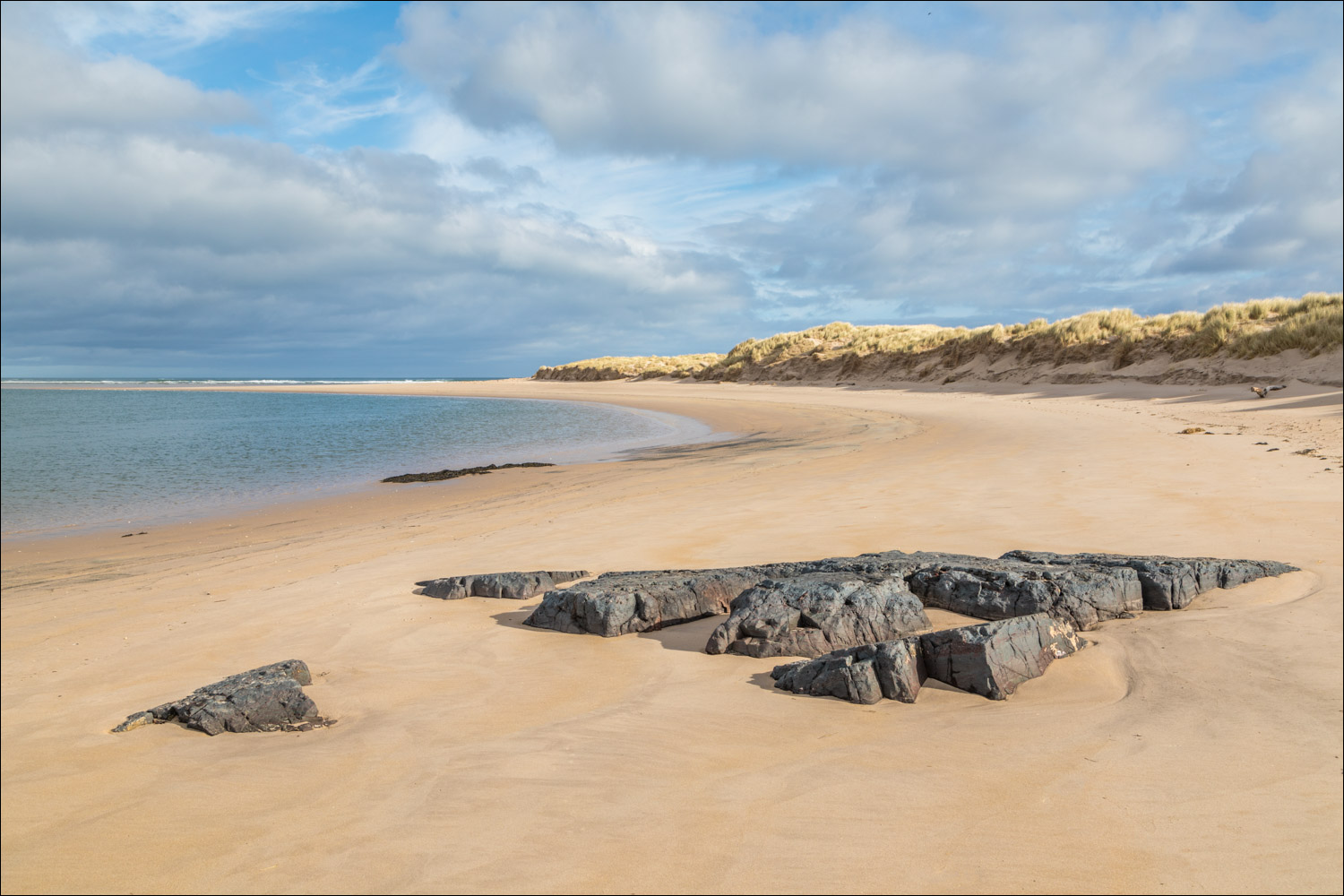
Acres of deserted golden sands stretch out ahead of us

Looking back

Footprints in the sand

We can just make out our destination, Seahouses, on the right of the photo

Reflections on the beach as we approach Blackrocks Point...


At Blackrocks Point we follow a path above the rocks

The path takes us past the lighthouse

Looking back over Harkess Rocks

Another scenic highlight as Bamburgh Castle comes into view...


No one knows why there is a white stag painted on the rock near Blackrocks Point, but legend has it that it was because a white stag jumped into the sea here to escape hunters


We walk over Harkess Rocks towards Bamburgh Catle


A heavenly walk along the beach towards Bamburgh Castle


We pass by Bamburgh Castle

Looking out to the Farne Islands...


We follow the golden beach towards Seahouses

Seahouses ahead

The beach ends at a rocky shoreline known as The Tumblers

We climb above The Tumblers and join the road leading into Seahouses

Seahouses lighthouse

Seahouses harbour

Benches overlooking the harbour - about 30 of them! The end of a wonderful coastal walk
Follow the link for more walks in Northumberland (29)
